
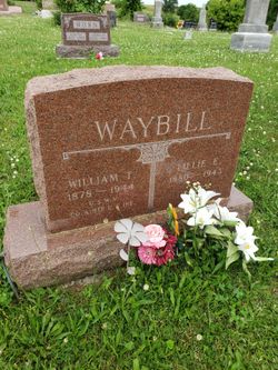
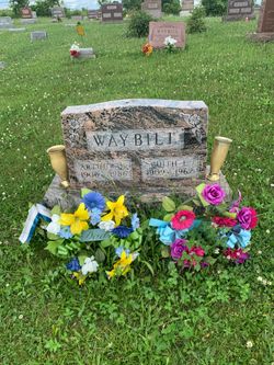
Lillie Emiline Starr Waybill
| Birth | : | 25 Mar 1880 Davis County, Iowa, USA |
| Death | : | 6 Apr 1943 Albuquerque, Bernalillo County, New Mexico, USA |
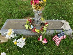
| Burial | : | Burgher Cemetery, Davis County, USA |
| Coordinate | : | 40.6644669, -92.6010208 |
| Description | : | MRS. WAYBILL TAKEN BY DEATH IN ALBEQUERQUE Long Time Resident of Moulton Had Gone to Mexico In Hope of Health Recovery Moulton (Special)—Word was received by relatives in Moulton this morning of the death of Mrs. William Waybill, age 63, the death occurring in Albuquerque, New Mexico, where she had gone with her husband and daughter last September, believing that the change in climate might be beneficial to her failing health. Mrs. Waybill, who was formerly Lillie Starr , had been a long time resident of Moulton, and although her many friends knew that she had been in poor, health for some time, her death comes as... Read More |
frequently asked questions (FAQ):
-
Where is Lillie Emiline Starr Waybill's memorial?
Lillie Emiline Starr Waybill's memorial is located at: Burgher Cemetery, Davis County, USA.
-
When did Lillie Emiline Starr Waybill death?
Lillie Emiline Starr Waybill death on 6 Apr 1943 in Albuquerque, Bernalillo County, New Mexico, USA
-
Where are the coordinates of the Lillie Emiline Starr Waybill's memorial?
Latitude: 40.6644669
Longitude: -92.6010208
Family Members:
Parent

Spouse

Siblings
Children
Flowers:


Nearby Cemetories:
1. Burgher Cemetery
Davis County, USA
Coordinate: 40.6644669, -92.6010208
2. Burger Cemetery
Davis County, USA
Coordinate: 40.6643982, -92.6007996
3. Horn Cemetery
Davis County, USA
Coordinate: 40.6568985, -92.6252975
4. Evergreen Cemetery
West Grove, Davis County, USA
Coordinate: 40.6916879, -92.6085237
5. Hetzler Cemetery
Davis County, USA
Coordinate: 40.6931000, -92.6241989
6. Johnson Cemetery
Davis County, USA
Coordinate: 40.6296997, -92.5768967
7. Shinn Cemetery
West Grove, Davis County, USA
Coordinate: 40.7041870, -92.6279687
8. Hopkins Cemetery
Davis County, USA
Coordinate: 40.6622009, -92.5333023
9. Kerby Cemetery
Appanoose County, USA
Coordinate: 40.6236000, -92.6425018
10. Bell Cemetery
West Grove, Davis County, USA
Coordinate: 40.7160900, -92.6026750
11. Bethel Cemetery
Davis County, USA
Coordinate: 40.6968994, -92.5436020
12. Washington Cemetery
Davis County, USA
Coordinate: 40.6164017, -92.5432968
13. Morgan Cemetery
Wyacondah, Davis County, USA
Coordinate: 40.6569072, -92.5151380
14. Sunset View Cemetery
Moulton, Appanoose County, USA
Coordinate: 40.7042007, -92.6753006
15. Hardin Cemetery
Moulton, Appanoose County, USA
Coordinate: 40.7036018, -92.6769028
16. Newton Cemetery
Davis County, USA
Coordinate: 40.6166923, -92.5335216
17. Mount Moriah Cemetery
West Grove, Davis County, USA
Coordinate: 40.6981000, -92.5186000
18. John Cemetery
Davis County, USA
Coordinate: 40.7346992, -92.6164017
19. West Grove Cemetery
West Grove, Davis County, USA
Coordinate: 40.7289009, -92.5567017
20. Oakland Cemetery
Moulton, Appanoose County, USA
Coordinate: 40.6822014, -92.6968994
21. Kelly Cemetery
Wyacondah, Davis County, USA
Coordinate: 40.6383330, -92.5069440
22. Coatsville Cemetery
Coatsville, Schuyler County, USA
Coordinate: 40.5872000, -92.6156000
23. Orleans Cemetery
Moulton, Appanoose County, USA
Coordinate: 40.7250000, -92.6665000
24. Fenton Cemetery
Davis County, USA
Coordinate: 40.6405983, -92.5017014