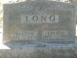
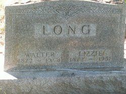
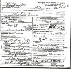
Lizzie Jordan Long
| Birth | : | 26 Jul 1872 Moniteau County, Missouri, USA |
| Death | : | 15 Jan 1951 California, Moniteau County, Missouri, USA |
| Burial | : | Silver Terrace Cemeteries, Virginia City, Storey County, USA |
| Coordinate | : | 39.3162130, -119.6428250 |
| Description | : | The Eldon Advertiser, January 1951 Mrs. Walter Long, died January 15, 1951, and funeral services were held at the High Point Baptist Church January 17 by Rev. N.E. Williams of Eldon. Burial was made in the Allen Cemetery. Lizzie Jordan was born July 26, 1872, the daughter of John and Elizabeth Jordan. She was married to Walter A. Long Sept. 7, 1892. At the age of 12 she became a member of the Mt. Herman Church and at the time of her death was a member of the High Point Baptist Church. Her parents preceded her in death. She is survived... Read More |
frequently asked questions (FAQ):
-
Where is Lizzie Jordan Long's memorial?
Lizzie Jordan Long's memorial is located at: Silver Terrace Cemeteries, Virginia City, Storey County, USA.
-
When did Lizzie Jordan Long death?
Lizzie Jordan Long death on 15 Jan 1951 in California, Moniteau County, Missouri, USA
-
Where are the coordinates of the Lizzie Jordan Long's memorial?
Latitude: 39.3162130
Longitude: -119.6428250
Family Members:
Parent
Spouse
Siblings
Nearby Cemetories:
1. Silver Terrace Cemeteries
Virginia City, Storey County, USA
Coordinate: 39.3162130, -119.6428250
2. Mount Saint Mary Cemetery
Virginia City, Storey County, USA
Coordinate: 39.3139900, -119.6387900
3. Old Virginia City Jewish Cemetery
Virginia City, Storey County, USA
Coordinate: 39.3231010, -119.6414032
4. Pioneer Cemetery
Virginia City, Storey County, USA
Coordinate: 39.3035187, -119.6351646
5. Gold Hill Cemetery
Gold Hill, Storey County, USA
Coordinate: 39.2847557, -119.6602783
6. Gold Hill Catholic Cemetery
Gold Hill, Storey County, USA
Coordinate: 39.2805900, -119.6631000
7. American Flat Burial Site
Gold Hill, Storey County, USA
Coordinate: 39.2701120, -119.6647850
8. Silver City Cemetery
Silver City, Lyon County, USA
Coordinate: 39.2635994, -119.6380005
9. Dayton Cemetery
Dayton, Lyon County, USA
Coordinate: 39.2334000, -119.5970000
10. Mound House Pioneer Cemetery
Dayton, Lyon County, USA
Coordinate: 39.2155640, -119.6718910
11. Phenix Family Cemetery
Steamboat, Washoe County, USA
Coordinate: 39.3861510, -119.7469260
12. Washoe City Cemetery
Reno, Washoe County, USA
Coordinate: 39.3171997, -119.8198547
13. Empire Cemetery
Carson City, USA
Coordinate: 39.1842003, -119.7046967
14. Whispering Pines Cemetery
Reno, Washoe County, USA
Coordinate: 39.3608017, -119.8197021
15. Saint Teresa Memorial Garden
Carson City, Carson City, USA
Coordinate: 39.1871030, -119.7437150
16. Bowers Mansion Cemetery
Washoe County, USA
Coordinate: 39.2852800, -119.8422000
17. Huffaker Cemetery
Washoe County, USA
Coordinate: 39.4360771, -119.7753067
18. Franktown Creek Cemetery
Franktown, Washoe County, USA
Coordinate: 39.2752991, -119.8463974
19. Lone Mountain Cemetery
Carson City, Carson City, USA
Coordinate: 39.1768990, -119.7600021
20. Waltons Chapel of the Valley Cemetery
Carson City, Carson City, USA
Coordinate: 39.1715012, -119.7602997
21. Nevada State Prison Burial Ground
Carson City, Carson City, USA
Coordinate: 39.1581900, -119.7378200
22. Dixon Family Cemetery
Carson City, USA
Coordinate: 39.1483269, -119.7432404
23. Carson Pioneer Cemetery
Carson City, Carson City, USA
Coordinate: 39.1612396, -119.7792969
24. Old Stewart Indian Cemetery
Stewart, Carson City, USA
Coordinate: 39.1178900, -119.7546700


