
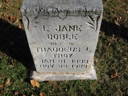
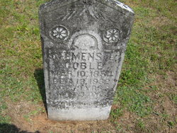
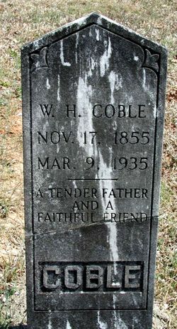
Loduska Jane Coble Troy
| Birth | : | 21 Jan 1838 |
| Death | : | 22 Nov 1923 Liberty, Randolph County, North Carolina, USA |
| Burial | : | Sun Set Cemetery, Quincy, Lewis County, USA |
| Coordinate | : | 38.6253800, -83.1291000 |
frequently asked questions (FAQ):
-
Where is Loduska Jane Coble Troy's memorial?
Loduska Jane Coble Troy's memorial is located at: Sun Set Cemetery, Quincy, Lewis County, USA.
-
When did Loduska Jane Coble Troy death?
Loduska Jane Coble Troy death on 22 Nov 1923 in Liberty, Randolph County, North Carolina, USA
-
Where are the coordinates of the Loduska Jane Coble Troy's memorial?
Latitude: 38.6253800
Longitude: -83.1291000
Family Members:
Parent
Siblings
Flowers:


Nearby Cemetories:
1. Sun Set Cemetery
Quincy, Lewis County, USA
Coordinate: 38.6253800, -83.1291000
2. Methodist Cemetery
Quincy, Lewis County, USA
Coordinate: 38.6219600, -83.1329500
3. Howland Cemetery
Lewis County, USA
Coordinate: 38.6192017, -83.1292038
4. Bivens Cemetery
Quincy, Lewis County, USA
Coordinate: 38.6353300, -83.1181140
5. Crystal Dawn Cemetery
Garrison, Lewis County, USA
Coordinate: 38.6131200, -83.1170200
6. Soldier Cemetery
Garrison, Lewis County, USA
Coordinate: 38.6036160, -83.1440720
7. Truitt-Woodworth Family Cemetery
Quincy, Lewis County, USA
Coordinate: 38.6074980, -83.1543600
8. Shaw-Davis Cemetery
Quincy, Lewis County, USA
Coordinate: 38.6482430, -83.1083630
9. Storer Cemetery
Nile Township, Scioto County, USA
Coordinate: 38.6590260, -83.1303710
10. Garland Cemetery
Garrison, Lewis County, USA
Coordinate: 38.6054220, -83.1645060
11. Storer Family Cemetery
Friendship, Scioto County, USA
Coordinate: 38.6608820, -83.1292410
12. Bassett Graveyard
Lewis County, USA
Coordinate: 38.5872231, -83.1254807
13. Mars Hills Burial Grounds
Saint Paul, Lewis County, USA
Coordinate: 38.6608780, -83.1022830
14. Hook Farm Cemetery
Garrison, Lewis County, USA
Coordinate: 38.6018610, -83.1733200
15. Waring Cemetery
Garrison, Lewis County, USA
Coordinate: 38.6006012, -83.1781006
16. Potter Cemetery
Garrison, Lewis County, USA
Coordinate: 38.6023974, -83.1813616
17. Mitchell-Morrison Cemetery
Buena Vista, Scioto County, USA
Coordinate: 38.6275750, -83.1989160
18. Greene Cemetery
Saint Paul, Lewis County, USA
Coordinate: 38.6713750, -83.0879420
19. Loper Cemetery
Letitia, Greenup County, USA
Coordinate: 38.6225014, -83.0569000
20. Bruce Cemetery
Garrison, Lewis County, USA
Coordinate: 38.5909140, -83.1912280
21. Skidmore Cemetery
Garrison, Lewis County, USA
Coordinate: 38.5780290, -83.1891480
22. Christy Cemetery
Lewis County, USA
Coordinate: 38.5774994, -83.1889038
23. Allen Cemetery
Greenup County, USA
Coordinate: 38.5722008, -83.0738983
24. Hubbard Cemetery
Lewis County, USA
Coordinate: 38.5752983, -83.1911011