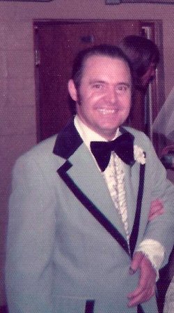
| Birth | : | 17 Mar 1910 Genoa, Wayne County, Iowa, USA |
| Death | : | 15 Jul 2005 Seymour, Wayne County, Iowa, USA |
| Burial | : | Rael Cemetery, Arroyo Hondo, Taos County, USA |
| Coordinate | : | 36.5400009, -105.6710968 |
| Description | : | Lois E. Walker, daughter of Aaron Jacob and Anna Ethel (Smith) Walker, lived her entire life in Wayne County, IA. She attended school in Seymour, and graduate from the high school in 1927. Lois married Ford Owen Holder on the 8th of October, 1929, at the Methodist parsonage in Chariton. They had three children: Lonnie Carlton, Charles Linden (Lin), and Mary Anna, all of whom were stricken with polio in 1949. Ford & Lois farmed in Seymour until 1951, and then they bought a farm just a few miles north of Corydon. I was almost 11 years... Read More |
frequently asked questions (FAQ):
-
Where is Lois E. Walker Holder's memorial?
Lois E. Walker Holder's memorial is located at: Rael Cemetery, Arroyo Hondo, Taos County, USA.
-
When did Lois E. Walker Holder death?
Lois E. Walker Holder death on 15 Jul 2005 in Seymour, Wayne County, Iowa, USA
-
Where are the coordinates of the Lois E. Walker Holder's memorial?
Latitude: 36.5400009
Longitude: -105.6710968
Family Members:
Spouse
Children
Flowers:
Nearby Cemetories:
1. Rael Cemetery
Arroyo Hondo, Taos County, USA
Coordinate: 36.5400009, -105.6710968
2. Campo Santo de San Cristobal Cemetery
Taos County, USA
Coordinate: 36.5996660, -105.6346070
3. Valdez Cemetery
Valdez, Taos County, USA
Coordinate: 36.5380060, -105.5844010
4. Kiowa Ranch Cemetery
San Cristobal, Taos County, USA
Coordinate: 36.5830000, -105.5945000
5. Arroyo Seco Church Cemetery
Arroyo Seco, Taos County, USA
Coordinate: 36.5167918, -105.5701830
6. Arroyo Seco Morada Cemetery
Arroyo Seco, Taos County, USA
Coordinate: 36.5202639, -105.5651919
7. Arroyo Seco Cemetery
Arroyo Seco, Taos County, USA
Coordinate: 36.5199660, -105.5649340
8. Colonias Cemetery
Taos County, USA
Coordinate: 36.4505997, -105.6136017
9. Dargah of Murshid Samuel Lewis
Questa, Taos County, USA
Coordinate: 36.6358000, -105.6004000
10. Lama Foundation Burial Gardens
Lama, Taos County, USA
Coordinate: 36.6362000, -105.6003000
11. Taos Pueblo Cemetery
Taos Pueblo, Taos County, USA
Coordinate: 36.4390610, -105.5466440
12. Manuel Miera Family Cemetery
Taos, Taos County, USA
Coordinate: 36.4158540, -105.5689600
13. Dolores Cemetery
El Prado, Taos County, USA
Coordinate: 36.4159640, -105.5675200
14. Sierra Vista Cemetery
Taos, Taos County, USA
Coordinate: 36.4152260, -105.5681740
15. LaLoma Cemetery
Taos, Taos County, USA
Coordinate: 36.4105988, -105.5766983
16. Campo Santo del Pueblo
Taos, Taos County, USA
Coordinate: 36.4157982, -105.5653000
17. Penas Negras Cemetery
Taos County, USA
Coordinate: 36.3922005, -105.6280975
18. Guadalupe Plaza
Taos, Taos County, USA
Coordinate: 36.4075790, -105.5756580
19. Kit Carson Memorial Cemetery
Taos, Taos County, USA
Coordinate: 36.4081001, -105.5686035
20. Graham Cemetery
Taos County, USA
Coordinate: 36.3953018, -105.5931015
21. Pacheco Cemetery
Taos County, USA
Coordinate: 36.3932991, -105.5955963
22. Las Cruces Cemetery
Taos, Taos County, USA
Coordinate: 36.4053180, -105.5643760
23. Eretz Shalom Cemetery
Taos, Taos County, USA
Coordinate: 36.3698614, -105.6375008
24. St James Episcopal Church
Taos County, USA
Coordinate: 36.3816795, -105.5838373


