
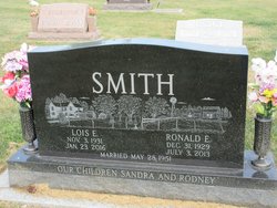
Lois Elaine Bierlein Smith
| Birth | : | 3 Nov 1931 Andover, Harrison County, Missouri, USA |
| Death | : | 23 Jan 2016 Plattsburg, Clinton County, Missouri, USA |
| Burial | : | Rose Hill Cemetery, Lamoni, Decatur County, USA |
| Coordinate | : | 40.6250000, -93.9475021 |
| Plot | : | Block 10, Lot G16, Space 2 |
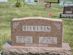
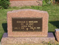
| Description | : | Lois Elaine (Bierlein) Smith was born in her parents farm home in Harrison County, MO near Andover on November 3, 1931 to Jacob and Bertha (Stoll) Bierlein.. She departed this life January 23, 2016 at Oakridge Nursing Home in Plattsburg, MO. Lois completed Jake and Berth's family being welcome by her big brother, Don. Bertha was happy as she dearly wanted a little girl. Lois received her education at the Andover school and then graduated from high school in Lamoni Iowa. Lois married Ronald Eugene Smith on May 28, 1951 and moved to his family's century... Read More |
frequently asked questions (FAQ):
-
Where is Lois Elaine Bierlein Smith's memorial?
Lois Elaine Bierlein Smith's memorial is located at: Rose Hill Cemetery, Lamoni, Decatur County, USA.
-
When did Lois Elaine Bierlein Smith death?
Lois Elaine Bierlein Smith death on 23 Jan 2016 in Plattsburg, Clinton County, Missouri, USA
-
Where are the coordinates of the Lois Elaine Bierlein Smith's memorial?
Latitude: 40.6250000
Longitude: -93.9475021
Family Members:
Parent

Spouse

Siblings
Flowers:


Nearby Cemetories:
1. Rose Hill Cemetery
Lamoni, Decatur County, USA
Coordinate: 40.6250000, -93.9475021
2. Sweet Home Cemetery
Fayette Township, Decatur County, USA
Coordinate: 40.5946550, -93.9566660
3. Lillie Cemetery
Lamoni, Decatur County, USA
Coordinate: 40.6565829, -93.9418602
4. Creveling Cemetery
Lamoni, Decatur County, USA
Coordinate: 40.6309232, -93.8984728
5. Hollen Cemetery
Lamoni, Decatur County, USA
Coordinate: 40.5952000, -94.0097000
6. Lewis Cemetery
Kellerton, Ringgold County, USA
Coordinate: 40.6588500, -94.0280500
7. Andover Cemetery
Andover, Harrison County, USA
Coordinate: 40.5588989, -93.9008026
8. Terre Haute Cemetery
Terre Haute, Decatur County, USA
Coordinate: 40.6836646, -93.8800621
9. Bucy Cemetery
Decatur City, Decatur County, USA
Coordinate: 40.6902056, -93.8869286
10. New Buda Cemetery
Davis City, Decatur County, USA
Coordinate: 40.6027448, -93.8314819
11. Patrick Cemetery
Riley Township, Ringgold County, USA
Coordinate: 40.5900000, -94.0586000
12. Downey Cemetery
Harrison County, USA
Coordinate: 40.5581017, -93.8606033
13. Elk Cemetery
Lamoni, Decatur County, USA
Coordinate: 40.7210467, -93.9390707
14. Mount Zion Cemetery
Riley Township, Ringgold County, USA
Coordinate: 40.5960000, -94.0731000
15. IOOF Cemetery
Davis City, Decatur County, USA
Coordinate: 40.6405800, -93.8174600
16. Miller Cemetery
Decatur County, USA
Coordinate: 40.7026000, -93.8592000
17. Anderson Cemetery
Eagleville, Harrison County, USA
Coordinate: 40.5293503, -93.9983292
18. Mount Pleasant No 2 Baptist Church Cemetery
Blythedale, Harrison County, USA
Coordinate: 40.5300010, -93.8916160
19. Old Davis City Cemetery
Davis City, Decatur County, USA
Coordinate: 40.6415100, -93.8115800
20. Brown Cemetery
Eagleville, Harrison County, USA
Coordinate: 40.5447006, -94.0357971
21. Millsap Cemetery
Grand River, Decatur County, USA
Coordinate: 40.7333310, -93.9502260
22. Maple Row Cemetery
Kellerton, Ringgold County, USA
Coordinate: 40.7077700, -94.0424500
23. Catholic Cemetery
Harrison County, USA
Coordinate: 40.5522003, -93.8380966
24. Payne Cemetery
Hatfield, Harrison County, USA
Coordinate: 40.5592003, -94.0733032