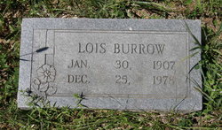
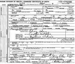
Lois Gertrude Schwartzentrub Burrow
| Birth | : | 30 Jan 1907 Coffeyville, Montgomery County, Kansas, USA |
| Death | : | 25 Dec 1978 Thayer, Oregon County, Missouri, USA |
| Burial | : | Saint Anthony's Roman Catholic Cemetery, Glace Bay, Cape Breton County, Canada |
| Coordinate | : | 46.1811840, -59.9681830 |
| Description | : | Daughter of Harry Schwartzentrub and Lola (Burnham) Schwartzentrub. Married Sam Burrow 08/Nov/1926 at Alton, MO. |
frequently asked questions (FAQ):
-
Where is Lois Gertrude Schwartzentrub Burrow's memorial?
Lois Gertrude Schwartzentrub Burrow's memorial is located at: Saint Anthony's Roman Catholic Cemetery, Glace Bay, Cape Breton County, Canada.
-
When did Lois Gertrude Schwartzentrub Burrow death?
Lois Gertrude Schwartzentrub Burrow death on 25 Dec 1978 in Thayer, Oregon County, Missouri, USA
-
Where are the coordinates of the Lois Gertrude Schwartzentrub Burrow's memorial?
Latitude: 46.1811840
Longitude: -59.9681830
Family Members:
Parent
Spouse
Nearby Cemetories:
1. Saint Anthony's Roman Catholic Cemetery
Glace Bay, Cape Breton County, Canada
Coordinate: 46.1811840, -59.9681830
2. Greenwood Cemetery
Glace Bay, Cape Breton County, Canada
Coordinate: 46.1827100, -59.9741500
3. Saint Mary's Anglican Cemetery
Glace Bay, Cape Breton County, Canada
Coordinate: 46.1736667, -59.9582167
4. King Edward Street Pioneer Cemetery
Glace Bay, Cape Breton County, Canada
Coordinate: 46.1994530, -59.9868110
5. Holy Cross Catholic Cemetery
Glace Bay, Cape Breton County, Canada
Coordinate: 46.2043700, -59.9759500
6. Saint Anne's Roman Catholic Cemetery
Glace Bay, Cape Breton County, Canada
Coordinate: 46.2044460, -59.9771370
7. Calvary Cemetery
Bridgeport, Cape Breton County, Canada
Coordinate: 46.2100700, -60.0008800
8. St. Luke's Anglican Cemetery
Port Caledonia, Cape Breton County, Canada
Coordinate: 46.1796000, -59.9090600
9. Chalmers Cemetery
Dominion, Cape Breton County, Canada
Coordinate: 46.2184100, -60.0033300
10. Saint Gregory's Cemetery
Donkin, Cape Breton County, Canada
Coordinate: 46.1802830, -59.9028050
11. St. Eugene's Roman Catholic Cemetery
Dominion, Cape Breton County, Canada
Coordinate: 46.2136111, -60.0195960
12. Saint Luke's United Church Cemetery
Donkin, Cape Breton County, Canada
Coordinate: 46.1814570, -59.8742650
13. Forest Haven Memorial Gardens
Sydney, Cape Breton County, Canada
Coordinate: 46.1744200, -60.0704100
14. St. Josephs Cemetery
Lingan, Cape Breton County, Canada
Coordinate: 46.2324320, -60.0462330
15. Black Brook Cemetery
Port Morien, Cape Breton County, Canada
Coordinate: 46.1361600, -59.8723600
16. St. Mary's Roman Catholic Cemetery
Port Morien, Cape Breton County, Canada
Coordinate: 46.1100900, -59.9030100
17. Maclean Cemetery
Cape Breton County, Canada
Coordinate: 46.0936580, -60.0210160
18. Mount Carmel Catholic Cemetery
New Waterford, Cape Breton County, Canada
Coordinate: 46.2401600, -60.0825800
19. Saint Alfonsus Cemetery
Cape Breton, Cape Breton County, Canada
Coordinate: 46.1413340, -60.1023430
20. Saint Michael's Cemetery
River Ryan, Cape Breton County, Canada
Coordinate: 46.2334706, -60.0950468
21. Saint Michael's Cemetery
Scotchtown, Cape Breton County, Canada
Coordinate: 46.2336800, -60.0949100
22. Christ Church Anglican Cemetery
South Head, Cape Breton County, Canada
Coordinate: 46.0964300, -59.8812400
23. Union Grove Cemetery
Scotchtown, Cape Breton County, Canada
Coordinate: 46.2368100, -60.1007200
24. All Saints Anglican Cemetery
New Waterford, Cape Breton County, Canada
Coordinate: 46.2557300, -60.0855800


