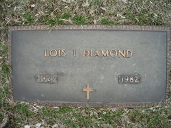
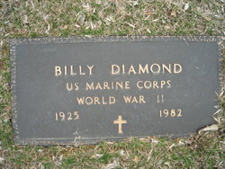
Lois Irene Mayer Diamond
| Birth | : | 29 Aug 1927 Sabetha, Nemaha County, Kansas, USA |
| Death | : | 2 Sep 1982 Council Bluffs, Pottawattamie County, Iowa, USA |
| Burial | : | Mansfield Catholic Cemetery, Mansfield, Richland County, USA |
| Coordinate | : | 40.7477240, -82.5139980 |
| Plot | : | Evergreen Section, Lot 255, Grave 5. |
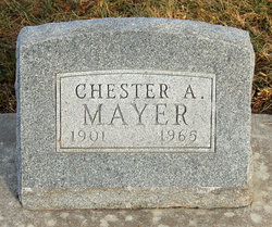
| Description | : | Lois I. Diamond Lois I. Diamond, 55 and 3 days, 1420 Avenue G, Council Bluffs, Pottawattamie County, Iowa, died Thursday September 2, 1982 at the Mercy Hospital after an extended illness, Dr. F. S. Gonlubol, M.D, 417 East Washington. Lois was born August 27, 1927 in Sabetha, Kansas to Chester Albert Mayer and Edith Pearl Porter and had resided since 1939 in Council Bluffs, Iowa. Mrs. Diamond was a clerk for Walgreen Drug Store 22 years both in Omaha and Council Bluffs retiring in 1970. She also worked in the Jubilee Bomber Plant during World War 11. She was... Read More |
frequently asked questions (FAQ):
-
Where is Lois Irene Mayer Diamond's memorial?
Lois Irene Mayer Diamond's memorial is located at: Mansfield Catholic Cemetery, Mansfield, Richland County, USA.
-
When did Lois Irene Mayer Diamond death?
Lois Irene Mayer Diamond death on 2 Sep 1982 in Council Bluffs, Pottawattamie County, Iowa, USA
-
Where are the coordinates of the Lois Irene Mayer Diamond's memorial?
Latitude: 40.7477240
Longitude: -82.5139980
Family Members:
Parent
Spouse
Siblings
Children
Flowers:
Nearby Cemetories:
1. Mansfield Cemetery
Mansfield, Richland County, USA
Coordinate: 40.7445030, -82.5110016
2. East Grave Yard (Defunct)
Mansfield, Richland County, USA
Coordinate: 40.7558880, -82.5117850
3. West Grave Yard (Defunct)
Mansfield, Richland County, USA
Coordinate: 40.7559420, -82.5183860
4. First English Lutheran Church Columbarium
Mansfield, Richland County, USA
Coordinate: 40.7583390, -82.5177620
5. Grace Episcopal Church Columbarium
Mansfield, Richland County, USA
Coordinate: 40.7598310, -82.5234630
6. First Congregational Church Columbarium
Mansfield, Richland County, USA
Coordinate: 40.7477740, -82.5394620
7. Painter Gravesite
Mansfield, Richland County, USA
Coordinate: 40.7700600, -82.4968400
8. Lantz Cemetery
Mansfield, Richland County, USA
Coordinate: 40.7517014, -82.4710999
9. Prince of Peace Catholic Cemetery
Mansfield, Richland County, USA
Coordinate: 40.7517630, -82.4687680
10. Ohio State Reformatory Cemetery
Mansfield, Richland County, USA
Coordinate: 40.7875460, -82.5028690
11. Marlow Cemetery
Mansfield, Richland County, USA
Coordinate: 40.7470200, -82.5719250
12. Caesarea Cemetery
Mansfield, Richland County, USA
Coordinate: 40.7106100, -82.4804400
13. Petit Cemetery
Mifflin Township, Richland County, USA
Coordinate: 40.7655983, -82.4550018
14. Emanuel Cemetery
Mifflin Township, Richland County, USA
Coordinate: 40.7417050, -82.4487230
15. Barr Cemetery
Mansfield, Richland County, USA
Coordinate: 40.7736220, -82.5742470
16. German Church Cemetery
Mansfield, Richland County, USA
Coordinate: 40.6913890, -82.5122500
17. Washington Village Cemetery
Little Washington, Richland County, USA
Coordinate: 40.6956000, -82.4772800
18. Valley Estates Gardens
Mansfield, Richland County, USA
Coordinate: 40.6977780, -82.5581940
19. Mansfield Memorial Park
Ontario, Richland County, USA
Coordinate: 40.7574997, -82.6053009
20. Saint Peters Evangelical Cemetery
Mansfield, Richland County, USA
Coordinate: 40.6778800, -82.5104900
21. Odd Fellows Cemetery
Lucas, Richland County, USA
Coordinate: 40.7047800, -82.4373878
22. Kisling Cemetery
Little Washington, Richland County, USA
Coordinate: 40.6745900, -82.5259440
23. Pleasant Grove Cemetery
Mansfield, Richland County, USA
Coordinate: 40.7821999, -82.4272003
24. Windsor Park Cemetery
Mansfield, Richland County, USA
Coordinate: 40.8018990, -82.4441986


