
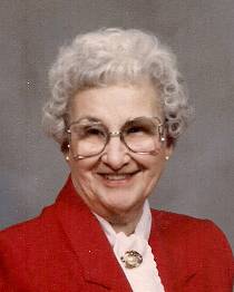

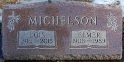
Lois Maxine Santage Michelson
| Birth | : | 8 Jan 1918 Royal, Clay County, Iowa, USA |
| Death | : | 26 Feb 2015 Spencer, Clay County, Iowa, USA |
| Burial | : | Riverside Cemetery, Spencer, Clay County, USA |
| Coordinate | : | 43.1441994, -95.1671982 |
| Description | : | Lois Maxine Michelson, the daughter of A.L. and Lorraine Faulkner Santage, was born January 8, 1918 in Royal, Iowa. She received her education from the Spencer High School. On November 25, 1936, Lois married Elmer Michelson in Sioux Falls, South Dakota. Following their marriage, they farmed near Fostoria until retiring and moving to Spencer in 1982. Lois was an active member of the First Christian Church in Spencer. She served as Deaconess, President and Secretary of C.W.F. and Ladies Circle. Lois also volunteered with the Spencer Hospital Auxiliary, R.S.V.P. and Tops. In her spare time, Lois enjoyed traveling, gardening and playing bridge. Lois... Read More |
frequently asked questions (FAQ):
-
Where is Lois Maxine Santage Michelson's memorial?
Lois Maxine Santage Michelson's memorial is located at: Riverside Cemetery, Spencer, Clay County, USA.
-
When did Lois Maxine Santage Michelson death?
Lois Maxine Santage Michelson death on 26 Feb 2015 in Spencer, Clay County, Iowa, USA
-
Where are the coordinates of the Lois Maxine Santage Michelson's memorial?
Latitude: 43.1441994
Longitude: -95.1671982
Family Members:
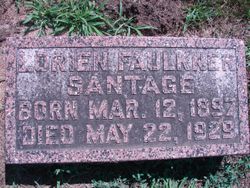
Parent
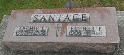
Spouse
Siblings
Flowers:


Nearby Cemetories:
1. Riverside Cemetery
Spencer, Clay County, USA
Coordinate: 43.1441994, -95.1671982
2. Dewey Readmore Books Memorial
Spencer, Clay County, USA
Coordinate: 43.1403999, -95.1443024
3. North Lawn Cemetery
Spencer, Clay County, USA
Coordinate: 43.1600000, -95.1470000
4. Evergreen Cemetery
Clay County, USA
Coordinate: 43.2052994, -95.2086029
5. Fairview Cemetery
Clay County, USA
Coordinate: 43.1899986, -95.0800018
6. Swedish Lutheran Cemetery
Royal, Clay County, USA
Coordinate: 43.0683000, -95.2350000
7. Dickens Cemetery
Dickens, Clay County, USA
Coordinate: 43.1280000, -95.0155000
8. Rosehill Cemetery
Clay County, USA
Coordinate: 43.0368996, -95.0919037
9. Lone Tree Cemetery
Everly, Clay County, USA
Coordinate: 43.1411018, -95.3347015
10. Little Sioux Lutheran Cemetery
Milford, Dickinson County, USA
Coordinate: 43.2702065, -95.2109528
11. First Reformed Cemetery
Clay County, USA
Coordinate: 43.2399500, -95.2889000
12. Lincoln Cemetery
Rossie, Clay County, USA
Coordinate: 43.0111008, -95.2313995
13. Willow Creek Cemetery
Royal, Clay County, USA
Coordinate: 43.0214005, -95.2885971
14. Liberty Cemetery
Greenville, Clay County, USA
Coordinate: 42.9897003, -95.1417007
15. Clay Center Cemetery
Royal, Clay County, USA
Coordinate: 43.0410995, -95.3272018
16. Milford Cemetery
Milford, Dickinson County, USA
Coordinate: 43.3092003, -95.1481018
17. TriMello Cemetery
Royal, Clay County, USA
Coordinate: 43.0682983, -95.3728027
18. Logan Township Cemetery
Clay County, USA
Coordinate: 43.0489006, -94.9747009
19. Zion Methodist Cemetery
Clay County, USA
Coordinate: 42.9808006, -95.2497025
20. Calvary Cemetery
Milford, Dickinson County, USA
Coordinate: 43.3213997, -95.1688995
21. Fanny Fern Cemetery
Clay County, USA
Coordinate: 42.9530983, -95.1607971
22. Crown Hill Cemetery
Ruthven, Palo Alto County, USA
Coordinate: 43.1328011, -94.8878021
23. Calvary Cemetery
Ruthven, Palo Alto County, USA
Coordinate: 43.1314011, -94.8869019
24. Westport Cemetery
Dickinson County, USA
Coordinate: 43.3130989, -95.3289032