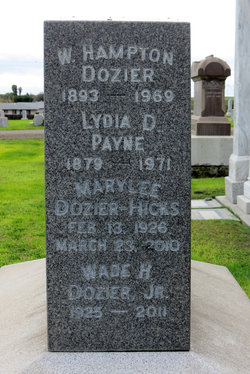
Lolita Kyte Dozier
| Birth | : | 7 Feb 1890 California, USA |
| Death | : | 25 May 1973 Sacramento County, California, USA |
| Burial | : | Rio Vista Odd Fellows and Masonic Cemetery, Rio Vista, Solano County, USA |
| Coordinate | : | 38.1632919, -121.6999283 |
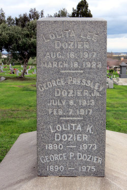
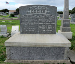
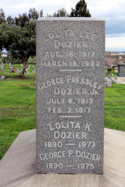
| Inscription | : | LOLITA K. DOZIER 1890 - 1973 |
| Description | : | Name: Lolita K Dozier Gender: Female Birth Date: 7 Feb 1890 Birth Place: California Death Date: 25 May 1973 Death Place: Sacramento At the time of the 1930 census, George and Lolita were married, they had one daughter, Mary Lee, were living in Township 5, Glenn County, CA, where George was working as a rice farmer. In 1940, George, Lolita and Mary were living in Sacramento (at that time the area they lived in was called Center) and George was working as a farm superintendent. SOURCE: ancestry.com - California Death Index - U.S. Federal Census |
frequently asked questions (FAQ):
-
Where is Lolita Kyte Dozier's memorial?
Lolita Kyte Dozier's memorial is located at: Rio Vista Odd Fellows and Masonic Cemetery, Rio Vista, Solano County, USA.
-
When did Lolita Kyte Dozier death?
Lolita Kyte Dozier death on 25 May 1973 in Sacramento County, California, USA
-
Where are the coordinates of the Lolita Kyte Dozier's memorial?
Latitude: 38.1632919
Longitude: -121.6999283
Family Members:
Parent
Spouse
Siblings
Children
Flowers:
Nearby Cemetories:
1. Rio Vista Odd Fellows and Masonic Cemetery
Rio Vista, Solano County, USA
Coordinate: 38.1632919, -121.6999283
2. Rio Vista Catholic Cemetery
Rio Vista, Solano County, USA
Coordinate: 38.1611176, -121.6976471
3. Rio Vista Memorial Park
Rio Vista, Solano County, USA
Coordinate: 38.1603127, -121.6971054
4. Collinsville Cemetery
Collinsville, Solano County, USA
Coordinate: 38.0768635, -121.8499580
5. Shiloh Cemetery
Birds Landing, Solano County, USA
Coordinate: 38.1685310, -121.8893440
6. Sharp Family Cemetery
Walnut Grove, Sacramento County, USA
Coordinate: 38.2351900, -121.5135800
7. Holy Cross Cemetery
Antioch, Contra Costa County, USA
Coordinate: 38.0057983, -121.7733002
8. Oak View Memorial Park
Antioch, Contra Costa County, USA
Coordinate: 38.0036011, -121.7696991
9. Haney Family Estate Cemetery
Antioch, Contra Costa County, USA
Coordinate: 38.0027700, -121.7704400
10. Binghampton Cemetery
Solano County, USA
Coordinate: 38.3510550, -121.8244220
11. Rose Hill Cemetery
Antioch, Contra Costa County, USA
Coordinate: 37.9576700, -121.8713100
12. Point Pleasant Cemetery
Point Pleasant, Sacramento County, USA
Coordinate: 38.3308525, -121.4638290
13. Union Cemetery
Brentwood, Contra Costa County, USA
Coordinate: 37.9103012, -121.6477966
14. Old County Hospital Cemetery
Fairfield, Solano County, USA
Coordinate: 38.2659190, -122.0135510
15. De Vries Ranch Family Cemetery
Lodi, San Joaquin County, USA
Coordinate: 38.2005530, -121.3556060
16. Vacaville-Elmira Cemetery
Vacaville, Solano County, USA
Coordinate: 38.3517570, -121.9634933
17. Port Chicago Naval Magazine National Memorial
Concord, Contra Costa County, USA
Coordinate: 38.0574610, -122.0296950
18. Suisun-Fairfield Cemetery
Fairfield, Solano County, USA
Coordinate: 38.2613678, -122.0405960
19. Saint Alphonsus Catholic Cemetery
Fairfield, Solano County, USA
Coordinate: 38.2620546, -122.0410961
20. Franklin Cemetery
Franklin, Sacramento County, USA
Coordinate: 38.3761749, -121.4558029
21. Fairmont Memorial Park
Fairfield, Solano County, USA
Coordinate: 38.2648040, -122.0411970
22. Sacramento Valley National Cemetery
Dixon, Solano County, USA
Coordinate: 38.4167800, -121.8754000
23. Dixon Cemetery
Dixon, Solano County, USA
Coordinate: 38.4354553, -121.8227005
24. Pioneer Cemetery at Pena Adobe
Vacaville, Solano County, USA
Coordinate: 38.3389200, -122.0127200

