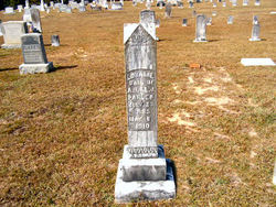
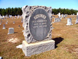
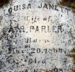
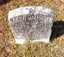
Loraine Parler
| Birth | : | 23 Jul 1896 South Carolina, USA |
| Death | : | 8 May 1910 Saluda, Saluda County, South Carolina, USA |
| Burial | : | Immanuel Lutheran Cemetery, Havillah, Okanogan County, USA |
| Coordinate | : | 48.8305500, -119.2033500 |
| Description | : | Orangeburg, May 10 - Miss Lorraine Parler, the 15-year-old daughter of A. R. Parler, died at Saluda, N.C. [S.C.], Sunday night, after a long illness. Mr. Parler moved his family to Saluda from Elloree some months ago. The body of the young lady passed through this city this morning, having been taken to the old home. The funeral ceremonies were held this morning at Santee Baptist church, near Elloree, at 11 o'clock. © The State, Columbia, SC, 11 May 1910 |
frequently asked questions (FAQ):
-
Where is Loraine Parler's memorial?
Loraine Parler's memorial is located at: Immanuel Lutheran Cemetery, Havillah, Okanogan County, USA.
-
When did Loraine Parler death?
Loraine Parler death on 8 May 1910 in Saluda, Saluda County, South Carolina, USA
-
Where are the coordinates of the Loraine Parler's memorial?
Latitude: 48.8305500
Longitude: -119.2033500
Family Members:
Parent
Siblings
Flowers:
Nearby Cemetories:
1. Immanuel Lutheran Cemetery
Havillah, Okanogan County, USA
Coordinate: 48.8305500, -119.2033500
2. Kipling Cemetery
Okanogan County, USA
Coordinate: 48.9080500, -119.1652900
3. Mountain View Memorial Cemetery
Ellisforde, Okanogan County, USA
Coordinate: 48.8328300, -119.4011300
4. Wauconda Cemetery
Wauconda, Okanogan County, USA
Coordinate: 48.7408300, -119.0597300
5. Ellisforde Mission Cemetery
Ellisforde, Okanogan County, USA
Coordinate: 48.7908300, -119.3972300
6. Molson Cemetery
Molson, Okanogan County, USA
Coordinate: 48.9657000, -119.2105000
7. Chesaw Cemetery
Okanogan County, USA
Coordinate: 48.9299900, -119.0541800
8. Thomason Ranch Graves
Okanogan County, USA
Coordinate: 48.7757200, -118.9821900
9. Thorp Cemetery
Chesaw, Okanogan County, USA
Coordinate: 48.9549900, -119.0316700
10. Old Oroville Cemetery
Okanogan County, USA
Coordinate: 48.8913360, -119.4456230
11. Anglin Cemetery
Okanogan County, USA
Coordinate: 48.6627700, -119.2783400
12. Old Riverview Cemetery
Oroville, Okanogan County, USA
Coordinate: 48.9177800, -119.4466700
13. Tonasket Cemetery
Tonasket, Okanogan County, USA
Coordinate: 48.7284400, -119.4328200
14. Oroville Riverview Cemetery
Oroville, Okanogan County, USA
Coordinate: 48.9202700, -119.4458500
15. Sidley-Lawless Cemetery
Sidley, Kootenay Boundary Regional District, Canada
Coordinate: 49.0153330, -119.2234330
16. Bridesville Cemetery
Bridesville, Kootenay Boundary Regional District, Canada
Coordinate: 49.0370800, -119.1372300
17. Phillip Raux Gravesite
Riverside, Okanogan County, USA
Coordinate: 48.6271800, -119.3308500
18. Golden Cemetery
Okanogan County, USA
Coordinate: 48.9014015, -119.5203018
19. Cook Place Cemetery
Tonasket, Okanogan County, USA
Coordinate: 48.6083330, -119.3544440
20. Cook Family Cemetery
Carlton, Okanogan County, USA
Coordinate: 48.6083300, -119.3544400
21. Mountain View Cemetery
Loomis, Okanogan County, USA
Coordinate: 48.8152700, -119.6100100
22. Aeneas Valley Cemetery
Okanogan County, USA
Coordinate: 48.5751200, -119.0513500
23. Little Chopaka Cemetery
Okanogan County, USA
Coordinate: 48.8272200, -119.6430600
24. Eagle Cliff Cemetery
Toroda, Ferry County, USA
Coordinate: 48.9404375, -118.7946296


