

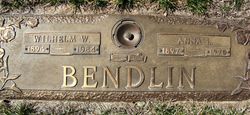
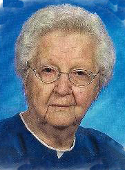
Lorraine Agnes Bendlin Pullen
| Birth | : | 31 Oct 1922 Clay County, Iowa, USA |
| Death | : | 21 Aug 2018 Spencer, Clay County, Iowa, USA |
| Burial | : | Riverside Cemetery, Spencer, Clay County, USA |
| Coordinate | : | 43.1441994, -95.1671982 |
| Description | : | Lorraine Agnes Pullen, the daughter of William and Anna (Pohl) Bendlin, was born October 31, 1922 in Clay County, IA. Her childhood years were spent in the Okoboji, IA area, where she received her education, graduating from Okoboji High School. Lorraine married Robert Wayne Pullen on March 27, 1949 in Spencer, IA. Throughout their married life they farmed on the “home place” south of Spencer, where Robert was born. Lorraine worked as a homemaker, a bookkeeper, and helped at the senior center, before retiring at 80. Lorraine enjoyed... Read More |
frequently asked questions (FAQ):
-
Where is Lorraine Agnes Bendlin Pullen's memorial?
Lorraine Agnes Bendlin Pullen's memorial is located at: Riverside Cemetery, Spencer, Clay County, USA.
-
When did Lorraine Agnes Bendlin Pullen death?
Lorraine Agnes Bendlin Pullen death on 21 Aug 2018 in Spencer, Clay County, Iowa, USA
-
Where are the coordinates of the Lorraine Agnes Bendlin Pullen's memorial?
Latitude: 43.1441994
Longitude: -95.1671982
Family Members:
Parent

Spouse
Siblings

Flowers:


Nearby Cemetories:
1. Riverside Cemetery
Spencer, Clay County, USA
Coordinate: 43.1441994, -95.1671982
2. Dewey Readmore Books Memorial
Spencer, Clay County, USA
Coordinate: 43.1403999, -95.1443024
3. North Lawn Cemetery
Spencer, Clay County, USA
Coordinate: 43.1600000, -95.1470000
4. Evergreen Cemetery
Clay County, USA
Coordinate: 43.2052994, -95.2086029
5. Fairview Cemetery
Clay County, USA
Coordinate: 43.1899986, -95.0800018
6. Swedish Lutheran Cemetery
Royal, Clay County, USA
Coordinate: 43.0683000, -95.2350000
7. Dickens Cemetery
Dickens, Clay County, USA
Coordinate: 43.1280000, -95.0155000
8. Rosehill Cemetery
Clay County, USA
Coordinate: 43.0368996, -95.0919037
9. Lone Tree Cemetery
Everly, Clay County, USA
Coordinate: 43.1411018, -95.3347015
10. Little Sioux Lutheran Cemetery
Milford, Dickinson County, USA
Coordinate: 43.2702065, -95.2109528
11. First Reformed Cemetery
Clay County, USA
Coordinate: 43.2399500, -95.2889000
12. Lincoln Cemetery
Rossie, Clay County, USA
Coordinate: 43.0111008, -95.2313995
13. Willow Creek Cemetery
Royal, Clay County, USA
Coordinate: 43.0214005, -95.2885971
14. Liberty Cemetery
Greenville, Clay County, USA
Coordinate: 42.9897003, -95.1417007
15. Clay Center Cemetery
Royal, Clay County, USA
Coordinate: 43.0410995, -95.3272018
16. Milford Cemetery
Milford, Dickinson County, USA
Coordinate: 43.3092003, -95.1481018
17. TriMello Cemetery
Royal, Clay County, USA
Coordinate: 43.0682983, -95.3728027
18. Logan Township Cemetery
Clay County, USA
Coordinate: 43.0489006, -94.9747009
19. Zion Methodist Cemetery
Clay County, USA
Coordinate: 42.9808006, -95.2497025
20. Calvary Cemetery
Milford, Dickinson County, USA
Coordinate: 43.3213997, -95.1688995
21. Fanny Fern Cemetery
Clay County, USA
Coordinate: 42.9530983, -95.1607971
22. Crown Hill Cemetery
Ruthven, Palo Alto County, USA
Coordinate: 43.1328011, -94.8878021
23. Calvary Cemetery
Ruthven, Palo Alto County, USA
Coordinate: 43.1314011, -94.8869019
24. Westport Cemetery
Dickinson County, USA
Coordinate: 43.3130989, -95.3289032