

Lottie May Stevens Sherrill
| Birth | : | 14 Jun 1898 Missouri, USA |
| Death | : | 19 Oct 1951 Farmington, St. Francois County, Missouri, USA |
| Burial | : | Mineral Baptist Cemetery, Keyser, Mineral County, USA |
| Coordinate | : | 39.4411400, -78.8264300 |
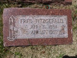
| Description | : | Daughter of George and Ida (Dennis) Stevens. Married (1) Fitzgerald and (2) Walter Sherrill. Information taken from death certificate. From Contributor #47374854: Mrs. Lottie Mae Stevens Fitzgerald married Walter Sherrill on December 30, 1944 in Crystal City, Jefferson County, Missouri. According to the Missouri Death Certificates, 1910 - 1966 for Mrs. Lottie Mae Stevens [Fitzgerald] Sherrill, Lottie was born on June 14, 1898 in Missouri and died on October 19, 1951 in St. Francois County, Missouri. Missouri, Marriage Records, 1805-2002 Name: Mrs Lottie Fitzgerald Marriage Date: 30 Dec 1944 Marriage Place: Crystal City, Jefferson County, Missouri Registration... Read More |
frequently asked questions (FAQ):
-
Where is Lottie May Stevens Sherrill's memorial?
Lottie May Stevens Sherrill's memorial is located at: Mineral Baptist Cemetery, Keyser, Mineral County, USA.
-
When did Lottie May Stevens Sherrill death?
Lottie May Stevens Sherrill death on 19 Oct 1951 in Farmington, St. Francois County, Missouri, USA
-
Where are the coordinates of the Lottie May Stevens Sherrill's memorial?
Latitude: 39.4411400
Longitude: -78.8264300
Family Members:
Parent
Spouse
Siblings
Children


Nearby Cemetories:
1. Mineral Baptist Cemetery
Keyser, Mineral County, USA
Coordinate: 39.4411400, -78.8264300
2. Eusebia Church Cemetery
Fort Ashby, Mineral County, USA
Coordinate: 39.4517708, -78.8118820
3. Centenary United Methodist Church Cemetery
Reeses Mill, Mineral County, USA
Coordinate: 39.4327202, -78.8578644
4. Rees Memorial Cemetery
Fort Ashby, Mineral County, USA
Coordinate: 39.4628868, -78.8004227
5. Greenwall Cemetery
Headsville, Mineral County, USA
Coordinate: 39.4077230, -78.8491330
6. Orr Cemetery
Independence, Preston County, USA
Coordinate: 39.4252620, -78.8777500
7. Headsville Methodist Episcopal Church Cemetery
Keyser, Mineral County, USA
Coordinate: 39.3899078, -78.8533401
8. Urice Cemetery
Mineral County, USA
Coordinate: 39.4687400, -78.8923000
9. Mount Zion Cemetery
Mineral County, USA
Coordinate: 39.4642900, -78.8974500
10. Omega-Alpha Cemetery
Short Gap, Mineral County, USA
Coordinate: 39.5026940, -78.8696110
11. Herriott Family Cemetery
Romney, Hampshire County, USA
Coordinate: 39.3765550, -78.7826250
12. Cabin Run Cemetery
Keyser, Mineral County, USA
Coordinate: 39.4206009, -78.9216995
13. Sears Cemetery
Mineral County, USA
Coordinate: 39.4026900, -78.9148200
14. Frankfort Cemetery
Fort Ashby, Mineral County, USA
Coordinate: 39.5028000, -78.7632980
15. Fort Ashby Cemetery
Fort Ashby, Mineral County, USA
Coordinate: 39.5041030, -78.7641890
16. Malone Cemetery
Mineral County, USA
Coordinate: 39.5169220, -78.7667840
17. Nicholas Leatherman Cemetery
Burlington, Mineral County, USA
Coordinate: 39.3625720, -78.8912770
18. County Poor House Cemetery
Mineral County, USA
Coordinate: 39.4788710, -78.9411070
19. Dawson Cemetery
Dawson, Allegany County, USA
Coordinate: 39.4737360, -78.9464880
20. Beaver Run Cemetery
Burlington, Mineral County, USA
Coordinate: 39.3467712, -78.8677979
21. Dayton Cemetery
McCoole, Allegany County, USA
Coordinate: 39.4437000, -78.9573400
22. Potomac Memorial Gardens
Keyser, Mineral County, USA
Coordinate: 39.4312000, -78.9579700
23. Waxler Cemetery
Danville, Allegany County, USA
Coordinate: 39.5097008, -78.9263992
24. Cresap Cemetery
Rawlings, Allegany County, USA
Coordinate: 39.5341988, -78.8874969