
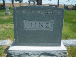

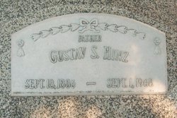
Louis Otto Hinz
| Birth | : | 4 May 1878 Texas, USA |
| Death | : | 25 Nov 1963 Arapahoe, Furnas County, Nebraska, USA |
| Burial | : | Eyre Cemetery, Sudbury, Greater Sudbury Municipality, Canada |
| Coordinate | : | 46.4839190, -81.0080430 |
| Description | : | Louis never married; the only one of twelve children who remained single. When he was eight years old he was injured while pulling a nail. The nail slipped and hit his left eye. Though surgery was performed on the eye he was blind in that eye for the rest of his life. As an adult he owned and operated a livery stable in Arapahoe for many years. |
frequently asked questions (FAQ):
-
Where is Louis Otto Hinz's memorial?
Louis Otto Hinz's memorial is located at: Eyre Cemetery, Sudbury, Greater Sudbury Municipality, Canada.
-
When did Louis Otto Hinz death?
Louis Otto Hinz death on 25 Nov 1963 in Arapahoe, Furnas County, Nebraska, USA
-
Where are the coordinates of the Louis Otto Hinz's memorial?
Latitude: 46.4839190
Longitude: -81.0080430
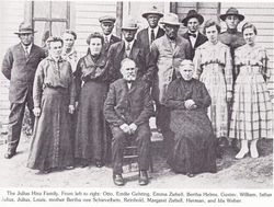
Family Members:
Parent


Siblings

Flowers:


Nearby Cemetories:
1. Eyre Cemetery
Sudbury, Greater Sudbury Municipality, Canada
Coordinate: 46.4839190, -81.0080430
2. Sudbury Anglican Cemetery
Sudbury, Greater Sudbury Municipality, Canada
Coordinate: 46.4843600, -81.0075800
3. Park Lawn Cemetery
Sudbury, Greater Sudbury Municipality, Canada
Coordinate: 46.4842010, -81.0127730
4. LaSalle Roman Catholic Cemetery
Sudbury, Greater Sudbury Municipality, Canada
Coordinate: 46.5226600, -80.9773200
5. McFarlane Cemetery
Sudbury, Greater Sudbury Municipality, Canada
Coordinate: 46.4358620, -80.9913230
6. Civic Memorial Cemetery
Sudbury, Greater Sudbury Municipality, Canada
Coordinate: 46.4995995, -80.9368515
7. Long Lake Finnish Cemetery
Sudbury, Sudbury District, Canada
Coordinate: 46.4218490, -81.0052630
8. Saint Stanislaus Roman Catholic Cemetery New
Lively, Greater Sudbury Municipality, Canada
Coordinate: 46.4316700, -81.1162900
9. Waters Cemetery
Lively, Greater Sudbury Municipality, Canada
Coordinate: 46.4236500, -81.1359200
10. Saint John's Cemetery
Garson, Greater Sudbury Municipality, Canada
Coordinate: 46.5513581, -80.8613157
11. Blezard Valley Cemetery
Blezard Valley, Greater Sudbury Municipality, Canada
Coordinate: 46.6094760, -81.0542630
12. Good Shepherd Cemetery
Garson, Greater Sudbury Municipality, Canada
Coordinate: 46.5722850, -80.8472730
13. Atikameksheng Cemetery
Naughton, Greater Sudbury Municipality, Canada
Coordinate: 46.4014470, -81.1790660
14. Wahnapitae Protestant Cemetery
Sudbury, Sudbury District, Canada
Coordinate: 46.4905280, -80.7858910
15. Ruff Pioneer Cemetery
Garson, Greater Sudbury Municipality, Canada
Coordinate: 46.5586900, -80.8132800
16. Wahnapitae Catholic Cemetery
Sudbury, Sudbury District, Canada
Coordinate: 46.4892760, -80.7840900
17. St. Joseph's Catholic Cemetery
Chelmsford, Greater Sudbury Municipality, Canada
Coordinate: 46.5855050, -81.1820650
18. Chelmsford Protestant Cemetery
Chelmsford, Greater Sudbury Municipality, Canada
Coordinate: 46.5687130, -81.2120780
19. Saint Jacques Roman Catholic Cemetery
Hanmer, Greater Sudbury Municipality, Canada
Coordinate: 46.6520700, -80.9422600
20. Valley East Cemetery
Valley East, Greater Sudbury Municipality, Canada
Coordinate: 46.6675800, -80.9518900
21. Elbow Ridge Cemetery
Estaire, Sudbury District, Canada
Coordinate: 46.3236700, -80.7989760
22. Capreol Cemetery
Capreol, Greater Sudbury Municipality, Canada
Coordinate: 46.6962130, -80.9126210
23. Whitefish Public Cemetery
Whitefish, Greater Sudbury Municipality, Canada
Coordinate: 46.3772000, -81.3185800
24. Whitefish Catholic Cemetery
Whitefish, Greater Sudbury Municipality, Canada
Coordinate: 46.3806900, -81.3232800