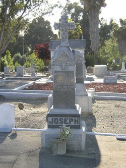
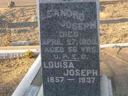
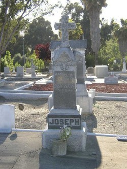
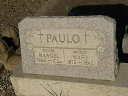
Louisa Ferreira Joseph
| Birth | : | 12 May 1857 Azores Region, Portugal |
| Death | : | 17 May 1937 Pleasanton, Alameda County, California, USA |
| Burial | : | Ripon Cemetery, Ripon, San Joaquin County, USA |
| Coordinate | : | 37.7420311, -121.1238708 |
| Description | : | Oakland Tribune Monday May 17, 1937 Deaths AVILLA - Louisa, wife of the late Leandro Joseph Avilla, loving mother of Mrs. Rollie Bell, Mrs. Maryana Andrade, Mrs. Joseph Paulo, Mrs. Mary Paulo, Mrs. Anthony Rabello of Pleasanton, Mrs. Louise Ferrera of Livermore, Mrs. Frank Daviner of Sunnyvale, and mother of the late Manuel and Leandro Joseph Avilla of Pleasanton, sister of Mrs. Isabel Avilla and Mary Rose of Pleasanton, James Ferreira of Livermore, and sister of the late Maryana Roe of Pleasanton, and John Ferreira of San Ramon, and Manuel Ferreira of Hayward, grandmother of 17 grandchildren and 15 great grandchildren; a native... Read More |
frequently asked questions (FAQ):
-
Where is Louisa Ferreira Joseph's memorial?
Louisa Ferreira Joseph's memorial is located at: Ripon Cemetery, Ripon, San Joaquin County, USA.
-
When did Louisa Ferreira Joseph death?
Louisa Ferreira Joseph death on 17 May 1937 in Pleasanton, Alameda County, California, USA
-
Where are the coordinates of the Louisa Ferreira Joseph's memorial?
Latitude: 37.7420311
Longitude: -121.1238708
Family Members:
Spouse
Children
Flowers:
Nearby Cemetories:
1. Ripon Cemetery
Ripon, San Joaquin County, USA
Coordinate: 37.7420311, -121.1238708
2. Wood Colony Cemetery
Salida, Stanislaus County, USA
Coordinate: 37.6893730, -121.0682144
3. Saint John's Catholic Cemetery
Escalon, San Joaquin County, USA
Coordinate: 37.7994537, -121.0705185
4. Good Shepherd Catholic Cemetery
Modesto, Stanislaus County, USA
Coordinate: 37.6853130, -121.0672890
5. Atlanta Cemetery
Five Corners, San Joaquin County, USA
Coordinate: 37.8270035, -121.1420135
6. East Union Cemetery
Manteca, San Joaquin County, USA
Coordinate: 37.8114014, -121.2350006
7. Burwood Cemetery
Escalon, San Joaquin County, USA
Coordinate: 37.7616997, -120.9593964
8. Park View Cemetery
Manteca, San Joaquin County, USA
Coordinate: 37.8617249, -121.2238312
9. Modesto Citizens Cemetery
Modesto, Stanislaus County, USA
Coordinate: 37.6472930, -120.9845570
10. Acacia Memorial Park
Modesto, Stanislaus County, USA
Coordinate: 37.6481080, -120.9836610
11. Modesto County Cemetery
Modesto, Stanislaus County, USA
Coordinate: 37.6492400, -120.9813800
12. Modesto Pioneer Cemetery
Modesto, Stanislaus County, USA
Coordinate: 37.6473350, -120.9829040
13. Saint Stanislaus Catholic Cemetery
Modesto, Stanislaus County, USA
Coordinate: 37.6473610, -120.9808440
14. Collegeville Cemetery
Collegeville, San Joaquin County, USA
Coordinate: 37.9044800, -121.1466141
15. Valley Home Memorial Park
Oakdale, Stanislaus County, USA
Coordinate: 37.8275528, -120.9333267
16. Congregation Adas Yeshuran of Stockton Cemetery
French Camp, San Joaquin County, USA
Coordinate: 37.8784065, -121.2740784
17. Congregation of Ahavas Achim Cemetery
French Camp, San Joaquin County, USA
Coordinate: 37.8778419, -121.2753067
18. Langworth Cemetery
Oakdale, Stanislaus County, USA
Coordinate: 37.7580986, -120.8957977
19. Chinese Cemetery
French Camp, San Joaquin County, USA
Coordinate: 37.8819962, -121.2805862
20. Grayson Cemetery
Grayson, Stanislaus County, USA
Coordinate: 37.5594559, -121.1802826
21. Ceres Memorial Park
Ceres, Stanislaus County, USA
Coordinate: 37.5958214, -120.9634399
22. Highland View Memorial Gardens
Farmington, San Joaquin County, USA
Coordinate: 37.9242935, -121.0008621
23. Lakewood Memorial Park
Hughson, Stanislaus County, USA
Coordinate: 37.6199760, -120.8975983
24. Patterson District Cemetery
Patterson, Stanislaus County, USA
Coordinate: 37.5268135, -121.1728287

