| Birth | : | 27 Dec 1927 Florence County, South Carolina, USA |
| Death | : | Mar 1987 Berkeley County, South Carolina, USA |
| Burial | : | Carolina Memorial Park, North Charleston, Charleston County, USA |
| Coordinate | : | 32.9281006, -80.0408020 |
| Inscription | : | Together Forever |
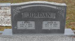
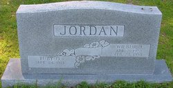
| Description | : | U.S., Social Security Applications and Claims Index, 1936-2007 Name: Lucille Ivory Jordan [Lucille Jordan Huggins] [Lucille Huggins] Gender: Female Race: White Birth Date: 27 Dec 1927 Birth Place: Scranton Flo, South Carolina Death Date: Mar 1987 Father: Byrd S Jordan Mother: Janie E Osborne SSN: Notes: Sep 1944: Name listed as LUCILLE IVORY JORDAN; Nov 1950: Name listed as LUCILLE JORDAN HUGGINS; 30 Dec 1987: Name listed as LUCILLE HUGGINS Social Security Death Index (SSDI) Death Record Name: Lucille Huggins State of Issue: South... Read More |
frequently asked questions (FAQ):
-
Where is Lucille Ivory Jordan Huggins's memorial?
Lucille Ivory Jordan Huggins's memorial is located at: Carolina Memorial Park, North Charleston, Charleston County, USA.
-
When did Lucille Ivory Jordan Huggins death?
Lucille Ivory Jordan Huggins death on Mar 1987 in Berkeley County, South Carolina, USA
-
Where are the coordinates of the Lucille Ivory Jordan Huggins's memorial?
Latitude: 32.9281006
Longitude: -80.0408020
Family Members:
Parent
Spouse
Siblings
Flowers:
Nearby Cemetories:
1. Carolina Memorial Park
North Charleston, Charleston County, USA
Coordinate: 32.9281006, -80.0408020
2. Johnson Cemetery
North Charleston, Charleston County, USA
Coordinate: 32.9268990, -80.0507965
3. Sunset Memorial Gardens
North Charleston, Charleston County, USA
Coordinate: 32.9300003, -80.0569000
4. Bee Cemetery
Hanahan, Berkeley County, USA
Coordinate: 32.9474100, -80.0182100
5. Shield of Faith Church Cemetery
Goose Creek, Berkeley County, USA
Coordinate: 32.9341930, -80.0063240
6. Greater Bethel AME Church Cemetery
Goose Creek, Berkeley County, USA
Coordinate: 32.9352930, -80.0063160
7. Oak Grove Baptist Church Cemetery
North Charleston, Charleston County, USA
Coordinate: 32.9019012, -80.0199966
8. Yeamans Park Presbyterian Church
Hanahan, Berkeley County, USA
Coordinate: 32.9135320, -80.0037600
9. Bethel A .M. E. Church
North Charleston, Charleston County, USA
Coordinate: 32.9015300, -80.0134200
10. Saint James Goose Creek Cemetery
Goose Creek, Berkeley County, USA
Coordinate: 32.9754400, -80.0326100
11. Yeamans Hall Plantation Cemetery
Goose Creek, Berkeley County, USA
Coordinate: 32.9268990, -79.9783020
12. Trinity Missionary Baptist Church
Goose Creek, Berkeley County, USA
Coordinate: 32.9814970, -80.0320500
13. NMC 1
Goose Creek, Berkeley County, USA
Coordinate: 32.9510713, -79.9736998
14. Pet Rest Cemetery & Cremation
Goose Creek, Berkeley County, USA
Coordinate: 32.9908490, -80.0362330
15. Saint Peter's AME Church Cemetery
North Charleston, Charleston County, USA
Coordinate: 32.8778343, -79.9947891
16. Rivers Cemetery
Goose Creek, Berkeley County, USA
Coordinate: 32.9866400, -80.0063980
17. Union Baptist Church Cemetery
North Charleston, Charleston County, USA
Coordinate: 32.8713900, -80.0004900
18. Historic African American Cemetery
Saint Andrews, Charleston County, USA
Coordinate: 32.8708354, -80.0826019
19. Castle Cemetery
Charleston County, USA
Coordinate: 32.8807983, -80.1025009
20. African American Cemetery
Saint Andrews, Charleston County, USA
Coordinate: 32.8655640, -80.0809940
21. Joshua Baptist Church Cemetery
North Charleston, Charleston County, USA
Coordinate: 32.8593254, -80.0129166
22. Promiseland Missionary Baptist Church
North Charleston, Charleston County, USA
Coordinate: 32.8581619, -80.0125046
23. Moore Family Cemetery
North Charleston, Charleston County, USA
Coordinate: 32.9048744, -80.1247598
24. New Zion RMUE Church Cemetery
North Charleston, Charleston County, USA
Coordinate: 32.8540580, -80.0185270


