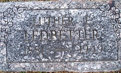
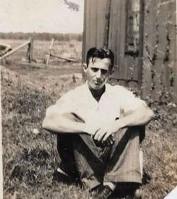
Luther Ellis “Snip” Ledbetter
| Birth | : | 23 Aug 1881 Hackett, Sebastian County, Arkansas, USA |
| Death | : | 12 Oct 1949 Midland, Sebastian County, Arkansas, USA |
| Burial | : | Highland Cemetery, Colville, Stevens County, USA |
| Coordinate | : | 48.5507060, -117.8875490 |
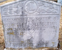
| Description | : | Luther's biological mother was Emilie Hester Crowell Ledbetter. She died in 1886 and his father married Emilie's, niece Mattie Bell Beatrice Crowell in 1902 and she raised all of the children with Jim Ledbetter. Luther and his siblings always considered Mattie their mother. Luther had several half siblings as well. |
frequently asked questions (FAQ):
-
Where is Luther Ellis “Snip” Ledbetter's memorial?
Luther Ellis “Snip” Ledbetter's memorial is located at: Highland Cemetery, Colville, Stevens County, USA.
-
When did Luther Ellis “Snip” Ledbetter death?
Luther Ellis “Snip” Ledbetter death on 12 Oct 1949 in Midland, Sebastian County, Arkansas, USA
-
Where are the coordinates of the Luther Ellis “Snip” Ledbetter's memorial?
Latitude: 48.5507060
Longitude: -117.8875490
Family Members:
Parent
Spouse
Siblings
Children
Flowers:
Nearby Cemetories:
1. Highland Cemetery
Colville, Stevens County, USA
Coordinate: 48.5507060, -117.8875490
2. Mountain View Cemetery
Colville, Stevens County, USA
Coordinate: 48.5510500, -117.8866500
3. Calvary Cemetery
Colville, Stevens County, USA
Coordinate: 48.5508830, -117.8834830
4. Evergreen Cemetery
Colville, Stevens County, USA
Coordinate: 48.5640400, -117.8798800
5. Fort Colville Post Cemetery
Stevens County, USA
Coordinate: 48.5722270, -117.8789230
6. Saint Francis Regis Mission Cemetery
Kettle Falls, Stevens County, USA
Coordinate: 48.6067500, -118.0250700
7. Lady Of The Valley Cemetery
Ward, Stevens County, USA
Coordinate: 48.6035900, -118.0281300
8. Meyers Falls Cemetery
Kettle Falls, Stevens County, USA
Coordinate: 48.6064000, -118.0634000
9. Grandview Cemetery
Kettle Falls, Stevens County, USA
Coordinate: 48.5760200, -118.1000700
10. River View Cemetery
Marcus, Stevens County, USA
Coordinate: 48.6690300, -118.0404400
11. Saint Paul Mission Cemetery
Stevens County, USA
Coordinate: 48.6296830, -118.1060430
12. Tanger-Skeels Cemetery
Stevens County, USA
Coordinate: 48.3699400, -117.8522400
13. Garden Valley Cemetery
Ferry County, USA
Coordinate: 48.5230560, -118.1891670
14. Addy Cemetery
Addy, Stevens County, USA
Coordinate: 48.3442688, -117.8465576
15. Mountain View Cemetery
Rice, Stevens County, USA
Coordinate: 48.4312515, -118.1510086
16. Bossburg Cemetery
Stevens County, USA
Coordinate: 48.7435989, -118.0485992
17. Cully Memorial Cemetery
Rice, Stevens County, USA
Coordinate: 48.4277992, -118.1650009
18. Green Mountain Cemetery
Stevens County, USA
Coordinate: 48.7200180, -118.1178760
19. Summit Valley Cemetery
Addy, Stevens County, USA
Coordinate: 48.3086014, -117.9424973
20. Barnaby Mission Cemetery (Defunct)
Inchelium, Ferry County, USA
Coordinate: 48.4328800, -118.2202500
21. Fairview Cemetery
Daisy, Stevens County, USA
Coordinate: 48.3627510, -118.1387650
22. Stranger Creek Cemetery
Daisy, Stevens County, USA
Coordinate: 48.3297005, -118.0832977
23. Meredith Homestead Cemetery
Tiger, Pend Oreille County, USA
Coordinate: 48.6319440, -117.4952780
24. Pia Mission Cemetery
Stevens County, USA
Coordinate: 48.7960700, -118.1097300

