| Birth | : | 7 Jul 1925 Cockeysville, Baltimore County, Maryland, USA |
| Death | : | 26 May 2007 Sylvania, Lucas County, Ohio, USA |
| Burial | : | Burnie Lawn Cemetery, East Cam, Burnie City, Australia |
| Coordinate | : | -41.0583700, 145.8518460 |
| Plot | : | 427 |
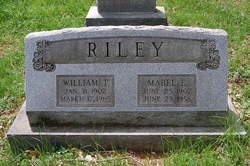
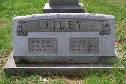
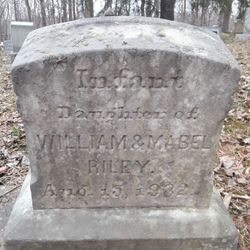
| Description | : | Mabel is the daughter of William T. & Mabel Estella (Howard) Riley. She married Wilson Keyser Huffman on August 25, 1951 in Page County, Virginia. |
frequently asked questions (FAQ):
-
Where is Mabel Estella Riley Huffman's memorial?
Mabel Estella Riley Huffman's memorial is located at: Burnie Lawn Cemetery, East Cam, Burnie City, Australia.
-
When did Mabel Estella Riley Huffman death?
Mabel Estella Riley Huffman death on 26 May 2007 in Sylvania, Lucas County, Ohio, USA
-
Where are the coordinates of the Mabel Estella Riley Huffman's memorial?
Latitude: -41.0583700
Longitude: 145.8518460
Family Members:
Parent
Spouse
Siblings
Flowers:
Nearby Cemetories:
1. Somerset Cemetery
Somerset, Waratah-Wynyard Council, Australia
Coordinate: -41.0434790, 145.8292770
2. Burnie Anglican Church Cemetery
Burnie, Burnie City, Australia
Coordinate: -41.0523570, 145.9045550
3. Wivenhoe General Cemetery
Burnie, Burnie City, Australia
Coordinate: -41.0722433, 145.9305850
4. Lower Mount Hicks Cemetery
Lower Mount Hicks, Waratah-Wynyard Council, Australia
Coordinate: -41.0422810, 145.7384950
5. Ridgley General Cemetery
Ridgley, Burnie City, Australia
Coordinate: -41.1506070, 145.8236570
6. Jenner Street Old General Cemetery
Wynyard, Waratah-Wynyard Council, Australia
Coordinate: -40.9851700, 145.7277810
7. Wynyard General Cemetery
Wynyard, Waratah-Wynyard Council, Australia
Coordinate: -40.9820596, 145.7179781
8. Table Cape Cemetery
Table Cape, Waratah-Wynyard Council, Australia
Coordinate: -40.9463750, 145.7279330
9. Henrietta Cemetery
Henrietta, Waratah-Wynyard Council, Australia
Coordinate: -41.1543686, 145.6882431
10. Flowerdale Cemetery
Flowerdale, Waratah-Wynyard Council, Australia
Coordinate: -40.9679460, 145.6740580
11. Penguin General Cemetery
Penguin, Central Coast Council, Australia
Coordinate: -41.1118724, 146.0646653
12. South Riana Uniting Church Cemetery
Central Coast Council, Australia
Coordinate: -41.2351280, 145.9792410
13. Central Coast Memorial Park
Ulverstone, Central Coast Council, Australia
Coordinate: -41.1397940, 146.1081230
14. St. John's Anglican Churchyard
North Motton, Central Coast Council, Australia
Coordinate: -41.2076090, 146.1088350
15. North Motton Methodist Cemetery
North Motton, Central Coast Council, Australia
Coordinate: -41.2091270, 146.1096290
16. George Woodhouse Lookout
Riana, Central Coast Council, Australia
Coordinate: -41.2818184, 145.9948120
17. Ulverstone General Cemetery
Ulverstone, Central Coast Council, Australia
Coordinate: -41.1625310, 146.1637200
18. Ulverstone Anglican Church Cemetery
Ulverstone, Central Coast Council, Australia
Coordinate: -41.1584540, 146.1683450
19. North West Crematorium and Memorial Garden
Ulverstone, Central Coast Council, Australia
Coordinate: -41.1592500, 146.1943370
20. McCulloch Family Cemetery
Ulverstone, Central Coast Council, Australia
Coordinate: -41.2289670, 146.1591010
21. St. Andrew's Churchyard
Sprent, Central Coast Council, Australia
Coordinate: -41.2596490, 146.1593130
22. Sprent Uniting Church Cemetery
Sprent, Central Coast Council, Australia
Coordinate: -41.2491180, 146.1722070
23. Forth Methodist Cemetery
Forth, Devonport City, Australia
Coordinate: -41.1797840, 146.2435630
24. Forth Congregational Cemetery
Forth, Devonport City, Australia
Coordinate: -41.1818520, 146.2463950


