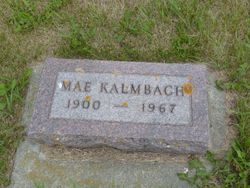
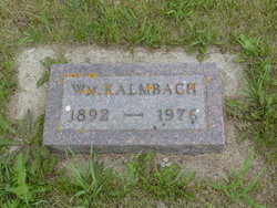
Mae Van Dusen Kalmbach
| Birth | : | 9 Apr 1900 Elmo, Nodaway County, Missouri, USA |
| Death | : | 5 Sep 1967 Kenmare, Ward County, North Dakota, USA |
| Burial | : | Pleasant View Cemetery, Norma, Renville County, USA |
| Coordinate | : | 48.9087219, -101.9672775 |
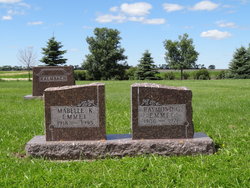
| Description | : | Mrs. Mae Kalmbach Dies in North Dakota Word has been received of the death of Mrs. Mae Kalmbach, 67 years old, Kenmare, ND, formerly of Joplin. Mrs. Kalmbach lived in Joplin as a child and attended Joplin schools. Her husband, William Kalmbach, who survives, was formerly employed by the Missouri Pacific Railroad in Joplin. Surviving, in addition to her husband, is a daughter, Mrs. Raymond Emmel, Kenmare, ND. Joplin Globe, September 17, 1967 |
frequently asked questions (FAQ):
-
Where is Mae Van Dusen Kalmbach's memorial?
Mae Van Dusen Kalmbach's memorial is located at: Pleasant View Cemetery, Norma, Renville County, USA.
-
When did Mae Van Dusen Kalmbach death?
Mae Van Dusen Kalmbach death on 5 Sep 1967 in Kenmare, Ward County, North Dakota, USA
-
Where are the coordinates of the Mae Van Dusen Kalmbach's memorial?
Latitude: 48.9087219
Longitude: -101.9672775
Family Members:
Parent
Spouse
Siblings
Children
Flowers:
Nearby Cemetories:
1. Pleasant View Cemetery
Norma, Renville County, USA
Coordinate: 48.9087219, -101.9672775
2. Zion Lutheran Cemetery
Norma, Renville County, USA
Coordinate: 48.8499184, -101.9987030
3. Evanger Lutheran Cemetery
Tolley, Renville County, USA
Coordinate: 48.8362990, -101.9006560
4. Prosperity Township Cemetery
Tolley, Renville County, USA
Coordinate: 48.9506200, -101.8462440
5. Wigdahl Cemetery
Tolley, Renville County, USA
Coordinate: 48.9804070, -101.8798630
6. Saint John Cemetery
Mohall, Renville County, USA
Coordinate: 48.9184380, -101.7382889
7. Meridian Cemetery
Glen Ewen, Estevan Census Division, Canada
Coordinate: 49.0578110, -102.0095890
8. Hamerly Lutheran Cemetery
Mohall, Renville County, USA
Coordinate: 48.8654700, -101.7270000
9. United Brethren Cemetery
Flaxton, Burke County, USA
Coordinate: 48.9383210, -102.2403550
10. Saint Pauls Evangelical Lutheran Church Cemetery
Northgate, Burke County, USA
Coordinate: 48.9368782, -102.2428055
11. Trinity Lutheran Cemetery
Kenmare, Ward County, USA
Coordinate: 48.7335590, -102.0646290
12. McKinney Cemetery
Tolley, Renville County, USA
Coordinate: 48.7594261, -101.7830963
13. Saint Charles Cemetery
Tolley, Renville County, USA
Coordinate: 48.7340012, -101.8345108
14. Saint Joseph Cemetery
Bowbells, Burke County, USA
Coordinate: 48.8069000, -102.2266998
15. Bowbells Cemetery
Bowbells, Burke County, USA
Coordinate: 48.8068000, -102.2278100
16. Saint Johns United Lutheran Cemetery
Mohall, Renville County, USA
Coordinate: 48.7928429, -101.7149429
17. Trinity Cemetery
Tolley, Renville County, USA
Coordinate: 48.7261009, -101.8341980
18. Union Cemetery
Sherwood, Renville County, USA
Coordinate: 48.9505997, -101.6508026
19. Bethany Lutheran Cemetery
Burke County, USA
Coordinate: 48.7349080, -102.1683880
20. Kopperud Cemetery
Northgate, Estevan Census Division, Canada
Coordinate: 49.0287500, -102.2534000
21. Rose Hill Cemetery
Kenmare, Ward County, USA
Coordinate: 48.6804600, -102.0723200
22. Saint Agnes Catholic Cemetery
Kenmare, Ward County, USA
Coordinate: 48.6804500, -102.0737200
23. Ebenezer Lutheran Cemetery
Flaxton, Burke County, USA
Coordinate: 48.9226418, -102.3491058
24. Bethlehem Lutheran Cemetery
Bowbells, Burke County, USA
Coordinate: 48.7963982, -102.3236008

