| Birth | : | 13 Feb 1903 Deep Creek Township, Clinton County, Iowa, USA |
| Death | : | 30 Nov 1943 Delmar, Clinton County, Iowa, USA |
| Burial | : | Evergreen Cemetery, Delmar, Clinton County, USA |
| Coordinate | : | 41.9897003, -90.6057968 |
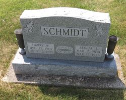
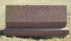
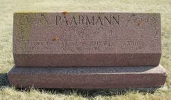
| Description | : | Malinda married Paul Frank Hinrichs on February 18, 1923 in Maquoketa, Iowa. Paul and Malinda were the parents of: 1) Carl Herman Hinrichs (January 8, 1925 - March 4, 2016) m. Ellen Dorothy McAvoy (April 11, 1924 - July 28, 2016) 2) Gladys Grace Hinrichs (July 1, 1928 - ?) m. John Roy Wise (son of John and Mary) 3) Paul Hinrichs (October 24, 1934 - December 1990) ******** Malinda married 2nd Harry W. Schmidt, in 1941. |
frequently asked questions (FAQ):
-
Where is Malinda Minnie Paarmann Schmidt's memorial?
Malinda Minnie Paarmann Schmidt's memorial is located at: Evergreen Cemetery, Delmar, Clinton County, USA.
-
When did Malinda Minnie Paarmann Schmidt death?
Malinda Minnie Paarmann Schmidt death on 30 Nov 1943 in Delmar, Clinton County, Iowa, USA
-
Where are the coordinates of the Malinda Minnie Paarmann Schmidt's memorial?
Latitude: 41.9897003
Longitude: -90.6057968
Family Members:
Parent
Spouse
Siblings
Flowers:
Nearby Cemetories:
1. Evergreen Cemetery
Delmar, Clinton County, USA
Coordinate: 41.9897003, -90.6057968
2. Saint Patrick's Cemetery
Delmar, Clinton County, USA
Coordinate: 42.0036011, -90.6149979
3. Bloomfield Cemetery
Clinton County, USA
Coordinate: 41.9458008, -90.6194000
4. Union Cemetery
Brookfield Township, Clinton County, USA
Coordinate: 42.0182991, -90.6694031
5. Immaculate Conception Cemetery
Petersville, Clinton County, USA
Coordinate: 41.9663000, -90.5332000
6. Rathbun Cemetery
Maquoketa, Jackson County, USA
Coordinate: 42.0402000, -90.5570000
7. Oakview Cemetery
Welton, Clinton County, USA
Coordinate: 41.9197930, -90.6031520
8. Seventh Day Baptist Cemetery
Welton, Clinton County, USA
Coordinate: 41.9130000, -90.6017000
9. Sacred Heart Cemetery
Maquoketa, Jackson County, USA
Coordinate: 42.0583496, -90.6617966
10. Pine Hill Cemetery
Bliedorn, Clinton County, USA
Coordinate: 41.9309300, -90.6836500
11. Mount Hope Cemetery
Maquoketa, Jackson County, USA
Coordinate: 42.0615616, -90.6619720
12. Codfish Hollow Cemetery
Maquoketa, Jackson County, USA
Coordinate: 42.0727997, -90.5793991
13. Union Center Cemetery
Maquoketa, Jackson County, USA
Coordinate: 42.0546989, -90.5246964
14. Saint Columbkille Cemetery
Bliedorn, Clinton County, USA
Coordinate: 41.9337330, -90.7039300
15. Elwood Cemetery
Elwood, Clinton County, USA
Coordinate: 41.9935989, -90.7307968
16. Bridgeport Cemetery
Maquoketa, Jackson County, USA
Coordinate: 42.0906000, -90.6267000
17. McClure Cemetery
Charlotte, Clinton County, USA
Coordinate: 41.9888992, -90.4669037
18. Assumption Catholic Cemetery
Charlotte, Clinton County, USA
Coordinate: 41.9668000, -90.4695000
19. Saint Joseph Cemetery
Clinton County, USA
Coordinate: 42.0158100, -90.4688100
20. Goddard Cemetery
Maquoketa, Jackson County, USA
Coordinate: 42.0391998, -90.7335968
21. Walrod Family Farm Cemetery
Welton, Clinton County, USA
Coordinate: 41.8805822, -90.5779145
22. Rossiter Cemetery
Charlotte, Clinton County, USA
Coordinate: 41.9418983, -90.4618988
23. Clinton County Farm Cemetery
Charlotte, Clinton County, USA
Coordinate: 41.9425011, -90.4614029
24. Summer Hill Cemetery
Spragueville, Jackson County, USA
Coordinate: 42.0556000, -90.4629000


