
| Birth | : | 28 Apr 1897 Allamakee County, Iowa, USA |
| Death | : | 19 Oct 1941 Allamakee County, Iowa, USA |
| Burial | : | St Gregory Churchyard, Dawlish, Teignbridge District, England |
| Coordinate | : | 50.5801090, -3.4796330 |
| Description | : | To find this grave; enter in the main gate from the south, this grave will be in one of the first two rows to your right. |
frequently asked questions (FAQ):
-
Where is Margaret Lorna Moore Kessel's memorial?
Margaret Lorna Moore Kessel's memorial is located at: St Gregory Churchyard, Dawlish, Teignbridge District, England.
-
When did Margaret Lorna Moore Kessel death?
Margaret Lorna Moore Kessel death on 19 Oct 1941 in Allamakee County, Iowa, USA
-
Where are the coordinates of the Margaret Lorna Moore Kessel's memorial?
Latitude: 50.5801090
Longitude: -3.4796330
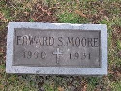
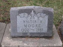
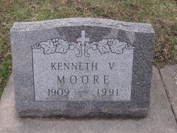
Family Members:
Parent

Spouse

Siblings
Flowers:


Nearby Cemetories:
1. St Gregory Churchyard
Dawlish, Teignbridge District, England
Coordinate: 50.5801090, -3.4796330
2. Dawlish Cemetery
Dawlish, Teignbridge District, England
Coordinate: 50.5767200, -3.4759780
3. Teignmouth Cemetery
Teignmouth, Teignbridge District, England
Coordinate: 50.5578180, -3.5039850
4. St. Michael the Archangel Churchyard
Teignmouth, Teignbridge District, England
Coordinate: 50.5474910, -3.4922043
5. Saint James Parish Church
Teignmouth, Teignbridge District, England
Coordinate: 50.5480450, -3.4985447
6. St. Mary's Churchyard
Cofton, Teignbridge District, England
Coordinate: 50.6133000, -3.4596500
7. St Nectan Churchyard
Ashcombe, Teignbridge District, England
Coordinate: 50.6056500, -3.5377500
8. St Nicholas Churchyard Ringmore
Shaldon, Teignbridge District, England
Coordinate: 50.5406080, -3.5196630
9. St John the Baptist Churchyard
Bishopsteignton, Teignbridge District, England
Coordinate: 50.5510800, -3.5385100
10. St. Paul's Churchyard
Starcross, Teignbridge District, England
Coordinate: 50.6252000, -3.4497800
11. Kenton Cemetery
Kenton, Teignbridge District, England
Coordinate: 50.6353408, -3.4797942
12. All Saints Church
Kenton, Teignbridge District, England
Coordinate: 50.6400926, -3.4747531
13. Powderham Castle
Powderham, Teignbridge District, England
Coordinate: 50.6430930, -3.4620230
14. All Saints Churchyard
Combeinteignhead, Teignbridge District, England
Coordinate: 50.5334460, -3.5506900
15. Parish Church of St Andrew Churchyard
Stokeinteignhead, Teignbridge District, England
Coordinate: 50.5238500, -3.5312800
16. St Cyprian Chapel
Chudleigh, Teignbridge District, England
Coordinate: 50.5906820, -3.5891920
17. St Clement's Churchyard
Powderham, Teignbridge District, England
Coordinate: 50.6504400, -3.4543420
18. Pound Lane Cemetery
Exmouth, East Devon District, England
Coordinate: 50.6302830, -3.3957290
19. Tower Hill Cemetery
Chudleigh, Teignbridge District, England
Coordinate: 50.6049295, -3.5931153
20. Saint Blaise Churchyard
Haccombe, Teignbridge District, England
Coordinate: 50.5207594, -3.5569565
21. Point in View Chapel
Exmouth, East Devon District, England
Coordinate: 50.6427390, -3.4044760
22. St. Margaret and St. Andrew Churchyard
Littleham, East Devon District, England
Coordinate: 50.6229200, -3.3744500
23. St Michael's Churchyard
Kingsteignton, Teignbridge District, England
Coordinate: 50.5448300, -3.5946480
24. Ss Martin and Mary Churchyard
Chudleigh, Teignbridge District, England
Coordinate: 50.6033400, -3.6021500