| Birth | : | 27 Jun 1890 Burchard, Pawnee County, Nebraska, USA |
| Death | : | 11 Sep 1977 Lawrence, Douglas County, Kansas, USA |
| Burial | : | Burchard Cemetery, Burchard, Pawnee County, USA |
| Coordinate | : | 40.1383018, -96.3538971 |
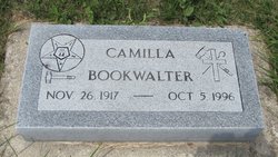
| Description | : | Daughter of Franklin & Anna Jane (Costello) Henderson, married Roy Earl Poteet on November 5, 1914 at Burchard, Nebraska. To their union were born three daughters, Audrey, Camilla and Maude Poteet. |
frequently asked questions (FAQ):
-
Where is Margaret May “Maggie” Henderson Poteet's memorial?
Margaret May “Maggie” Henderson Poteet's memorial is located at: Burchard Cemetery, Burchard, Pawnee County, USA.
-
When did Margaret May “Maggie” Henderson Poteet death?
Margaret May “Maggie” Henderson Poteet death on 11 Sep 1977 in Lawrence, Douglas County, Kansas, USA
-
Where are the coordinates of the Margaret May “Maggie” Henderson Poteet's memorial?
Latitude: 40.1383018
Longitude: -96.3538971
Family Members:
Parent
Spouse
Siblings
Children
Flowers:
Nearby Cemetories:
1. Burchard Cemetery
Burchard, Pawnee County, USA
Coordinate: 40.1383018, -96.3538971
2. Sacred Heart Cemetery
Burchard, Pawnee County, USA
Coordinate: 40.1460991, -96.3683014
3. Mount Pleasant Cemetery
Burchard, Pawnee County, USA
Coordinate: 40.1822014, -96.4049988
4. West Branch Cemetery
Pawnee County, USA
Coordinate: 40.0787940, -96.2797160
5. Pleasant Hill Cemetery
Gage County, USA
Coordinate: 40.1462250, -96.4676820
6. Salems Cemetery
Steinauer, Pawnee County, USA
Coordinate: 40.2166000, -96.2555000
7. Lewiston Cemetery
Lewiston, Pawnee County, USA
Coordinate: 40.2477989, -96.3882980
8. Tanner Cemetery
Pawnee County, USA
Coordinate: 40.0238991, -96.4143982
9. Saint Anthonys Cemetery
Steinauer, Pawnee County, USA
Coordinate: 40.2075005, -96.2189026
10. Rinne Cemetery
Pawnee County, USA
Coordinate: 40.2472000, -96.2742004
11. Liberty Cemetery
Liberty, Gage County, USA
Coordinate: 40.0772018, -96.4982986
12. Mission Creek Cemetery
Pawnee County, USA
Coordinate: 40.0149994, -96.4263992
13. Summerfield Cemetery
Summerfield, Marshall County, USA
Coordinate: 40.0005989, -96.3422012
14. Johnson Creek Cemetery
Pawnee City, Pawnee County, USA
Coordinate: 40.0270000, -96.2465000
15. Holy Family Cemetery
Summerfield, Marshall County, USA
Coordinate: 39.9994011, -96.3414001
16. Virginia Cemetery
Virginia, Gage County, USA
Coordinate: 40.2186012, -96.5117035
17. Pawnee City Cemetery
Pawnee City, Pawnee County, USA
Coordinate: 40.1109009, -96.1608810
18. Kinney Cemetery
Gage County, USA
Coordinate: 40.1102100, -96.5588800
19. Beranek Cemetery
Table Rock, Pawnee County, USA
Coordinate: 40.2042007, -96.1607971
20. Evangelical Lutheran Cemetery
Liberty, Gage County, USA
Coordinate: 40.0083300, -96.4825100
21. Madden Cemetery
Axtell, Marshall County, USA
Coordinate: 39.9866800, -96.2490300
22. Saint Pauls United Church of Christ Cemetery
Tecumseh, Johnson County, USA
Coordinate: 40.2996000, -96.2742000
23. Mission Creek Cemetery
Marshall County, USA
Coordinate: 39.9866982, -96.4649963
24. Saint Peters Lutheran Church Cemetery
Steinauer, Pawnee County, USA
Coordinate: 40.2555000, -96.1801000


