| Birth | : | 26 Jul 1912 Saline County, Nebraska, USA |
| Death | : | 14 Jan 1998 Palmer, Merrick County, Nebraska, USA |
| Burial | : | Zion Lutheran Cemetery, Worms, Merrick County, USA |
| Coordinate | : | 41.0983470, -98.2688650 |
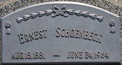
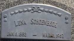
| Description | : | Marie M. Wieck was born on July 26, 1912, on a farm five miles west of Western, Nebraska, the daughter of Ernest and Lena (Jordening) Schoenbeck. She died on Wednesday, January 14, 1998 at Community Care of America in Palmer, Nebraska, at the age of 85 years old. Marie was baptized on August 11, 1912 and later attended school and was confirmed in April of 1927 at the Zion Lutheran Church School at Tobias, Nebraska. She graduated from Western High School and then attended the University of Nebraska-Lincoln. Upon graduation she taught school in Saline County for five... Read More |
frequently asked questions (FAQ):
-
Where is Marie M. Schoenbeck Wieck's memorial?
Marie M. Schoenbeck Wieck's memorial is located at: Zion Lutheran Cemetery, Worms, Merrick County, USA.
-
When did Marie M. Schoenbeck Wieck death?
Marie M. Schoenbeck Wieck death on 14 Jan 1998 in Palmer, Merrick County, Nebraska, USA
-
Where are the coordinates of the Marie M. Schoenbeck Wieck's memorial?
Latitude: 41.0983470
Longitude: -98.2688650
Family Members:
Parent
Spouse
Siblings
Flowers:
Nearby Cemetories:
1. Zion Lutheran Cemetery
Worms, Merrick County, USA
Coordinate: 41.0983470, -98.2688650
2. Norwegian Cemetery
Howard County, USA
Coordinate: 41.1039009, -98.2866974
3. German Methodist Cemetery
Palmer, Merrick County, USA
Coordinate: 41.1472830, -98.2317640
4. Saint Libory Catholic Cemetery
Saint Libory, Howard County, USA
Coordinate: 41.0828700, -98.3569700
5. Haggart Cemetery
Saint Libory, Howard County, USA
Coordinate: 41.0698500, -98.3547500
6. Wiegert Cemetery
Hall County, USA
Coordinate: 41.0243988, -98.2822037
7. Archer Evangelical Community Cemetery
Archer, Merrick County, USA
Coordinate: 41.1473236, -98.1740417
8. Prairie Creek Cemetery
Archer, Merrick County, USA
Coordinate: 41.1175003, -98.1536026
9. Chapman Cemetery
Chapman, Merrick County, USA
Coordinate: 41.0163994, -98.1547012
10. Laurel Cemetery
Chapman, Merrick County, USA
Coordinate: 40.9915600, -98.1950710
11. Rose Hill Cemetery
Palmer, Merrick County, USA
Coordinate: 41.2256012, -98.2692032
12. Poor Farm Cemetery
Grand Island, Hall County, USA
Coordinate: 40.9745000, -98.3597000
13. Goettsche-Tramm Burial Site
Merrick County, USA
Coordinate: 40.9583800, -98.2364400
14. East Grand Island Cemetery
Grand Island, Hall County, USA
Coordinate: 40.9446983, -98.3103027
15. Soldiers And Sailors Cemetery
Grand Island, Hall County, USA
Coordinate: 40.9467010, -98.3775024
16. Trinity United Methodist Church Columbarium
Grand Island, Hall County, USA
Coordinate: 40.9275000, -98.3472000
17. Elmwood Cemetery
Saint Paul, Howard County, USA
Coordinate: 41.2002983, -98.4677963
18. Saint Stephens Church Columbarium
Grand Island, Hall County, USA
Coordinate: 40.9234000, -98.3435000
19. Burke Cemetery
Central City, Merrick County, USA
Coordinate: 41.1833420, -98.0398407
20. Monroe Evangelical Free Church Cemetery
Murphy, Hamilton County, USA
Coordinate: 40.9449000, -98.1125000
21. Glenwood Cemetery
Nance County, USA
Coordinate: 41.2928990, -98.2148550
22. First Presbyterian Columbarium
Grand Island, Hall County, USA
Coordinate: 40.9097000, -98.3568000
23. Grand Island Cemetery
Grand Island, Hall County, USA
Coordinate: 40.9048830, -98.3721500
24. Central City Cemetery
Central City, Merrick County, USA
Coordinate: 41.1369019, -97.9944000

