
| Birth | : | 29 Dec 1941 Moorhead, Monona County, Iowa, USA |
| Death | : | 5 Apr 2013 Council Bluffs, Pottawattamie County, Iowa, USA |
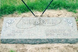
| Burial | : | Woodbine Cemetery, Woodbine, Harrison County, USA |
| Coordinate | : | 41.7466316, -95.7143936 |
| Plot | : | 6th Add., Blk 1 row 7 |
| Description | : | Marilyn Kay (Leibold) Black was born December 29, 1941, to Merritt Wayne and Mary Christine (Sorenson) Leibold near Moorhead, Iowa. She was raised in Woodbine and graduated from Woodbine High School in 1960. Marilyn then worked at Northwestern Bell Telephone Company. Marilyn married Dale Eugene Black at the RLDS Church in Dunlap on September 23, 1961. The couple lived in Omaha, then Council Bluffs, and then moved to Woodbine in the mid 1960s. Marilyn then worked as the cook for the Woodbine Community School District. She retired from the school in 2003. Marilyn loved her family. She enjoyed crocheting, sewing and... Read More |
frequently asked questions (FAQ):
-
Where is Marilyn Kay Leibold Black's memorial?
Marilyn Kay Leibold Black's memorial is located at: Woodbine Cemetery, Woodbine, Harrison County, USA.
-
When did Marilyn Kay Leibold Black death?
Marilyn Kay Leibold Black death on 5 Apr 2013 in Council Bluffs, Pottawattamie County, Iowa, USA
-
Where are the coordinates of the Marilyn Kay Leibold Black's memorial?
Latitude: 41.7466316
Longitude: -95.7143936
Family Members:
Parent

Spouse

Children
Flowers:


Nearby Cemetories:
1. Woodbine Cemetery
Woodbine, Harrison County, USA
Coordinate: 41.7466316, -95.7143936
2. Biglers Grove Cemetery
Woodbine, Harrison County, USA
Coordinate: 41.7327995, -95.7786026
3. Benjamin Purcell Cemetery
Allen, Harrison County, USA
Coordinate: 41.7694328, -95.7794523
4. Mefferd Cemetery
Harrison County, USA
Coordinate: 41.7132200, -95.6576200
5. Cowan-Pardee Cemetery
Woodbine, Harrison County, USA
Coordinate: 41.6976500, -95.6765000
6. Greenwood Cemetery
Harrison County, USA
Coordinate: 41.6729660, -95.7257690
7. Silver Hill Cemetery
Harrison County, USA
Coordinate: 41.6897011, -95.7919006
8. Jesse Purcell Cemetery
Woodbine, Harrison County, USA
Coordinate: 41.7431000, -95.8232000
9. Logan Cemetery
Logan, Harrison County, USA
Coordinate: 41.6487579, -95.7843170
10. Ellison Cemetery
Harrison County, USA
Coordinate: 41.6561012, -95.6260986
11. Hawkins Cemetery
Harrison County, USA
Coordinate: 41.6458800, -95.6355000
12. Bethel Cemetery
Logan, Harrison County, USA
Coordinate: 41.6239014, -95.6999969
13. Henderson Cemetery
Harrison County, USA
Coordinate: 41.6257000, -95.6794000
14. Pleasant Hill Cemetery
Dunlap, Harrison County, USA
Coordinate: 41.8446999, -95.5939026
15. Valley View Cemetery
Crawford County, USA
Coordinate: 41.8647003, -95.6252975
16. Magnolia Cemetery
Magnolia, Harrison County, USA
Coordinate: 41.6903000, -95.8799973
17. Saint Bridgets Cemetery
Magnolia, Harrison County, USA
Coordinate: 41.6915660, -95.8812480
18. Manteno Cemetery
Shelby County, USA
Coordinate: 41.8343964, -95.5367355
19. Doyle Cemetery
Earling, Shelby County, USA
Coordinate: 41.8051000, -95.5087000
20. Harris Grove Cemetery
Beebeetown, Harrison County, USA
Coordinate: 41.5782928, -95.7262192
21. Washington Township Cemetery
Panama, Shelby County, USA
Coordinate: 41.7305984, -95.4867020
22. Saint Mary's Cemetery
Portsmouth, Shelby County, USA
Coordinate: 41.6519012, -95.5233002
23. Calhoun Cemetery
Calhoun, Harrison County, USA
Coordinate: 41.6391983, -95.8938980
24. Saint Marys Cemetery
Panama, Shelby County, USA
Coordinate: 41.7332993, -95.4811020