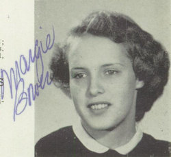
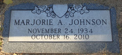
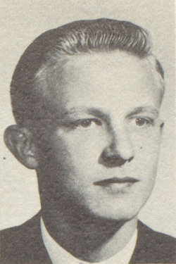
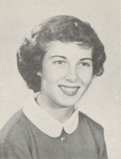
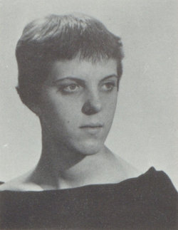
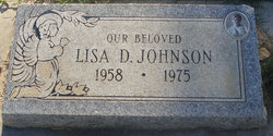
Marjorie Anne Bowers Johnson
| Birth | : | 24 Nov 1934 Patterson, Stanislaus County, California, USA |
| Death | : | 16 Oct 2010 Hughson, Stanislaus County, California, USA |
| Burial | : | Patterson District Cemetery, Patterson, Stanislaus County, USA |
| Coordinate | : | 37.5268135, -121.1728287 |
| Plot | : | Plot C, Row 9, Site 9 |
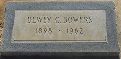
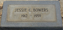
| Description | : | On Saturday, October 16, 2010, Marjorie Anne (Bowers) Johnson, 75, passed away in Hughson, Calif. She was born on Saturday, November 24, 1934 in Patterson, CA, and was the daughter of Dewey Clayton Bowers and Jessie Cora (Daily) Bowers. Marjorie lived in Merced and later moved to Twain Harte, where she lived for 42 years. She was a cosmetologist and worked in retail sales. Mrs. Johnson is survived by her son, Michael Johnson, of Escondido; daughter, Debbie Solem, of Soulsbyville; sister, Barbara Thorkelson, of Patterson, CA. She was preceded in death by her parents, Dewey Clayton Bowers and Jessie Cora (Daily) Bowers, husband,... Read More |
frequently asked questions (FAQ):
-
Where is Marjorie Anne Bowers Johnson's memorial?
Marjorie Anne Bowers Johnson's memorial is located at: Patterson District Cemetery, Patterson, Stanislaus County, USA.
-
When did Marjorie Anne Bowers Johnson death?
Marjorie Anne Bowers Johnson death on 16 Oct 2010 in Hughson, Stanislaus County, California, USA
-
Where are the coordinates of the Marjorie Anne Bowers Johnson's memorial?
Latitude: 37.5268135
Longitude: -121.1728287
Family Members:
Parent
Spouse
Siblings
Children
Flowers:
Nearby Cemetories:
1. Patterson District Cemetery
Patterson, Stanislaus County, USA
Coordinate: 37.5268135, -121.1728287
2. Grayson Cemetery
Grayson, Stanislaus County, USA
Coordinate: 37.5594559, -121.1802826
3. Good Shepherd Catholic Cemetery
Modesto, Stanislaus County, USA
Coordinate: 37.6853130, -121.0672890
4. Ceres Memorial Park
Ceres, Stanislaus County, USA
Coordinate: 37.5958214, -120.9634399
5. Wood Colony Cemetery
Salida, Stanislaus County, USA
Coordinate: 37.6893730, -121.0682144
6. Modesto Citizens Cemetery
Modesto, Stanislaus County, USA
Coordinate: 37.6472930, -120.9845570
7. Modesto Pioneer Cemetery
Modesto, Stanislaus County, USA
Coordinate: 37.6473350, -120.9829040
8. Acacia Memorial Park
Modesto, Stanislaus County, USA
Coordinate: 37.6481080, -120.9836610
9. Saint Stanislaus Catholic Cemetery
Modesto, Stanislaus County, USA
Coordinate: 37.6473610, -120.9808440
10. Modesto County Cemetery
Modesto, Stanislaus County, USA
Coordinate: 37.6492400, -120.9813800
11. Brichetto Tomb
San Joaquin County, USA
Coordinate: 37.6272011, -121.3871994
12. Hills Ferry Cemetery
Newman, Stanislaus County, USA
Coordinate: 37.3321991, -121.0496979
13. Ripon Cemetery
Ripon, San Joaquin County, USA
Coordinate: 37.7420311, -121.1238708
14. Lakewood Memorial Park
Hughson, Stanislaus County, USA
Coordinate: 37.6199760, -120.8975983
15. Turlock Memorial Park
Turlock, Stanislaus County, USA
Coordinate: 37.4937592, -120.8659821
16. North Hilmar Cemetery
Hilmar, Merced County, USA
Coordinate: 37.4146614, -120.8864288
17. Saint Francis Episcopal Church Columbarium
Turlock, Stanislaus County, USA
Coordinate: 37.5014300, -120.8368400
18. Colonel James J Stevinson Cemetery
Stevinson, Merced County, USA
Coordinate: 37.3572044, -120.9112320
19. South Hilmar Cemetery
Hilmar, Merced County, USA
Coordinate: 37.3802681, -120.8868408
20. Tracy Mausoleum
Tracy, San Joaquin County, USA
Coordinate: 37.7250214, -121.4150696
21. Tracy Public Cemetery
Tracy, San Joaquin County, USA
Coordinate: 37.7251358, -121.4189453
22. Denair Cemetery
Denair, Stanislaus County, USA
Coordinate: 37.5293999, -120.8199997
23. Stevinson Sunnyside Cemetery
Stevinson, Merced County, USA
Coordinate: 37.3292007, -120.9231033
24. Saint John's Catholic Cemetery
Escalon, San Joaquin County, USA
Coordinate: 37.7994537, -121.0705185

