
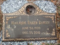

Marjorie Eileen Sweeney Ramsey
| Birth | : | 24 Jun 1920 Sutherland, O'Brien County, Iowa, USA |
| Death | : | 25 Dec 2010 Sun City, Maricopa County, Arizona, USA |
| Burial | : | North Lawn Cemetery, Spencer, Clay County, USA |
| Coordinate | : | 43.1600000, -95.1470000 |
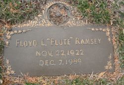
| Description | : | Marjorie Eileen Ramsey June 24, 1920 - December 25, 2010 Marjorie Eileen Ramsey, the daughter of Frances and Anna (Donavan) Sweeney, was born on June 24, 1920, in Sutherland, Iowa. She was raised and received her early education there, graduating from Sutherland High School. After high school, she attended beauty school and was self-employed as a cosmetologist for years in Royal, IA. Marjorie married Floyd 'Flute' Ramsey on August 28, 1944, in Sutherland. They adopted one son, Patrick, in January of 1960. Her family resided in Royal, IA for many years. Marjorie was an active member of St. Louis Catholic Church in Royal. She... Read More |
frequently asked questions (FAQ):
-
Where is Marjorie Eileen Sweeney Ramsey's memorial?
Marjorie Eileen Sweeney Ramsey's memorial is located at: North Lawn Cemetery, Spencer, Clay County, USA.
-
When did Marjorie Eileen Sweeney Ramsey death?
Marjorie Eileen Sweeney Ramsey death on 25 Dec 2010 in Sun City, Maricopa County, Arizona, USA
-
Where are the coordinates of the Marjorie Eileen Sweeney Ramsey's memorial?
Latitude: 43.1600000
Longitude: -95.1470000
Family Members:
Flowers:


Nearby Cemetories:
1. North Lawn Cemetery
Spencer, Clay County, USA
Coordinate: 43.1600000, -95.1470000
2. Dewey Readmore Books Memorial
Spencer, Clay County, USA
Coordinate: 43.1403999, -95.1443024
3. Riverside Cemetery
Spencer, Clay County, USA
Coordinate: 43.1441994, -95.1671982
4. Fairview Cemetery
Clay County, USA
Coordinate: 43.1899986, -95.0800018
5. Evergreen Cemetery
Clay County, USA
Coordinate: 43.2052994, -95.2086029
6. Dickens Cemetery
Dickens, Clay County, USA
Coordinate: 43.1280000, -95.0155000
7. Swedish Lutheran Cemetery
Royal, Clay County, USA
Coordinate: 43.0683000, -95.2350000
8. Little Sioux Lutheran Cemetery
Milford, Dickinson County, USA
Coordinate: 43.2702065, -95.2109528
9. Rosehill Cemetery
Clay County, USA
Coordinate: 43.0368996, -95.0919037
10. First Reformed Cemetery
Clay County, USA
Coordinate: 43.2399500, -95.2889000
11. Lone Tree Cemetery
Everly, Clay County, USA
Coordinate: 43.1411018, -95.3347015
12. Milford Cemetery
Milford, Dickinson County, USA
Coordinate: 43.3092003, -95.1481018
13. Lincoln Cemetery
Rossie, Clay County, USA
Coordinate: 43.0111008, -95.2313995
14. Calvary Cemetery
Milford, Dickinson County, USA
Coordinate: 43.3213997, -95.1688995
15. Logan Township Cemetery
Clay County, USA
Coordinate: 43.0489006, -94.9747009
16. Liberty Cemetery
Greenville, Clay County, USA
Coordinate: 42.9897003, -95.1417007
17. Willow Creek Cemetery
Royal, Clay County, USA
Coordinate: 43.0214005, -95.2885971
18. Clay Center Cemetery
Royal, Clay County, USA
Coordinate: 43.0410995, -95.3272018
19. TriMello Cemetery
Royal, Clay County, USA
Coordinate: 43.0682983, -95.3728027
20. Crown Hill Cemetery
Ruthven, Palo Alto County, USA
Coordinate: 43.1328011, -94.8878021
21. Calvary Cemetery
Ruthven, Palo Alto County, USA
Coordinate: 43.1314011, -94.8869019
22. Zion Methodist Cemetery
Clay County, USA
Coordinate: 42.9808006, -95.2497025
23. Westport Cemetery
Dickinson County, USA
Coordinate: 43.3130989, -95.3289032
24. Okoboji Cemetery
Arnolds Park, Dickinson County, USA
Coordinate: 43.3649406, -95.1303558