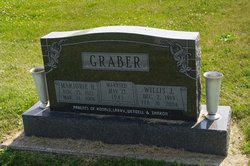
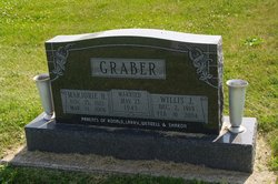
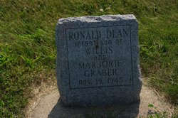
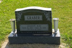
Marjorie Helen Watts Graber
| Birth | : | 25 Nov 1923 Henry County, Iowa, USA |
| Death | : | 11 Mar 2006 Iowa City, Johnson County, Iowa, USA |
| Burial | : | Sugar Creek Cemetery, Wayland, Henry County, USA |
| Coordinate | : | 41.1347008, -91.6343994 |
| Description | : | Marjorie Helen Graber, 82, Wayland, died Saturday, March 11, 2006 at Mercy Hospital in Iowa City. Born November 25, 1923, Henry County, she was the daughter of Howard P. and Bessie Scarff Watts. On May 23, 1943, she married Willis Graber in Wayland. He died on February 16, 2004. Mrs. Graber worked at Henry County Savings prior to her marriage. She worked with her husband on the farm for many years. She worked for various restaurants and the Parkview Home. She retired as manager from Congregate Meals in Wayland. She was a 1941 graduate of Mount Pleasant High School. She was a member... Read More |
frequently asked questions (FAQ):
-
Where is Marjorie Helen Watts Graber's memorial?
Marjorie Helen Watts Graber's memorial is located at: Sugar Creek Cemetery, Wayland, Henry County, USA.
-
When did Marjorie Helen Watts Graber death?
Marjorie Helen Watts Graber death on 11 Mar 2006 in Iowa City, Johnson County, Iowa, USA
-
Where are the coordinates of the Marjorie Helen Watts Graber's memorial?
Latitude: 41.1347008
Longitude: -91.6343994
Family Members:
Parent
Spouse
Siblings
Children
Flowers:
Nearby Cemetories:
1. Sugar Creek Cemetery
Wayland, Henry County, USA
Coordinate: 41.1347008, -91.6343994
2. Wayland Methodist Church Cemetery
Wayland, Henry County, USA
Coordinate: 41.1480000, -91.6585000
3. Old Baptist Cemetery
Wayland, Henry County, USA
Coordinate: 41.1045000, -91.6209000
4. Center Cemetery
Wayland, Henry County, USA
Coordinate: 41.1567000, -91.6013000
5. North Hill Cemetery
Washington County, USA
Coordinate: 41.1666985, -91.6592026
6. Eicher Cemetery
Washington County, USA
Coordinate: 41.1782990, -91.6260986
7. Finley Cemetery
Henry County, USA
Coordinate: 41.0913800, -91.6202800
8. Pioneer Shively-Neff Cemetery
Wayland, Henry County, USA
Coordinate: 41.1420950, -91.7027100
9. Rumble Cemetery
Washington County, USA
Coordinate: 41.1857500, -91.6150500
10. Cottonwood Cemetery
Coppock, Henry County, USA
Coordinate: 41.1488991, -91.7024994
11. Haynes Cemetery
Wayland, Henry County, USA
Coordinate: 41.1441000, -91.7074000
12. Kurtz Cemetery
Wayland, Henry County, USA
Coordinate: 41.1470000, -91.7071000
13. Sommers Cemetery
Washington County, USA
Coordinate: 41.1927986, -91.6505966
14. Fern Cliff Evangelic Cemetery
Washington County, USA
Coordinate: 41.1937000, -91.6122000
15. Nelson Plot
Jefferson County, USA
Coordinate: 41.1243890, -91.7185420
16. Bethel Mennonite Church Cemetery
Washington County, USA
Coordinate: 41.1963997, -91.6596985
17. Green Mound Cemetery
Henry County, USA
Coordinate: 41.0696983, -91.6652985
18. Martin Cemetery
Marion Township, Washington County, USA
Coordinate: 41.2000194, -91.6668323
19. North Wayne Cemetery
Olds, Henry County, USA
Coordinate: 41.1422000, -91.5422000
20. Swedesburg Cemetery
Swedesburg, Henry County, USA
Coordinate: 41.1060000, -91.5456000
21. Custer Cemetery
Washington County, USA
Coordinate: 41.1921500, -91.7125900
22. Asbury Cemetery
Olds, Henry County, USA
Coordinate: 41.1570000, -91.5253000
23. Armstrong Cemetery
Jefferson County, USA
Coordinate: 41.1547012, -91.7444000
24. Dallner Cemetery
Jefferson County, USA
Coordinate: 41.1047000, -91.7458000


