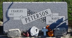
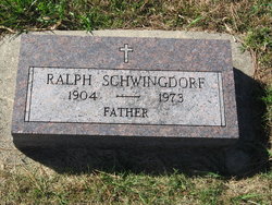
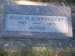
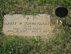
Marjorie Jean “Marge” Schwingdorf Peterson
| Birth | : | 28 Dec 1933 Charter Oak, Crawford County, Iowa, USA |
| Death | : | 14 Dec 2016 Council Bluffs, Pottawattamie County, Iowa, USA |
| Burial | : | Pleasant Hill Cemetery, Dunlap, Harrison County, USA |
| Coordinate | : | 41.8446999, -95.5939026 |
| Plot | : | Block 20 |
| Description | : | . . KNOD Mass of Christian Burial for 82 year old Marge Peterson of Dunlap will be held at 10:30 am, Saturday, December 17th, at St. Patrick's Catholic Church in Dunlap. Burial will be at the Pleasant Hill Cemetery in Dunlap. Marge passed away at the Mercy Hospital in Council Bluffs on Wednesday, December 14th. Survivors include her husband, Charlie; 8 children, Robert (Bonnie) Peterson of Omaha, Gordon Peterson of Adel, Keith (Etta) Peterson of Denison, Roger (Penny) Peterson of Woodbine, Mary Jo (Byron) Hartwig of Battle Creek, Tim Peterson of Smith Station, Alabama, Tom (Lydia)... Read More |
frequently asked questions (FAQ):
-
Where is Marjorie Jean “Marge” Schwingdorf Peterson's memorial?
Marjorie Jean “Marge” Schwingdorf Peterson's memorial is located at: Pleasant Hill Cemetery, Dunlap, Harrison County, USA.
-
When did Marjorie Jean “Marge” Schwingdorf Peterson death?
Marjorie Jean “Marge” Schwingdorf Peterson death on 14 Dec 2016 in Council Bluffs, Pottawattamie County, Iowa, USA
-
Where are the coordinates of the Marjorie Jean “Marge” Schwingdorf Peterson's memorial?
Latitude: 41.8446999
Longitude: -95.5939026
Family Members:
Parent
Siblings
Flowers:
Nearby Cemetories:
1. Pleasant Hill Cemetery
Dunlap, Harrison County, USA
Coordinate: 41.8446999, -95.5939026
2. Valley View Cemetery
Crawford County, USA
Coordinate: 41.8647003, -95.6252975
3. Manteno Cemetery
Shelby County, USA
Coordinate: 41.8343964, -95.5367355
4. Doyle Cemetery
Earling, Shelby County, USA
Coordinate: 41.8051000, -95.5087000
5. Abel Galland Memorial Cemetery
Manteno, Shelby County, USA
Coordinate: 41.8370000, -95.4932500
6. Gallands Grove RLDS Holcomb Cemetery
Shelby County, USA
Coordinate: 41.8342018, -95.4788971
7. Dow City Cemetery
Dow City, Crawford County, USA
Coordinate: 41.9219017, -95.5119019
8. Woodbine Cemetery
Woodbine, Harrison County, USA
Coordinate: 41.7466316, -95.7143936
9. Butler Cemetery
Arion, Crawford County, USA
Coordinate: 41.9364014, -95.4627991
10. Washington Township Cemetery
Panama, Shelby County, USA
Coordinate: 41.7305984, -95.4867020
11. Saint Marys Cemetery
Panama, Shelby County, USA
Coordinate: 41.7332993, -95.4811020
12. Mefferd Cemetery
Harrison County, USA
Coordinate: 41.7132200, -95.6576200
13. Saint Joseph Cemetery
Earling, Shelby County, USA
Coordinate: 41.7797012, -95.4207993
14. Willow Township Cemetery
Charter Oak, Crawford County, USA
Coordinate: 41.9913776, -95.6141702
15. Benjamin Purcell Cemetery
Allen, Harrison County, USA
Coordinate: 41.7694328, -95.7794523
16. Cowan-Pardee Cemetery
Woodbine, Harrison County, USA
Coordinate: 41.6976500, -95.6765000
17. Crawford County Poor Farm Cemetery
Crawford County, USA
Coordinate: 41.9508216, -95.4308331
18. Buck Grove Cemetery
Buck Grove, Crawford County, USA
Coordinate: 41.9067841, -95.3839722
19. Soldier Lutheran Church Cemetery
Soldier, Monona County, USA
Coordinate: 41.9510000, -95.7800000
20. Old Norwegian Lutheran Cemetery
Soldier, Monona County, USA
Coordinate: 41.9460000, -95.7885000
21. Biglers Grove Cemetery
Woodbine, Harrison County, USA
Coordinate: 41.7327995, -95.7786026
22. Union Township Cemetery
Defiance, Shelby County, USA
Coordinate: 41.8269005, -95.3471985
23. Saints Peter and Paul Catholic Cemetery
Defiance, Shelby County, USA
Coordinate: 41.8269005, -95.3450012
24. Ellison Cemetery
Harrison County, USA
Coordinate: 41.6561012, -95.6260986

