
| Birth | : | 13 Apr 1930 Monroe County, Kentucky, USA |
| Death | : | 8 Feb 2016 Tompkinsville, Monroe County, Kentucky, USA |
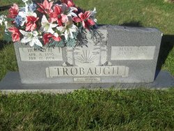
| Burial | : | Macedonia Cemetery, Moss, Clay County, USA |
| Coordinate | : | 36.5643997, -85.6110992 |
| Description | : | Martha Trobaugh, Age 85, Passed away February 8, 2016, at The Monroe County Medical Center. She was Born April 13, 1930, in Monroe County Kentucky to the Late; Viola Jane Emberton Crowe and Elkana "Dude" Crowe. She was Married to Hershell Trobaugh, he preceded her in death. She was of the Baptist Faith. She had worked at Goolsby Bar-B- Que. Other than her Parents and Husband, she was preceded in death By A Brother, Willie Thomas Crowe, Two Sisters; Ada Pearl Clark and Dolly Crowe. Survivors; A Sister, Zora Crowe,... Read More |
frequently asked questions (FAQ):
-
Where is Martha Crowe Trobaugh's memorial?
Martha Crowe Trobaugh's memorial is located at: Macedonia Cemetery, Moss, Clay County, USA.
-
When did Martha Crowe Trobaugh death?
Martha Crowe Trobaugh death on 8 Feb 2016 in Tompkinsville, Monroe County, Kentucky, USA
-
Where are the coordinates of the Martha Crowe Trobaugh's memorial?
Latitude: 36.5643997
Longitude: -85.6110992
Family Members:
Flowers:


Nearby Cemetories:
1. Strong Family Cemetery
Clay County, USA
Coordinate: 36.5690700, -85.6042600
2. McLerran Cemetery
Moss, Clay County, USA
Coordinate: 36.5790000, -85.5973000
3. Kendall Cemetery
Moss, Clay County, USA
Coordinate: 36.5672540, -85.6362650
4. Moss Cemetery
Moss, Clay County, USA
Coordinate: 36.5911210, -85.6214460
5. Eads-Denton Cemetery
Pine Hill, Clay County, USA
Coordinate: 36.5644207, -85.6503187
6. Odle Cemetery
Clay County, USA
Coordinate: 36.5966988, -85.6085968
7. Spear Family Cemetery
Moss, Clay County, USA
Coordinate: 36.5933200, -85.5876500
8. Meadows Cemetery
Clay County, USA
Coordinate: 36.5946999, -85.5875015
9. Smith Cemetery
Pine Hill, Clay County, USA
Coordinate: 36.5714930, -85.6568170
10. Liberty Church Cemetery
Boles, Clay County, USA
Coordinate: 36.6010850, -85.6496830
11. Dalton Cemetery
Arcott, Clay County, USA
Coordinate: 36.5429540, -85.5546170
12. Moore Cemetery
Moss, Clay County, USA
Coordinate: 36.6113400, -85.6374980
13. Walker Reecer Cemetery
Celina, Clay County, USA
Coordinate: 36.5746290, -85.5480270
14. New Hope Cemetery
Clay County, USA
Coordinate: 36.6021996, -85.5653000
15. Archibald Plumlee Cemetery
Pine Hill, Clay County, USA
Coordinate: 36.5203018, -85.5682983
16. Pricetown Cemetery
Clay County, USA
Coordinate: 36.5422500, -85.6750670
17. Willhoite-Curtis Cemetery
Tompkinsville, Monroe County, USA
Coordinate: 36.6182208, -85.6442948
18. Lester Brown Family Cemetery
Arcott, Clay County, USA
Coordinate: 36.5205700, -85.5547530
19. Jonestown Cemetery
Clay County, USA
Coordinate: 36.5619011, -85.6921997
20. McColgan Cemetery
Clay County, USA
Coordinate: 36.5163994, -85.5560989
21. Roberts Cemetery
Celina, Clay County, USA
Coordinate: 36.5066986, -85.5727997
22. Freedom Cemetery #2
Tompkinsville, Monroe County, USA
Coordinate: 36.6284060, -85.6289940
23. Plumlee Cemetery
Celina, Clay County, USA
Coordinate: 36.5694280, -85.5282830
24. Moore Cemetery #1
Moss, Clay County, USA
Coordinate: 36.6164920, -85.6636620