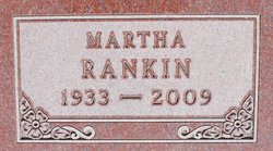
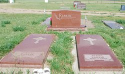
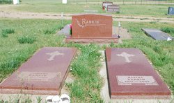
Martha Geraldine Haugland Rankin
| Birth | : | 19 Jun 1933 Murdo, Jones County, South Dakota, USA |
| Death | : | 25 Dec 2009 Pierre, Hughes County, South Dakota, USA |
| Burial | : | Draper Cemetery, Draper, Jones County, USA |
| Coordinate | : | 43.9322014, -100.5475006 |
| Description | : | Martha Rankin of Fort Pierre passed away December 25, 2009, at St. Mary's Hospital in Pierre. Her children and grandchildren were all there with her for Christmas Eve. Visitation will be from 5-7 PM, Tuesday, December 29, at St. John's Catholic Church in Fort Pierre with a Prayer Service at 7:00PM. Services will be at 11:00AM, Wednesday, December 30, at St. John's Catholic Church in Fort Pierre with burial at Draper Cemetery. Martha Geraldine Rankin was born June 19, 1933, in Murdo, SD, to Anfin and Inger (Sletto) Haugland. She grew up on a ranch south of Draper and graduated from... Read More |
frequently asked questions (FAQ):
-
Where is Martha Geraldine Haugland Rankin's memorial?
Martha Geraldine Haugland Rankin's memorial is located at: Draper Cemetery, Draper, Jones County, USA.
-
When did Martha Geraldine Haugland Rankin death?
Martha Geraldine Haugland Rankin death on 25 Dec 2009 in Pierre, Hughes County, South Dakota, USA
-
Where are the coordinates of the Martha Geraldine Haugland Rankin's memorial?
Latitude: 43.9322014
Longitude: -100.5475006
Family Members:
Spouse
Flowers:
Nearby Cemetories:
1. Draper Cemetery
Draper, Jones County, USA
Coordinate: 43.9322014, -100.5475006
2. Murdo Cemetery
Murdo, Jones County, USA
Coordinate: 43.8802986, -100.7035980
3. Vera Cemetery
Draper, Jones County, USA
Coordinate: 43.8504130, -100.3753260
4. Vivian Cemetery
Vivian, Lyman County, USA
Coordinate: 43.9233017, -100.2652969
5. Immanuel Lutheran Cemetery
Van Metre, Jones County, USA
Coordinate: 44.0958800, -100.7263300
6. Mathews Family Cemetery
Stanley County, USA
Coordinate: 44.1816040, -100.5581080
7. Saint Philip Episcopal Cemetery
White River, Mellette County, USA
Coordinate: 43.6788400, -100.6305700
8. Rattlesnake Hill Cemetery
Badnation, Mellette County, USA
Coordinate: 43.6620120, -100.4439850
9. Burnette Cemetery
Mellette County, USA
Coordinate: 43.7717018, -100.8666992
10. Lower Camp Cemetery
White River, Mellette County, USA
Coordinate: 43.6311800, -100.6774000
11. Hilmoe Cemetery
Presho, Lyman County, USA
Coordinate: 43.7510986, -100.1793976
12. Rosebud Cemetery
Mellette County, USA
Coordinate: 43.6632996, -100.2917023
13. Saint Georges Cemetery
Badnation, Mellette County, USA
Coordinate: 43.6633000, -100.2917000
14. Medicine Creek Cemetery
Presho, Lyman County, USA
Coordinate: 43.9053001, -100.0952988
15. Saint Catherine Cemetery
Wood, Mellette County, USA
Coordinate: 43.6666370, -100.2805800
16. Riverview Cemetery
Capa, Jones County, USA
Coordinate: 44.0952400, -100.9668100
17. Presho Cemetery
Presho, Lyman County, USA
Coordinate: 43.9108658, -100.0631256
18. Holy Angels Cemetery
Presho, Lyman County, USA
Coordinate: 43.8911018, -100.0643997
19. Saint Marks Catholic Cemetery
Capa, Jones County, USA
Coordinate: 44.1247100, -100.9948900
20. White River Cemetery
White River, Mellette County, USA
Coordinate: 43.5749890, -100.7502510
21. Saint Peters Lutheran Cemetery
Stamford, Jackson County, USA
Coordinate: 43.9623000, -101.0843100
22. Saint Paul German Lutheran Cemetery
White River, Mellette County, USA
Coordinate: 43.7803439, -101.0513015
23. Good Road Cemetery
Corn Creek, Mellette County, USA
Coordinate: 43.7856000, -101.0609400
24. Standing Elk Cemetery
White River, Mellette County, USA
Coordinate: 43.5722900, -100.7847500


