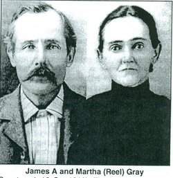
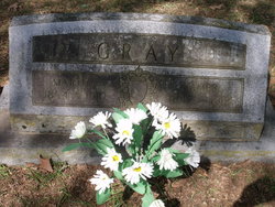
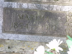
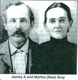
Martha Lucetta Reel Gray
| Birth | : | 12 Mar 1854 Sevier County, Arkansas, USA |
| Death | : | 12 Oct 1910 Sevier County, Arkansas, USA |
| Burial | : | Riverside Cemetery, Three Rivers, St. Joseph County, USA |
| Coordinate | : | 41.9444008, -85.6164017 |
| Description | : | Martha L. Reel was born to James b.Jan.25,1814-d.Aug.15,1869 and Elizabeth Reel b.1827-d.1868 (Both are buried in the Greens Chapel cemetery),in the Greens Chapel (Lebanon)Area of Sevier Co. Ar. on March 12,1854 she married James(Jim) A. Gray on March 8,1867 they were the parents of eleven children all born in Sevier Co.(see below). |
frequently asked questions (FAQ):
-
Where is Martha Lucetta Reel Gray's memorial?
Martha Lucetta Reel Gray's memorial is located at: Riverside Cemetery, Three Rivers, St. Joseph County, USA.
-
When did Martha Lucetta Reel Gray death?
Martha Lucetta Reel Gray death on 12 Oct 1910 in Sevier County, Arkansas, USA
-
Where are the coordinates of the Martha Lucetta Reel Gray's memorial?
Latitude: 41.9444008
Longitude: -85.6164017
Family Members:
Parent
Spouse
Children
Nearby Cemetories:
1. Riverside Cemetery
Three Rivers, St. Joseph County, USA
Coordinate: 41.9444008, -85.6164017
2. Lockport Pioneer Cemetery
Three Rivers, St. Joseph County, USA
Coordinate: 41.9331930, -85.6246250
3. Bowman Park Cemetery
Three Rivers, St. Joseph County, USA
Coordinate: 41.9540176, -85.6339645
4. Lower Flatbush Cemetery
Flowerfield Township, St. Joseph County, USA
Coordinate: 41.9906006, -85.6600037
5. Beadle Cemetery
Fabius, St. Joseph County, USA
Coordinate: 41.9555550, -85.6916650
6. Peek Cemetery
Constantine, St. Joseph County, USA
Coordinate: 41.8802986, -85.6382980
7. Broad Street Cemetery
Constantine Township, St. Joseph County, USA
Coordinate: 41.8859863, -85.6644363
8. Morrison Cemetery
Fabius, St. Joseph County, USA
Coordinate: 41.8993988, -85.6875000
9. South Park Cemetery
Parkville, St. Joseph County, USA
Coordinate: 41.9980550, -85.5569460
10. Moore Park Cemetery
Moore Park, St. Joseph County, USA
Coordinate: 42.0138893, -85.6266632
11. Prairie River Cemetery
Centreville, St. Joseph County, USA
Coordinate: 41.9305992, -85.5235977
12. Center Park Cemetery
Parkville, St. Joseph County, USA
Coordinate: 42.0127790, -85.5936130
13. Culbertson Cemetery
Centreville, St. Joseph County, USA
Coordinate: 41.9764370, -85.5283200
14. Upper Flatbush Cemetery
Flowerfield Township, St. Joseph County, USA
Coordinate: 42.0057983, -85.6735992
15. Old Order Amish Cemetery
Centreville, St. Joseph County, USA
Coordinate: 41.9255560, -85.5152780
16. Saint Gregorys Abbey Cemetery
Three Rivers, St. Joseph County, USA
Coordinate: 41.9749990, -85.7133330
17. Calhoun Cemetery
Centreville, St. Joseph County, USA
Coordinate: 41.8675003, -85.5849991
18. Parkville Cemetery
Parkville, St. Joseph County, USA
Coordinate: 42.0127983, -85.5569000
19. Old Centreville Cemetery
Centreville, St. Joseph County, USA
Coordinate: 41.9263880, -85.5091630
20. Brick Chapel Cemetery
Constantine, St. Joseph County, USA
Coordinate: 41.8741989, -85.7022018
21. Fellowship Bible Church Cemetery
Centreville, St. Joseph County, USA
Coordinate: 41.8677530, -85.5367850
22. Scott Cemetery
Mendon, St. Joseph County, USA
Coordinate: 42.0208015, -85.5205994
23. Knob Cemetery
Flowerfield Township, St. Joseph County, USA
Coordinate: 41.9994011, -85.7416992
24. Pioneer Cemetery
Nottawa, St. Joseph County, USA
Coordinate: 41.9550018, -85.4710999

