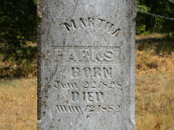
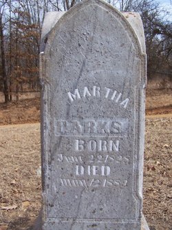
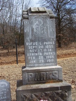
Martha McBride Parks
| Birth | : | 22 Jun 1828 Warren County, Tennessee, USA |
| Death | : | 12 May 1889 USA |
| Burial | : | Parks Cemetery, St. Clair County, USA |
| Coordinate | : | 38.0797005, -93.8647003 |
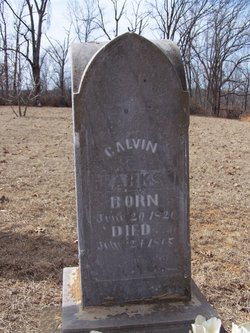
| Description | : | Martha, along with her husband (Calvin Parks) were originally buried in Chalk Level (Garnett Cemetery), their stones were then moved to Parks/Shady Grove Cemetery to allow for the building of Truman Dam. ---------------- Martha McBride married Calvin Parks, both born Grundy Co., TN, and lived their lives in Monegan Springs(St. Clair Co.) MO. They were both buried in Garnett Cemetery in Chalk Level. The land was owned by the owner of the 1st store in Chalk Level named Mormon Cooper. He sold the land to a man Named Garnett in 1911 ie., the name. Since 1971 it has been owned by Martin... Read More |
frequently asked questions (FAQ):
-
Where is Martha McBride Parks's memorial?
Martha McBride Parks's memorial is located at: Parks Cemetery, St. Clair County, USA.
-
When did Martha McBride Parks death?
Martha McBride Parks death on 12 May 1889 in USA
-
Where are the coordinates of the Martha McBride Parks's memorial?
Latitude: 38.0797005
Longitude: -93.8647003
Family Members:
Parent
Spouse
Siblings
Children
Flowers:
Nearby Cemetories:
1. Parks Cemetery
St. Clair County, USA
Coordinate: 38.0797005, -93.8647003
2. Lewellen Cemetery
St. Clair County, USA
Coordinate: 38.1119003, -93.8767014
3. Terry Cemetery
St. Clair County, USA
Coordinate: 38.1161003, -93.8478012
4. Kidds Chapel Cemetery
Lowry City, St. Clair County, USA
Coordinate: 38.1077385, -93.8281708
5. Schoonaver Cemetery
St. Clair County, USA
Coordinate: 38.0374985, -93.8846970
6. Motley Cemetery
St. Clair County, USA
Coordinate: 38.0508003, -93.8146973
7. Harmony Church Cemetery
St. Clair County, USA
Coordinate: 38.1249199, -93.8898163
8. Bean Cemetery
Appleton City, St. Clair County, USA
Coordinate: 38.0960999, -93.9325027
9. Monegaw Springs Cemetery
Monegaw Springs, St. Clair County, USA
Coordinate: 38.0268300, -93.8367800
10. Mount Zion Cemetery
Appleton City, St. Clair County, USA
Coordinate: 38.0518799, -93.9313507
11. Short Cemetery
St. Clair County, USA
Coordinate: 38.0797005, -93.9464035
12. Benton Green Cemetery
Roscoe, St. Clair County, USA
Coordinate: 38.0141983, -93.8167038
13. Concord Cemetery
St. Clair County, USA
Coordinate: 38.1184502, -93.7816925
14. Yeater Cemetery
St. Clair County, USA
Coordinate: 38.0696983, -93.7675018
15. Ditty Cemetery
St. Clair County, USA
Coordinate: 38.0908012, -93.9664001
16. Daller Cemetery
St. Clair County, USA
Coordinate: 38.0988998, -93.9664001
17. Thomas Cemetery
St. Clair County, USA
Coordinate: 38.0169200, -93.7926900
18. Westfield Cemetery
St. Clair County, USA
Coordinate: 38.1707993, -93.8677979
19. Good Cemetery
St. Clair County, USA
Coordinate: 38.0167007, -93.9681015
20. Ridgeway Cemetery
St. Clair County, USA
Coordinate: 38.1114006, -93.9931030
21. Lowry City Cemetery
Lowry City, St. Clair County, USA
Coordinate: 38.1342010, -93.7394028
22. Moore Cemetery
St. Clair County, USA
Coordinate: 37.9914017, -93.7718964
23. Roscoe Cemetery
Roscoe, St. Clair County, USA
Coordinate: 37.9782982, -93.7949982
24. Pleasant Springs Cemetery
Oyer, St. Clair County, USA
Coordinate: 37.9599991, -93.8707962

