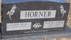
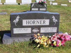
Martha Rose DeBusk Horner
| Birth | : | 6 Jul 1930 Morrill, Brown County, Kansas, USA |
| Death | : | 10 Jan 2010 Ponca City, Kay County, Oklahoma, USA |
| Burial | : | Mount Hope Cemetery, Litchfield, Hillsdale County, USA |
| Coordinate | : | 42.0332985, -84.7332993 |
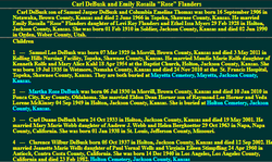
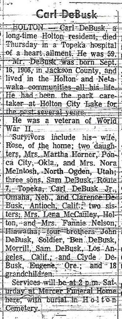
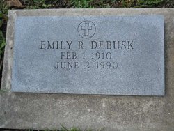
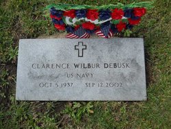
| Description | : | Martha Rose DeBusk Horner was born in Morrill, Brown County, Kansas, the second child of Emily Rosalia Flanders and Carl DeBusk, on July 6, 1930. She passed away at her home in Ponca City, Oklahoma on January 10, 210. * Martha was preceded in death by her parents and two brothers, Clarence "Babe" and Carl Jr. "Pop" DeBusk. Memorial service will be held at First Methodist Church, Ponca City, Wednesday January 13th at 10;00 am. Visitation and viewing will be at Trout Funeral Home, 7:00 pm to 9:00 pm on Tuesday, January 12th. Internment will be at Holton, Kansas at 10:00 am Thursday, January 14th. Visitation and viewing will be at Mercer Funeral Home of Holton from 7-9:00 pm, Wednesday, January 13th. The family request that in lieu of flowers donations made be made to: Hospice of North Central Oklahoma, 1904 N. Union Ste 103, Ponca City, OK 74601 Alzheimer's Research Association, 6465 S. Yale St., Ste 206, Tulsa, OK 74136, American Lung Association, 1010 E. 8th St., Tulsa, OK 74120 |
frequently asked questions (FAQ):
-
Where is Martha Rose DeBusk Horner's memorial?
Martha Rose DeBusk Horner's memorial is located at: Mount Hope Cemetery, Litchfield, Hillsdale County, USA.
-
When did Martha Rose DeBusk Horner death?
Martha Rose DeBusk Horner death on 10 Jan 2010 in Ponca City, Kay County, Oklahoma, USA
-
Where are the coordinates of the Martha Rose DeBusk Horner's memorial?
Latitude: 42.0332985
Longitude: -84.7332993
Family Members:
Parent
Siblings
Flowers:
Nearby Cemetories:
1. Mount Hope Cemetery
Litchfield, Hillsdale County, USA
Coordinate: 42.0332985, -84.7332993
2. Old Litchfield Cemetery
Litchfield, Hillsdale County, USA
Coordinate: 42.0433330, -84.7533330
3. Sand Creek Cemetery
Litchfield, Hillsdale County, USA
Coordinate: 41.9998950, -84.7568390
4. Case Cemetery
Hillsdale County, USA
Coordinate: 42.0435982, -84.6813965
5. Hiram King Cemetery
Pulaski, Jackson County, USA
Coordinate: 42.0706370, -84.7087120
6. Saratoga Cemetery
Litchfield, Hillsdale County, USA
Coordinate: 42.0585500, -84.7930280
7. Todd Town Cemetery
Litchfield, Hillsdale County, USA
Coordinate: 41.9989430, -84.8036280
8. Johnson Cemetery
Scipio Township, Hillsdale County, USA
Coordinate: 42.0180560, -84.6505560
9. Mosherville Cemetery
Mosherville, Hillsdale County, USA
Coordinate: 42.0597220, -84.6555560
10. First Presbyterian Church Memorial Garden
Jonesville, Hillsdale County, USA
Coordinate: 41.9836930, -84.6611390
11. Sunset View Cemetery
Jonesville, Hillsdale County, USA
Coordinate: 41.9869003, -84.6524963
12. Buck Cemetery
Pulaski, Jackson County, USA
Coordinate: 42.0839539, -84.6563568
13. Allen Cemetery
Allen, Hillsdale County, USA
Coordinate: 41.9561110, -84.7600000
14. Fisher Cemetery
Homer, Calhoun County, USA
Coordinate: 42.1147220, -84.7202770
15. Homer Amish Cemetery
Homer, Calhoun County, USA
Coordinate: 42.1165600, -84.7512800
16. Granger-Pope Cemetery
Mosherville, Hillsdale County, USA
Coordinate: 42.0333330, -84.6125000
17. Allen Township Cemetery
Allen, Hillsdale County, USA
Coordinate: 41.9417100, -84.7096800
18. Whig Center Cemetery
Butler, Branch County, USA
Coordinate: 42.0433330, -84.8611110
19. White Cemetery
Butler, Branch County, USA
Coordinate: 42.0339940, -84.8638920
20. Shooks Prairie Cemetery
Butler, Branch County, USA
Coordinate: 42.0003014, -84.8561020
21. Saint Joseph Cemetery
Clarendon Township, Calhoun County, USA
Coordinate: 42.0727780, -84.8575000
22. Layton Graves
Allen, Hillsdale County, USA
Coordinate: 41.9460869, -84.8142776
23. Pulaski Cemetery
Pulaski, Jackson County, USA
Coordinate: 42.1212410, -84.6422550
24. McNair Cemetery
Pulaski, Jackson County, USA
Coordinate: 42.1008339, -84.6127777

