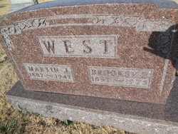
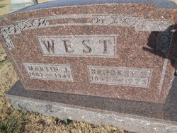
Martin J West
| Birth | : | 7 Oct 1887 Russellville, Cole County, Missouri, USA |
| Death | : | 26 Dec 1947 Russellville, Cole County, Missouri, USA |
| Burial | : | Dixon Cemetery, Dixon, Solano County, USA |
| Coordinate | : | 38.4354553, -121.8227005 |
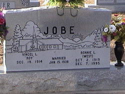
| Description | : | Cole Co. Enterprise--Jan. 2, 1948 MARTIN J. WEST Mt. Olive Farmer Dies in Doctor's Office Martin J. West, age 60, passed away suddenly Dec. 26, 1948 (sic) in Dr. W. L. Leslie's office. Mr. and Mrs. West had started to Jefferson City on business when he began to feel ill, they stopped in Russellville at the doctor's office where he passed away. Mr. West was a farmer in the Mt. Olive community. He was the youngest of a family of fourteen children. He was married on March 21, 1915 to Miss Brooks Shikles who with two daughters, Mrs. Archie Glover and Mrs. Roy Jobe... Read More |
frequently asked questions (FAQ):
-
Where is Martin J West's memorial?
Martin J West's memorial is located at: Dixon Cemetery, Dixon, Solano County, USA.
-
When did Martin J West death?
Martin J West death on 26 Dec 1947 in Russellville, Cole County, Missouri, USA
-
Where are the coordinates of the Martin J West's memorial?
Latitude: 38.4354553
Longitude: -121.8227005
Family Members:
Spouse
Children
Flowers:
Nearby Cemetories:
1. Dixon Cemetery
Dixon, Solano County, USA
Coordinate: 38.4354553, -121.8227005
2. Sacramento Valley National Cemetery
Dixon, Solano County, USA
Coordinate: 38.4167800, -121.8754000
3. Binghampton Cemetery
Solano County, USA
Coordinate: 38.3510550, -121.8244220
4. Tremont Cemetery
Dixon, Solano County, USA
Coordinate: 38.4940987, -121.7043991
5. Episcopal Church of Saint Martin Columbarium
Davis, Yolo County, USA
Coordinate: 38.5488870, -121.7611850
6. Vacaville-Elmira Cemetery
Vacaville, Solano County, USA
Coordinate: 38.3517570, -121.9634933
7. Davis Cemetery
Davis, Yolo County, USA
Coordinate: 38.5550003, -121.7260971
8. Winters Cemetery
Winters, Yolo County, USA
Coordinate: 38.5256004, -121.9777985
9. Pioneer Cemetery at Pena Adobe
Vacaville, Solano County, USA
Coordinate: 38.3389200, -122.0127200
10. Old County Hospital Cemetery
Fairfield, Solano County, USA
Coordinate: 38.2659190, -122.0135510
11. Saint Joseph Cemetery
Woodland, Yolo County, USA
Coordinate: 38.6694400, -121.7842120
12. Woodland Cemetery
Woodland, Yolo County, USA
Coordinate: 38.6711006, -121.7846985
13. Corbin Cemetery
Esparto, Yolo County, USA
Coordinate: 38.6240710, -122.0105040
14. Fairmont Memorial Park
Fairfield, Solano County, USA
Coordinate: 38.2648040, -122.0411970
15. Cottonwood Cemetery
Winters, Yolo County, USA
Coordinate: 38.6500015, -121.9677963
16. Saint Alphonsus Catholic Cemetery
Fairfield, Solano County, USA
Coordinate: 38.2620546, -122.0410961
17. Suisun-Fairfield Cemetery
Fairfield, Solano County, USA
Coordinate: 38.2613678, -122.0405960
18. Monument Hill Memorial Park
Woodland, Yolo County, USA
Coordinate: 38.6781020, -121.8566400
19. Wragg Canyon Cemetery
Napa County, USA
Coordinate: 38.4680220, -122.1562050
20. Gordon Family Cemetery
Esparto, Yolo County, USA
Coordinate: 38.6966060, -121.9151540
21. Shiloh Cemetery
Birds Landing, Solano County, USA
Coordinate: 38.1685310, -121.8893440
22. Sunset Hill Cemetery
Sacramento, Sacramento County, USA
Coordinate: 38.5608000, -121.5037300
23. Masonic Lawn Cemetery
Sacramento, Sacramento County, USA
Coordinate: 38.5604720, -121.5032600
24. Odd Fellows Lawn Cemetery and Mausoleum
Sacramento, Sacramento County, USA
Coordinate: 38.5585000, -121.5011000


