Marvin Charles Henning
| Birth | : | 25 Aug 1902 Farmersburg, Clayton County, Iowa, USA |
| Death | : | 26 Jan 1982 Farmersburg, Clayton County, Iowa, USA |
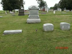
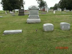
| Burial | : | Rockport Protestant Cemetery New, Rockport, Leeds and Grenville United Counties, Canada |
| Coordinate | : | 44.3800170, -75.9387340 |
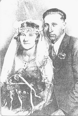
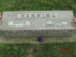
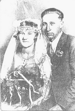
| Description | : | Clayton County Register Wednesday, February 3, 1982 pg. 6A Marvin Charles Henning Services for Marvin Charles Henning were held Friday, January 29, 1982, at 11 a.m. at St. John Lutheran Church, Farmersburg, with Pastor Karl Hansen officiating. Burial was in the Farmersburg-Wagner cemetery. Pallbearers were Ronald Henning, Randy Henning, Larry Best, Dale Best, Kevin Henning, Kent Henning, Jeffrey Miller, Richard Henning and Scott Miller. He was born to Henry and Sophia Backhaus Henning August 25, 1902. Henning was baptized October 3, 1902, at Zion Lutheran Church, Clayton Centre, confirmed October 2, 1921, and obtained his education in the area schools. October 5, 1927, he... Read More |
frequently asked questions (FAQ):
-
Where is Marvin Charles Henning's memorial?
Marvin Charles Henning's memorial is located at: Rockport Protestant Cemetery New, Rockport, Leeds and Grenville United Counties, Canada.
-
When did Marvin Charles Henning death?
Marvin Charles Henning death on 26 Jan 1982 in Farmersburg, Clayton County, Iowa, USA
-
Where are the coordinates of the Marvin Charles Henning's memorial?
Latitude: 44.3800170
Longitude: -75.9387340
Family Members:
Parent
Spouse
Siblings
Children
Flowers:
Nearby Cemetories:
1. Rockport Protestant Cemetery New
Rockport, Leeds and Grenville United Counties, Canada
Coordinate: 44.3800170, -75.9387340
2. Rockport Protestant Cemetery Old
Rockport, Leeds and Grenville United Counties, Canada
Coordinate: 44.3812890, -75.9370750
3. Saint Brendans Roman Catholic Cemetery
Rockport, Leeds and Grenville United Counties, Canada
Coordinate: 44.3807870, -75.9363580
4. Hunt Family Cemetery
Rockport, Leeds and Grenville United Counties, Canada
Coordinate: 44.3815510, -75.9361480
5. Old McNickle Cemetery
Holland, Leeds and Grenville United Counties, Canada
Coordinate: 44.4040500, -75.9574670
6. Buell Cemetery
Rockport, Leeds and Grenville United Counties, Canada
Coordinate: 44.4120000, -75.9051940
7. Walton Street Cemetery
Alexandria Bay, Jefferson County, USA
Coordinate: 44.3375000, -75.9127900
8. Church Street Cemetery
Alexandria Bay, Jefferson County, USA
Coordinate: 44.3308300, -75.9136100
9. Grenadier Island Cemetery
Front of Escott, Leeds and Grenville United Counties, Canada
Coordinate: 44.4134660, -75.8812830
10. Saint Cyril's Cemetery
Alexandria Bay, Jefferson County, USA
Coordinate: 44.3300018, -75.9085999
11. Highland Park Cemetery
Alexandria Bay, Jefferson County, USA
Coordinate: 44.3294400, -75.9084800
12. Escott Cemetery
Escott, Leeds and Grenville United Counties, Canada
Coordinate: 44.4403740, -75.9378900
13. Houghton Cemetery
Jefferson County, USA
Coordinate: 44.3194008, -75.9432983
14. Union Cemetery
Lansdowne, Leeds and Grenville United Counties, Canada
Coordinate: 44.4335300, -75.9864900
15. LaRue Family Cemetery
Escott, Leeds and Grenville United Counties, Canada
Coordinate: 44.4314860, -75.8859600
16. Riverside Cemetery
Alexandria, Jefferson County, USA
Coordinate: 44.3125000, -75.9677963
17. Barnes Settlement Cemetery
Alexandria Bay, Jefferson County, USA
Coordinate: 44.3405991, -75.8463974
18. Lansdowne Cemetery
Ebenezer, Leeds and Grenville United Counties, Canada
Coordinate: 44.3852740, -76.0507110
19. Saint Patrick's Roman Catholic Cemetery
Lansdowne, Leeds and Grenville United Counties, Canada
Coordinate: 44.4265600, -76.0520200
20. Cross Cemetery
Halsteads Bay, Leeds and Grenville United Counties, Canada
Coordinate: 44.3602110, -76.0710950
21. Ruttle-Warburton Cemetery
Lansdowne, Leeds and Grenville United Counties, Canada
Coordinate: 44.4662366, -76.0087640
22. Warren Burial Site
Rockfield, Leeds and Grenville United Counties, Canada
Coordinate: 44.4795030, -75.9478100
23. Dulcemaine Cemetery
Dulcemaine, Leeds and Grenville United Counties, Canada
Coordinate: 44.4480110, -76.0434560
24. Hill Cemetery
Jefferson County, USA
Coordinate: 44.3153000, -75.8277969

