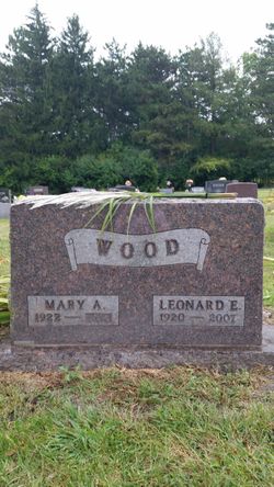
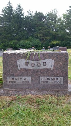
Mary Amanda Siddall Wood
| Birth | : | 2 Aug 1922 Laurens, Pocahontas County, Iowa, USA |
| Death | : | 25 Mar 2017 State Center, Marshall County, Iowa, USA |
| Burial | : | Bass Point Cemetery, Boone, Boone County, USA |
| Coordinate | : | 42.0992012, -93.8957977 |
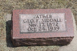
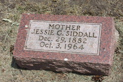
| Description | : | Mary Wood, age 94, formerly of Boone, died March 25, 2017 at State Center Specialty Care in State Center. Mary Amanda (Siddall) Wood, was born on a farm near Laurens, Iowa, on August 2, 1922, the daughter of George and Jessie (Russell) Siddall. She married Leonard Wood in Pocahontas, Iowa, on August 21, 1943. Mary was a devoted wife and mother, and enjoyed going for drives in a car or driving her power wheelchair. She really enjoyed her life in spite of it's many challenges. She loved spending time with her family and friends, and especially enjoyed time with her grandchildren... Read More |
frequently asked questions (FAQ):
-
Where is Mary Amanda Siddall Wood's memorial?
Mary Amanda Siddall Wood's memorial is located at: Bass Point Cemetery, Boone, Boone County, USA.
-
When did Mary Amanda Siddall Wood death?
Mary Amanda Siddall Wood death on 25 Mar 2017 in State Center, Marshall County, Iowa, USA
-
Where are the coordinates of the Mary Amanda Siddall Wood's memorial?
Latitude: 42.0992012
Longitude: -93.8957977
Family Members:
Parent
Spouse
Siblings
Children
Flowers:
Nearby Cemetories:
1. Bass Point Cemetery
Boone, Boone County, USA
Coordinate: 42.0992012, -93.8957977
2. Buckley Cemetery
Boone, Boone County, USA
Coordinate: 42.0999810, -93.9418960
3. Hickory Grove Cemetery
Boone County, USA
Coordinate: 42.1074982, -93.9507980
4. Linwood Park Cemetery
Boone, Boone County, USA
Coordinate: 42.0550003, -93.8850021
5. Latham Cemetery
Boone, Boone County, USA
Coordinate: 42.0489006, -93.8878021
6. Sacred Heart Cemetery
Boone, Boone County, USA
Coordinate: 42.0485992, -93.9163971
7. Biblical College Cemetery
Boone, Boone County, USA
Coordinate: 42.0456009, -93.9113998
8. Boone Memorial Gardens Cemetery
Boone, Boone County, USA
Coordinate: 42.0449982, -93.9152985
9. Boone County Poor Farm Cemetery
Boone County, USA
Coordinate: 42.1591100, -93.9159000
10. Bluff Creek Cemetery
Boone, Boone County, USA
Coordinate: 42.0774994, -93.9796982
11. Rose Hill Cemetery
Boone, Boone County, USA
Coordinate: 42.0419006, -93.9408035
12. Leininger Cemetery
Boone County, USA
Coordinate: 42.1492004, -93.8356018
13. Sarah Dinwoodie Cemetery
Worth Township, Boone County, USA
Coordinate: 42.0278000, -93.8697000
14. Schlicht Cemetery
Fraser, Boone County, USA
Coordinate: 42.1444200, -93.9780100
15. Mineral Ridge Cemetery
Ridgeport, Boone County, USA
Coordinate: 42.1749992, -93.9266968
16. Oakwood Cemetery
Moingona, Boone County, USA
Coordinate: 42.0219002, -93.9396973
17. White Cemetery
Boone County, USA
Coordinate: 42.1777992, -93.9636002
18. Hollaway Cemetery
Moingona, Boone County, USA
Coordinate: 42.0138720, -93.9530080
19. Saint Paul Lutheran Cemetery
Boone, Boone County, USA
Coordinate: 42.1700000, -93.8070000
20. Quincy Cemetery
Boone, Boone County, USA
Coordinate: 42.0074997, -93.9503021
21. Squire Boone Cemetery
Luther, Boone County, USA
Coordinate: 42.0032997, -93.8531036
22. Mitchell Cemetery
Boone County, USA
Coordinate: 42.1208000, -93.7544022
23. Runyan Cemetery
Pilot Mound, Boone County, USA
Coordinate: 42.1749992, -94.0015030
24. Pilot Mound Cemetery
Pilot Mound, Boone County, USA
Coordinate: 42.1636200, -94.0282600

