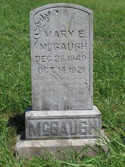
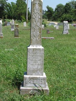
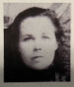
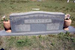
Mary Ann Eliza Poarch McGaugh
| Birth | : | 28 Dec 1849 Tennessee, USA |
| Death | : | 14 Oct 1921 Benton County, Arkansas, USA |
| Burial | : | Mount Hebron Cemetery, Cave Springs, Benton County, USA |
| Coordinate | : | 36.2762450, -94.1947930 |
| Description | : | Mary Ann Eliza Porch and Andrew Jackson McGaugh were married June 14, 1869 in Giles County, Tennessee |
frequently asked questions (FAQ):
-
Where is Mary Ann Eliza Poarch McGaugh's memorial?
Mary Ann Eliza Poarch McGaugh's memorial is located at: Mount Hebron Cemetery, Cave Springs, Benton County, USA.
-
When did Mary Ann Eliza Poarch McGaugh death?
Mary Ann Eliza Poarch McGaugh death on 14 Oct 1921 in Benton County, Arkansas, USA
-
Where are the coordinates of the Mary Ann Eliza Poarch McGaugh's memorial?
Latitude: 36.2762450
Longitude: -94.1947930
Family Members:
Parent
Spouse
Siblings
Children
Flowers:
Nearby Cemetories:
1. Mount Hebron Cemetery
Cave Springs, Benton County, USA
Coordinate: 36.2762450, -94.1947930
2. Pinnacle Memorial Gardens
Rogers, Benton County, USA
Coordinate: 36.2826570, -94.1946910
3. Mount Olive Cemetery
Cave Springs, Benton County, USA
Coordinate: 36.2629050, -94.1958840
4. Allen Cemetery
Cave Springs, Benton County, USA
Coordinate: 36.2676690, -94.2308220
5. Cave Springs Cemetery
Cave Springs, Benton County, USA
Coordinate: 36.2572490, -94.2241100
6. Old Cave Springs Cemetery
Cave Springs, Benton County, USA
Coordinate: 36.2597008, -94.2303009
7. Hart Cemetery
Rogers, Benton County, USA
Coordinate: 36.3135986, -94.2074966
8. Pleasant Grove Cemetery
Rogers, Benton County, USA
Coordinate: 36.2827988, -94.1466980
9. Goad Springs Cemetery
Lowell, Benton County, USA
Coordinate: 36.2496986, -94.1530991
10. Phillips Cemetery
Cave Springs, Benton County, USA
Coordinate: 36.2813988, -94.2506027
11. First Presbyterian Church Columbarium
Rogers, Benton County, USA
Coordinate: 36.3118020, -94.1564570
12. Burch Family Cemetery
Cave Springs, Benton County, USA
Coordinate: 36.2592239, -94.2517090
13. Spring Creek Cemetery
Cave Springs, Benton County, USA
Coordinate: 36.2261009, -94.1917038
14. Prayer Garden Columbarium
Rogers, Benton County, USA
Coordinate: 36.2847200, -94.1333430
15. Sharp Cemetery
Benton County, USA
Coordinate: 36.2241880, -94.1868240
16. McDaniel Cemetery
Lowell, Benton County, USA
Coordinate: 36.2792015, -94.1228027
17. Oak Grove Cemetery
Rogers, Benton County, USA
Coordinate: 36.2823800, -94.1230400
18. Putman Cemetery
Bentonville, Benton County, USA
Coordinate: 36.3340874, -94.1870880
19. Oakley Chapel Cemetery
Rogers, Benton County, USA
Coordinate: 36.3344002, -94.1735992
20. Benton County Memorial Park
Rogers, Benton County, USA
Coordinate: 36.3342018, -94.1722031
21. Silent Grove Cemetery
Benton County, USA
Coordinate: 36.2216670, -94.1598540
22. Bland Cemetery
Rogers, Benton County, USA
Coordinate: 36.3372002, -94.1844025
23. Derrick-Robbins Cemetery
Healing Springs, Benton County, USA
Coordinate: 36.2472100, -94.2642200
24. Dodson Cemetery
Benton County, USA
Coordinate: 36.3424988, -94.1975021

