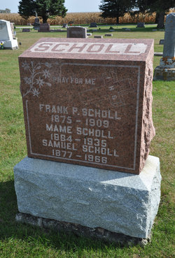
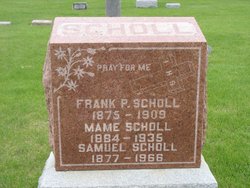
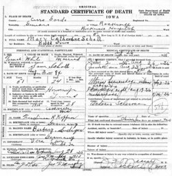
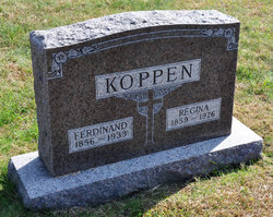
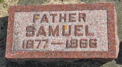
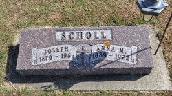
Mary Anna Katherine “Mame” Koppen Scholl
| Birth | : | 2 Aug 1884 Cassville, Grant County, Wisconsin, USA |
| Death | : | 26 Aug 1935 Rockwell, Cerro Gordo County, Iowa, USA |
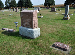
| Burial | : | Rice Lake Cemetery, Faribault County, USA |
| Coordinate | : | 43.6288986, -93.7277985 |
| Description | : | Daughter of Ferdinand Koppen & Barbara Ludiger |
frequently asked questions (FAQ):
-
Where is Mary Anna Katherine “Mame” Koppen Scholl's memorial?
Mary Anna Katherine “Mame” Koppen Scholl's memorial is located at: Rice Lake Cemetery, Faribault County, USA.
-
When did Mary Anna Katherine “Mame” Koppen Scholl death?
Mary Anna Katherine “Mame” Koppen Scholl death on 26 Aug 1935 in Rockwell, Cerro Gordo County, Iowa, USA
-
Where are the coordinates of the Mary Anna Katherine “Mame” Koppen Scholl's memorial?
Latitude: 43.6288986
Longitude: -93.7277985
Family Members:
Parent
Spouse
Siblings
Flowers:
Nearby Cemetories:
1. Rice Lake Cemetery
Faribault County, USA
Coordinate: 43.6288986, -93.7277985
2. United Lutheran Cemetery
Walters, Faribault County, USA
Coordinate: 43.6080370, -93.6936380
3. Walters Cemetery
Walters, Faribault County, USA
Coordinate: 43.6069412, -93.6777802
4. North Blue Earth Cemetery
Brush Creek, Faribault County, USA
Coordinate: 43.6284943, -93.8105392
5. Fairview Cemetery
Kiester, Faribault County, USA
Coordinate: 43.5583000, -93.7086029
6. Brush Creek Cemetery
Faribault County, USA
Coordinate: 43.6452789, -93.8272171
7. Clayton Cemetery
Bricelyn, Faribault County, USA
Coordinate: 43.5806007, -93.8383026
8. United Brethren Cemetery
Mansfield, Freeborn County, USA
Coordinate: 43.5583305, -93.6402817
9. Our Saviors Lutheran Cemetery
Kiester, Faribault County, USA
Coordinate: 43.5356100, -93.7039440
10. Walnut Lake Cemetery
Faribault County, USA
Coordinate: 43.6958700, -93.8287180
11. Bricelyn Cemetery
Bricelyn, Faribault County, USA
Coordinate: 43.5572014, -93.8292007
12. Mansfield Lutheran Cemetery
Mansfield, Freeborn County, USA
Coordinate: 43.5686111, -93.6097183
13. Alden Cemetery
Alden, Freeborn County, USA
Coordinate: 43.6796989, -93.5832977
14. Saint Casimir Cemetery
Wells, Faribault County, USA
Coordinate: 43.7456017, -93.7382965
15. Walnut Lake Methodist Cemetery
Wells, Faribault County, USA
Coordinate: 43.7224330, -93.8269330
16. Rosehill Cemetery
Wells, Faribault County, USA
Coordinate: 43.7472000, -93.7391968
17. Mansfield Township Cemetery
Mansfield, Freeborn County, USA
Coordinate: 43.5558014, -93.5892029
18. Zion Swedish Lutheran Cemetery
Mansfield, Freeborn County, USA
Coordinate: 43.5291710, -93.6233292
19. South Blue Earth Lutheran Cemetery
Bricelyn, Faribault County, USA
Coordinate: 43.5583305, -93.8813934
20. Dell Lutheran Cemetery
Faribault County, USA
Coordinate: 43.6252785, -93.9147186
21. Carlston Cemetery
Alden, Freeborn County, USA
Coordinate: 43.7099991, -93.5693970
22. Trinity Lutheran Church Cemetery
Scarville, Winnebago County, USA
Coordinate: 43.4871300, -93.7796200
23. Conger Community Cemetery
Conger, Freeborn County, USA
Coordinate: 43.6158295, -93.5183334
24. Emerald Cemetery
Frost, Faribault County, USA
Coordinate: 43.5898399, -93.9326782

