| Birth | : | 24 Jul 1861 Corydon, Wayne County, Iowa, USA |
| Death | : | 18 Apr 1913 Osborne County, Kansas, USA |
| Burial | : | Cedar Bluff Cemetery, Osborne County, USA |
| Coordinate | : | 39.2496986, -98.8431015 |
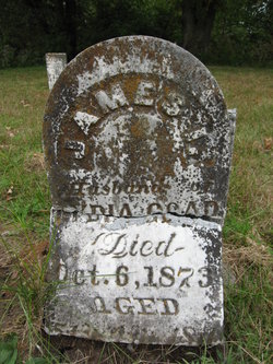
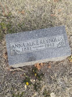
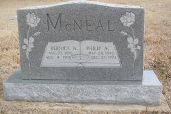
| Description | : | Daughter of James Isham Goad (1822-18730 and Lydia Catherine Markham Goad (1821-1885). Married William Franklin McNeal (1854-1907) on 4-28-1880 in Osborne Co., Ks. Children are Alice Anna McNeal Reynolds (1881-1942), Lydia Catherine McNeal Harris (1882-1958), Albert Oscar McNeal (1885-1953), Rose Ethel McNeal Fritche (1887-1935), Georgia Ella McNeal Elliott (1889-1978), Jesse Myrle McNeal (1891-1972), Philip Arthur McNeal (1895-1974), Gilbert Anthony McNeal (1897-xxxx) and Baby boy McNeal b.& d. 3-23-1904). Siblings are Vance Carrick Goad (1842-1901), Nathaniel Perry Goad (1844-1905), Jasper I. Goad (1846-1850), Martha Caroline Goad Balm (1848-1880), Thomas Jefferson Goad (1849-1927), Lucretia Jane Goad Davidson Slater Smith (1855-1925), James Wesley... Read More |
frequently asked questions (FAQ):
-
Where is Mary Christian Goad McNeal's memorial?
Mary Christian Goad McNeal's memorial is located at: Cedar Bluff Cemetery, Osborne County, USA.
-
When did Mary Christian Goad McNeal death?
Mary Christian Goad McNeal death on 18 Apr 1913 in Osborne County, Kansas, USA
-
Where are the coordinates of the Mary Christian Goad McNeal's memorial?
Latitude: 39.2496986
Longitude: -98.8431015
Family Members:
Parent
Spouse
Siblings
Children
Flowers:
Nearby Cemetories:
1. Victor Cemetery
Osborne County, USA
Coordinate: 39.2380981, -98.8613968
2. Cole Cemetery
Osborne County, USA
Coordinate: 39.2352982, -98.8060989
3. Covert Cemetery
Osborne County, USA
Coordinate: 39.2896996, -98.8107986
4. IXL Cemetery
Natoma, Osborne County, USA
Coordinate: 39.2491989, -98.9218979
5. Round Mound Cemetery
Osborne County, USA
Coordinate: 39.2630997, -98.9636002
6. Vincent Cemetery
Osborne, Osborne County, USA
Coordinate: 39.1921997, -98.7228012
7. Grand Center Cemetery
Osborne County, USA
Coordinate: 39.1469002, -98.7602997
8. Bristow Cemetery
Osborne, Osborne County, USA
Coordinate: 39.3506012, -98.7506027
9. Immanuel Lutheran Cemetery
Natoma, Osborne County, USA
Coordinate: 39.2708015, -99.0096970
10. Kill Creek Cemetery
Alton, Osborne County, USA
Coordinate: 39.3805528, -98.8967658
11. Mount Hermon Cemetery
Paradise, Russell County, USA
Coordinate: 39.1324997, -98.9439011
12. Potterville Cemetery
Cheyenne, Osborne County, USA
Coordinate: 39.2417500, -98.6576900
13. Mount Hope Cemetery
Bloomington, Osborne County, USA
Coordinate: 39.3939018, -98.8450012
14. Natoma Cemetery
Natoma, Osborne County, USA
Coordinate: 39.1907700, -99.0162700
15. Natoma Lutheran Cemetery
Natoma, Osborne County, USA
Coordinate: 39.1907700, -99.0162700
16. Waldo Catholic Cemetery
Waldo Township, Russell County, USA
Coordinate: 39.1036600, -98.8162400
17. Natoma Catholic Cemetery
Natoma, Osborne County, USA
Coordinate: 39.2054050, -99.0289480
18. Mount Ayr Cemetery
Alton, Osborne County, USA
Coordinate: 39.3764000, -98.9717026
19. Zimmerman Cemetery
Osborne County, USA
Coordinate: 39.3217010, -98.6568985
20. Cheyenne Cemetery
Cheyenne, Osborne County, USA
Coordinate: 39.1767006, -98.6408005
21. Pleasant Plain Cemetery
Osborne County, USA
Coordinate: 39.3367004, -99.0372009
22. Luray Cemetery
Luray, Russell County, USA
Coordinate: 39.1109980, -98.6872380
23. Aurora Cemetery
Laton, Rooks County, USA
Coordinate: 39.2778015, -99.0847015
24. Chalk Mound Cemetery
Laton, Rooks County, USA
Coordinate: 39.3208008, -99.0852966

