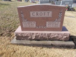
| Birth | : | 27 Oct 1829 New Bedford, Coshocton County, Ohio, USA |
| Death | : | 14 Jul 1886 New Bedford, Coshocton County, Ohio, USA |
| Burial | : | Highland Cemetery, Junction City, Geary County, USA |
| Coordinate | : | 39.0139008, -96.8416977 |
| Description | : | Mary was the daughter of John Michael & Catherine Conrad Croft. She was wed on June 1, 1846 to Isaac Henry Lower in Coshocton Co., OH. They became the parents of TEN children: Conrad J, Benjamin Joseph, John M, Catherine Elizabeth, Mary Elizabeth (one year old), Amanda Mabeley, Hannah Elizabeth, Isaac Henry,Jr, Infant Son & Mary Elizabeth (2nd) Lower. Mary was 86Yrs 2Mos, 12Days when she passed. She is interred with husband - Isaac Henry, Sr at Zion United Church of Christ Cemetery in New Bedford. Submitted by relative - Peter Lower Rodgers |
frequently asked questions (FAQ):
-
Where is Mary Croft Lower's memorial?
Mary Croft Lower's memorial is located at: Highland Cemetery, Junction City, Geary County, USA.
-
When did Mary Croft Lower death?
Mary Croft Lower death on 14 Jul 1886 in New Bedford, Coshocton County, Ohio, USA
-
Where are the coordinates of the Mary Croft Lower's memorial?
Latitude: 39.0139008
Longitude: -96.8416977
Family Members:
Parent
Spouse
Siblings
Children
Flowers:
Nearby Cemetories:
1. Highland Cemetery
Junction City, Geary County, USA
Coordinate: 39.0139008, -96.8416977
2. Saint Marys Cemetery
Junction City, Geary County, USA
Coordinate: 39.0092010, -96.8522034
3. Episcopal Church of the Covenant Columbarium
Junction City, Geary County, USA
Coordinate: 39.0259480, -96.8338650
4. Geary County Poor Farm Cemetery
Junction City, Geary County, USA
Coordinate: 39.0064500, -96.8727100
5. Wreford Cemetery
Junction City, Geary County, USA
Coordinate: 38.9620300, -96.8423500
6. Fort Riley Post Cemetery
Fort Riley, Geary County, USA
Coordinate: 39.0638500, -96.7934900
7. Cavalry Parade Field
Fort Riley, Geary County, USA
Coordinate: 39.0638800, -96.7839200
8. Saint Pauls Lutheran Cemetery
Junction City, Geary County, USA
Coordinate: 38.9964600, -96.7501400
9. Fairview Cemetery
Grandview Plaza, Geary County, USA
Coordinate: 39.0621986, -96.7457962
10. Wetzel Cemetery
Geary County, USA
Coordinate: 38.9449997, -96.7649994
11. Davis Creek Cemetery
Geary County, USA
Coordinate: 38.9606018, -96.7425003
12. Salchow Cemetery
Geary County, USA
Coordinate: 38.9352989, -96.7731018
13. Saint Johns Cemetery
Geary County, USA
Coordinate: 39.0741997, -96.9610977
14. Alida Zion Evangelical Cemetery
Upland, Dickinson County, USA
Coordinate: 39.0750008, -96.9721985
15. Vinton Cemetery
Geary County, USA
Coordinate: 39.1375008, -96.8399963
16. Good Hope Cemetery
Chapman, Dickinson County, USA
Coordinate: 39.0388985, -96.9991989
17. Alida Cemetery
Geary County, USA
Coordinate: 39.1030998, -96.9618988
18. Skiddy Cemetery
Geary County, USA
Coordinate: 38.8852997, -96.8078003
19. Saint Patricks Cemetery
Chapman, Dickinson County, USA
Coordinate: 38.9803330, -97.0062850
20. Humboldt Cemetery
Junction City, Geary County, USA
Coordinate: 39.0008011, -96.6691971
21. Saint Patricks Cemetery
Ogden, Riley County, USA
Coordinate: 39.1236000, -96.7208023
22. Rinehart Cemetery
Enterprise, Dickinson County, USA
Coordinate: 38.9021988, -96.9638977
23. Ogden Cemetery
Ogden, Riley County, USA
Coordinate: 39.1225014, -96.7106018
24. Olson Cemetery
Geary County, USA
Coordinate: 38.9091988, -96.7024994


