
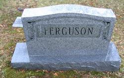
Mary E. “Mamie” Dunkle Ferguson
| Birth | : | 5 Dec 1874 Lavalette, Wayne County, West Virginia, USA |
| Death | : | unknown |
| Burial | : | North Walsham New Cemetery, North Walsham, North Norfolk District, England |
| Coordinate | : | 52.8242410, 1.3913360 |
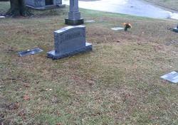
| Plot | : | Section 8, lot 10, space 8 |
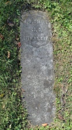
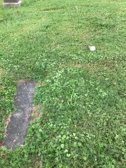
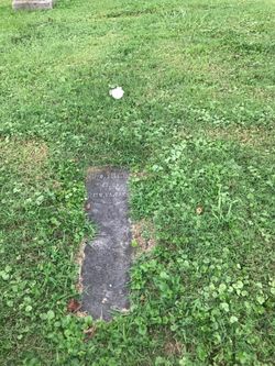
| Description | : | Mamie E. Dunkle was the daughter of James Dolliver Dunkle (1844-1889) and Eglantine Ray (1848-1899). She married Lucian C. Ferguson. She died between 1895 and 1900. She is my great-grandmother. Spring Hill Cemetery: Ferguson, Mamie, Sec 8, Lot 10, Space 8 |
frequently asked questions (FAQ):
-
Where is Mary E. “Mamie” Dunkle Ferguson's memorial?
Mary E. “Mamie” Dunkle Ferguson's memorial is located at: North Walsham New Cemetery, North Walsham, North Norfolk District, England.
-
When did Mary E. “Mamie” Dunkle Ferguson death?
Mary E. “Mamie” Dunkle Ferguson death on unknown in
-
Where are the coordinates of the Mary E. “Mamie” Dunkle Ferguson's memorial?
Latitude: 52.8242410
Longitude: 1.3913360
Family Members:
Parent
Spouse
Siblings
Children
Flowers:


Nearby Cemetories:
1. North Walsham New Cemetery
North Walsham, North Norfolk District, England
Coordinate: 52.8242410, 1.3913360
2. Saint Nicholas Churchyard
North Walsham, North Norfolk District, England
Coordinate: 52.8216050, 1.3873600
3. St Giles Churchyard
Bradfield, North Norfolk District, England
Coordinate: 52.8493740, 1.3667290
4. St. Andrews Church Burial Ground
Felmingham, North Norfolk District, England
Coordinate: 52.8139100, 1.3391320
5. St. Mary's Churchyard
Antingham, North Norfolk District, England
Coordinate: 52.8464655, 1.3436395
6. St Peter & St Paul Churchyard
Knapton, North Norfolk District, England
Coordinate: 52.8555000, 1.4260000
7. All Saints, Edingthorpe
Bacton, North Norfolk District, England
Coordinate: 52.8454870, 1.4482110
8. St. Margaret's Churchyard
Witton, Broadland District, England
Coordinate: 52.8313690, 1.4582740
9. St Peter and St Paul Churchyard
Honing, North Norfolk District, England
Coordinate: 52.7993600, 1.4500820
10. St Margaret Churchyard
Paston, North Norfolk District, England
Coordinate: 52.8575930, 1.4491160
11. St. Andrew Churchyard
Bacton, North Norfolk District, England
Coordinate: 52.8500500, 1.4676900
12. St Peter Churchyard
Ridlington, North Norfolk District, England
Coordinate: 52.8260460, 1.4804170
13. All Saints Churchyard
Gimingham, North Norfolk District, England
Coordinate: 52.8790220, 1.3948380
14. St Nicholas Churchyard
Dilham, North Norfolk District, England
Coordinate: 52.7808760, 1.4477890
15. St. Giles Churchyard
Colby, North Norfolk District, England
Coordinate: 52.8318190, 1.2945700
16. St Andrew's Churchyard
Gunton, North Norfolk District, England
Coordinate: 52.8584910, 1.3097280
17. Bromholm Priory
Bacton, North Norfolk District, England
Coordinate: 52.8458000, 1.4846000
18. All Saints Churchyard
Mundesley, North Norfolk District, England
Coordinate: 52.8803700, 1.4324000
19. St Peter & St Paul's Church
Tuttington, Broadland District, England
Coordinate: 52.7962090, 1.3009760
20. St. Botolph Churchyard
Banningham, North Norfolk District, England
Coordinate: 52.8170850, 1.2865060
21. St. Mary's Churchyard
East Ruston, North Norfolk District, England
Coordinate: 52.8038130, 1.5057820
22. St. Andrew Churchyard
Lamas, Broadland District, England
Coordinate: 52.7598010, 1.3262770
23. St. Michael & All Angels Churchyard
Oxnead, Broadland District, England
Coordinate: 52.7680820, 1.3042030
24. Quaker Burial Ground
Lamas, Broadland District, England
Coordinate: 52.7584960, 1.3235840