
| Birth | : | 1857 Lee County, Iowa, USA |
| Death | : | 10 Oct 1937 Clarks, Merrick County, Nebraska, USA |
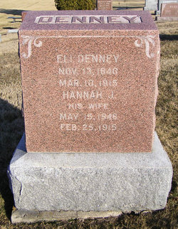
| Burial | : | Central City Cemetery, Central City, Merrick County, USA |
| Coordinate | : | 41.1369019, -97.9944000 |
| Description | : | Mrs. Mary Elizabeth Cowgill passed away Monday afternoon, October 11, 1937. She had been in failing health for the past year and had been a patient sufferer. She had attained the age of 81 years, 7 months and 25 days. She was born February 16, 1856, to John Denney and Sarah Cook in Lee County, Iowa. On September 9, 1874, she was united in marriage to George Cowgill in Lee County, Iowa, and to this union seven children were born. Clyde died in infancy and Lena Braucher, a daughter, passed away about eighteen months ago. In 1894 Mr. and Mrs. Cowgill and... Read More |
frequently asked questions (FAQ):
-
Where is Mary Elizabeth Denney Cowgill's memorial?
Mary Elizabeth Denney Cowgill's memorial is located at: Central City Cemetery, Central City, Merrick County, USA.
-
When did Mary Elizabeth Denney Cowgill death?
Mary Elizabeth Denney Cowgill death on 10 Oct 1937 in Clarks, Merrick County, Nebraska, USA
-
Where are the coordinates of the Mary Elizabeth Denney Cowgill's memorial?
Latitude: 41.1369019
Longitude: -97.9944000
Family Members:
Parent
Spouse

Siblings
Children
Flowers:


Nearby Cemetories:
1. Burke Cemetery
Central City, Merrick County, USA
Coordinate: 41.1833420, -98.0398407
2. Mamre Church Cemetery
Marquette, Hamilton County, USA
Coordinate: 41.0458000, -97.9506000
3. Fridhem Lutheran Cemetery
Hordville, Hamilton County, USA
Coordinate: 41.0817600, -97.8873000
4. Bluff Cemetery
Hordville, Hamilton County, USA
Coordinate: 41.1194250, -97.8609800
5. Mount Zion Cemetery
Hordville, Hamilton County, USA
Coordinate: 41.0466995, -97.9128036
6. George Western Cemetery
Marquette, Hamilton County, USA
Coordinate: 41.0181900, -97.9888900
7. Prairie Creek Cemetery
Archer, Merrick County, USA
Coordinate: 41.1175003, -98.1536026
8. North Blue Cemetery
Hordville, Hamilton County, USA
Coordinate: 41.0456009, -97.8649979
9. Bureau Cemetery
Clarks, Merrick County, USA
Coordinate: 41.2639008, -97.9344025
10. Lindale Cemetery
Hordville, Hamilton County, USA
Coordinate: 41.0614014, -97.8460999
11. Archer Evangelical Community Cemetery
Archer, Merrick County, USA
Coordinate: 41.1473236, -98.1740417
12. Immanuel Lutheran Church Cemetery
Hordville, Hamilton County, USA
Coordinate: 41.0602460, -97.8379730
13. Saint Johns Evangelical Lutheran Church Cemetery
Kronborg, Hamilton County, USA
Coordinate: 40.9995000, -97.9393610
14. Calvary Cemetery
Clarks, Merrick County, USA
Coordinate: 41.2196999, -97.8193970
15. Laclede Cemetery
Polk, Polk County, USA
Coordinate: 41.1049995, -97.7891998
16. Chapman Cemetery
Chapman, Merrick County, USA
Coordinate: 41.0163994, -98.1547012
17. Richland Cemetery
Marquette, Hamilton County, USA
Coordinate: 40.9668999, -98.0175018
18. German Methodist Cemetery
Palmer, Merrick County, USA
Coordinate: 41.1472830, -98.2317640
19. Swede Plain Cemetery
Stromsburg, Polk County, USA
Coordinate: 41.1199100, -97.7576800
20. Polk Cemetery
Polk, Polk County, USA
Coordinate: 41.0917015, -97.7514038
21. Arborville Rural Cemetery
Arborville, York County, USA
Coordinate: 41.0393982, -97.7703018
22. Morning Star Cemetery
Fullerton, Nance County, USA
Coordinate: 41.3229750, -98.0977170
23. Salem Evangelical Cemetery
Hamilton County, USA
Coordinate: 40.9300003, -97.9828033
24. Laurel Cemetery
Chapman, Merrick County, USA
Coordinate: 40.9915600, -98.1950710