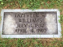
| Birth | : | 30 Apr 1802 Floyd County, Virginia, USA |
| Death | : | 24 Jan 1875 Floyd County, Virginia, USA |
| Burial | : | St Mary's Churchyard, Long Stratton, South Norfolk District, England |
| Coordinate | : | 52.4840800, 1.2339000 |
| Inscription | : | In memory of Mary Williams was Born April 30, 1802 died January 24 1875. Age 72 yr. 9 mo and 24 d. |
frequently asked questions (FAQ):
-
Where is Mary Elizabeth Holland Williams's memorial?
Mary Elizabeth Holland Williams's memorial is located at: St Mary's Churchyard, Long Stratton, South Norfolk District, England.
-
When did Mary Elizabeth Holland Williams death?
Mary Elizabeth Holland Williams death on 24 Jan 1875 in Floyd County, Virginia, USA
-
Where are the coordinates of the Mary Elizabeth Holland Williams's memorial?
Latitude: 52.4840800
Longitude: 1.2339000
Family Members:
Spouse
Children
Flowers:
Nearby Cemetories:
1. St Mary's Churchyard
Long Stratton, South Norfolk District, England
Coordinate: 52.4840800, 1.2339000
2. Long Stratton Congregational Churchyard
Long Stratton, South Norfolk District, England
Coordinate: 52.4818890, 1.2324460
3. Saint John the Baptist Churchyard
Morningthorpe, South Norfolk District, England
Coordinate: 52.4859170, 1.2654150
4. St. Mary's Churchyard
Shelton, South Norfolk District, England
Coordinate: 52.4720940, 1.2686120
5. St Catherine Churchyard
Fritton, Great Yarmouth Borough, England
Coordinate: 52.4919750, 1.2796600
6. St Peter Churchyard
Forncett, South Norfolk District, England
Coordinate: 52.4906450, 1.1862950
7. Saint Margaret's Churchyard
Hardwick, South Norfolk District, England
Coordinate: 52.4632800, 1.2712440
8. St Mary Churchyard
Forncett, South Norfolk District, England
Coordinate: 52.4994380, 1.1897810
9. St. Michael's Churchyard
Great Moulton, South Norfolk District, England
Coordinate: 52.4718860, 1.1868760
10. St Michael Churchyard
Aslacton, South Norfolk District, England
Coordinate: 52.4750490, 1.1737040
11. St. Margaret Churchyard
Hapton, South Norfolk District, England
Coordinate: 52.5244110, 1.2066410
12. St Margaret Churchyard
Hempnall, South Norfolk District, England
Coordinate: 52.5018500, 1.3004810
13. St Michael And All Saint's
Flordon, South Norfolk District, England
Coordinate: 52.5294700, 1.2261400
14. Methodist Churchyard
Forncett End, South Norfolk District, England
Coordinate: 52.4993440, 1.1545110
15. St. Mary's Churchyard
Saxlingham Nethergate, South Norfolk District, England
Coordinate: 52.5268910, 1.2880390
16. Saint Mary Magdalene Churchyard
Pulham Market, South Norfolk District, England
Coordinate: 52.4285200, 1.2301100
17. Pulham Market Cemetery
Pulham Market, South Norfolk District, England
Coordinate: 52.4281900, 1.2297700
18. Saint Nicholas Churchyard
Fundenhall, South Norfolk District, England
Coordinate: 52.5275430, 1.1717020
19. St Mary's Churchyard
Newton Flotman, South Norfolk District, England
Coordinate: 52.5393520, 1.2617220
20. St. Michael and All Angels Churchyard
Bunwell, South Norfolk District, England
Coordinate: 52.4914460, 1.1296800
21. St Mary the Virgin Churchyard
Pulham St Mary, South Norfolk District, England
Coordinate: 52.4205290, 1.2520380
22. All Saints Churchyard
Ashwellthorpe, South Norfolk District, England
Coordinate: 52.5346560, 1.1638810
23. St Mary Churchyard
Shotesham, South Norfolk District, England
Coordinate: 52.5411110, 1.2985880
24. Carleton Rode Baptist Churchyard
Carleton Rode, South Norfolk District, England
Coordinate: 52.4937320, 1.1185210


