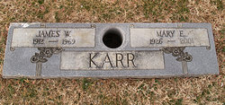
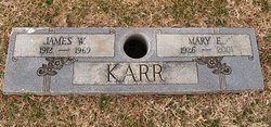
Mary Elizabeth Pack Karr
| Birth | : | 20 Sep 1926 Summers County, West Virginia, USA |
| Death | : | 29 Oct 2001 Montgomery County, Virginia, USA |
| Burial | : | Oakwood Cemetery, Grand Ledge, Eaton County, USA |
| Coordinate | : | 42.7566986, -84.7332993 |
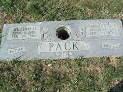
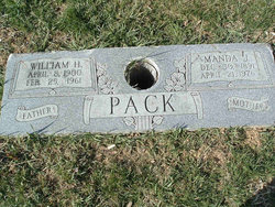
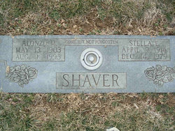
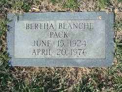
| Description | : | SHAVER, Mary Pack, 75, of Blacksburg, went to be with the Lord Monday, October 29, 2001. She was a member of the Blacksburg First Wesleyan Church and Senior Citizens. She was retired from C.E.C. at Virginia Tech. She was preceded in death by her husbands, James (Jim) W. Karr and Alonzo M. Shaver; her parents, William H. and Amanda Johnston Pack; a brother, Lacy L. Pack; and a sister, Blanche Pack. She is survived by a stepdaughter, Kathleen Shaver Price of Blacksburg; brother and sister-in-law, Raymond and Violet Pack of Christiansburg; a sister, Edith Pack of Franklin County; numerous nieces... Read More |
frequently asked questions (FAQ):
-
Where is Mary Elizabeth Pack Karr's memorial?
Mary Elizabeth Pack Karr's memorial is located at: Oakwood Cemetery, Grand Ledge, Eaton County, USA.
-
When did Mary Elizabeth Pack Karr death?
Mary Elizabeth Pack Karr death on 29 Oct 2001 in Montgomery County, Virginia, USA
-
Where are the coordinates of the Mary Elizabeth Pack Karr's memorial?
Latitude: 42.7566986
Longitude: -84.7332993
Family Members:
Parent
Spouse
Siblings
Flowers:
Nearby Cemetories:
1. Oakwood Cemetery
Grand Ledge, Eaton County, USA
Coordinate: 42.7566986, -84.7332993
2. Immanuel Lutheran Memorial Garden
Grand Ledge, Eaton County, USA
Coordinate: 42.7436580, -84.7388540
3. Our Savior Lutheran Memorial Garden
Lansing, Ingham County, USA
Coordinate: 42.7257980, -84.6829620
4. Pioneer Cemetery
Grand Ledge, Eaton County, USA
Coordinate: 42.7043991, -84.7414017
5. Niles Cemetery
Eagle, Clinton County, USA
Coordinate: 42.8121986, -84.7497025
6. Union Cemetery
Grand Ledge, Eaton County, USA
Coordinate: 42.7670050, -84.8187450
7. Delta Center Cemetery
Grand Ledge, Eaton County, USA
Coordinate: 42.7270000, -84.6560000
8. Hillside Cemetery
Delta Mills, Eaton County, USA
Coordinate: 42.7647600, -84.6421600
9. Wacousta Cemetery
Wacousta, Clinton County, USA
Coordinate: 42.8206980, -84.6963820
10. Strange Cemetery
Grand Ledge, Eaton County, USA
Coordinate: 42.6952800, -84.7783300
11. Eddy Family Cemetery
Eagle, Clinton County, USA
Coordinate: 42.8287100, -84.7691800
12. Saint David's Memorial Garden
Delta Township, Eaton County, USA
Coordinate: 42.7514420, -84.6231690
13. Chapel Hill Memorial Gardens
DeWitt, Clinton County, USA
Coordinate: 42.7738810, -84.6113460
14. North Eagle Cemetery
Eagle Township, Clinton County, USA
Coordinate: 42.8396988, -84.7956009
15. Deepdale Memorial Park
Delta Township, Eaton County, USA
Coordinate: 42.7080994, -84.6069031
16. Saint Joseph Catholic Cemetery
Lansing, Ingham County, USA
Coordinate: 42.7505989, -84.5883026
17. West Windsor Cemetery
Dimondale, Eaton County, USA
Coordinate: 42.6504610, -84.7010390
18. Pinch Cemetery
Benton Township, Eaton County, USA
Coordinate: 42.6552770, -84.7877770
19. Needmore Cemetery
Needmore, Eaton County, USA
Coordinate: 42.6829010, -84.8430130
20. Dimondale Cemetery
Dimondale, Eaton County, USA
Coordinate: 42.6492004, -84.6607971
21. Meadowbrook Cemetery
Mulliken, Eaton County, USA
Coordinate: 42.7550011, -84.9028015
22. Hurd Cemetery
DeWitt, Clinton County, USA
Coordinate: 42.7999992, -84.5733032
23. South Riley Township Cemetery
South Riley, Clinton County, USA
Coordinate: 42.8633003, -84.6414032
24. Danby Cemetery
Danby Township, Ionia County, USA
Coordinate: 42.7989006, -84.8983002

