
| Birth | : | 18 Sep 1866 Watauga County, North Carolina, USA |
| Death | : | 18 Jan 1960 Vilas, Watauga County, North Carolina, USA |
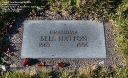
| Burial | : | Sacred Heart Cemetery, Park, Gove County, USA |
| Coordinate | : | 39.1147003, -100.3555984 |
| Description | : | Mary Ellen Ford Cannon Mary Ellen Ford was the daughter of John S. Ford and Senia Cook Ford. She was married to James Bynum Cannon on April 18, 1900. |
frequently asked questions (FAQ):
-
Where is Mary Ellen Ford Cannon's memorial?
Mary Ellen Ford Cannon's memorial is located at: Sacred Heart Cemetery, Park, Gove County, USA.
-
When did Mary Ellen Ford Cannon death?
Mary Ellen Ford Cannon death on 18 Jan 1960 in Vilas, Watauga County, North Carolina, USA
-
Where are the coordinates of the Mary Ellen Ford Cannon's memorial?
Latitude: 39.1147003
Longitude: -100.3555984
Family Members:
Parent

Spouse
Siblings
Children
Flowers:


Nearby Cemetories:
1. Sacred Heart Cemetery
Park, Gove County, USA
Coordinate: 39.1147003, -100.3555984
2. West Park Cemetery
Gove County, USA
Coordinate: 39.1107100, -100.3688300
3. Grainfield Cemetery
Grainfield, Gove County, USA
Coordinate: 39.1180992, -100.4708023
4. Quinter Cemetery
Quinter, Gove County, USA
Coordinate: 39.0736008, -100.2236023
5. Old Order German Baptist Cemetery
Quinter, Gove County, USA
Coordinate: 39.0299988, -100.2052994
6. Bethel Christian Cemetery
Studley, Sheridan County, USA
Coordinate: 39.2334100, -100.2051300
7. Red Top Cemetery
Quinter, Gove County, USA
Coordinate: 38.9449997, -100.2431030
8. Gove Cemetery
Gove, Gove County, USA
Coordinate: 38.9467010, -100.4847031
9. Saint Michaels Cemetery
Collyer, Trego County, USA
Coordinate: 39.0318985, -100.1153030
10. Mount Pleasant Community Cemetery
Studley, Sheridan County, USA
Coordinate: 39.2550011, -100.1635971
11. Union Cemetery
Collyer, Trego County, USA
Coordinate: 39.0299988, -100.1125031
12. Immaculate Conception Cemetery
Grinnell, Gove County, USA
Coordinate: 39.1282997, -100.6316986
13. Grinnell Cemetery
Grinnell, Gove County, USA
Coordinate: 39.1300011, -100.6352997
14. Baugher Cemetery
Studley, Sheridan County, USA
Coordinate: 39.3205600, -100.2560800
15. Gove County Cemetery
Gove Township, Gove County, USA
Coordinate: 38.9376127, -100.5277188
16. Saint Anthony Cemetery
Graham County, USA
Coordinate: 39.1892014, -100.0805969
17. Saint Frances Cemetery
Hoxie, Sheridan County, USA
Coordinate: 39.3541985, -100.4597015
18. Saint Pauls Catholic Cemetery
Angelus, Sheridan County, USA
Coordinate: 39.1912810, -100.6854250
19. Hoxie Cemetery
Hoxie, Sheridan County, USA
Coordinate: 39.3736000, -100.4421997
20. Morning Star Cemetery
Gove County, USA
Coordinate: 38.8431015, -100.3349991
21. Studley Cemetery
Studley, Sheridan County, USA
Coordinate: 39.3568993, -100.1631012
22. Leland Cemetery
Penokee, Graham County, USA
Coordinate: 39.2256012, -100.0149994
23. Saint Martins Cemetery
Seguin, Sheridan County, USA
Coordinate: 39.3396988, -100.5907974
24. Saline Valley Cemetery
Trego County, USA
Coordinate: 39.1180992, -99.9610977