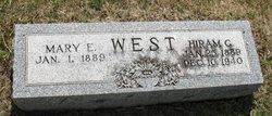
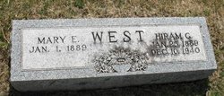
Mary Elmira Crawford West
| Birth | : | 1 Jan 1889 Minburn, Dallas County, Iowa, USA |
| Death | : | 15 Dec 1964 |
| Burial | : | Coningsby Cemetery, Coningsby, East Lindsey District, England |
| Coordinate | : | 53.0991060, -0.1774390 |
| Description | : | Wife of Hiram G. West, 15 Feb 1912, Des Moines, Polk Co. Iowa. |
frequently asked questions (FAQ):
-
Where is Mary Elmira Crawford West's memorial?
Mary Elmira Crawford West's memorial is located at: Coningsby Cemetery, Coningsby, East Lindsey District, England.
-
When did Mary Elmira Crawford West death?
Mary Elmira Crawford West death on 15 Dec 1964 in
-
Where are the coordinates of the Mary Elmira Crawford West's memorial?
Latitude: 53.0991060
Longitude: -0.1774390
Family Members:
Parent
Spouse
Siblings
Flowers:
Nearby Cemetories:
1. Coningsby Cemetery
Coningsby, East Lindsey District, England
Coordinate: 53.0991060, -0.1774390
2. St. Michael & All Angels Churchyard
Coningsby, East Lindsey District, England
Coordinate: 53.1055090, -0.1756300
3. Coningsby Baptist Chapelyard
Coningsby, East Lindsey District, England
Coordinate: 53.1086300, -0.1689600
4. Holy Trinity Graveyard
Chapel Hill, North Kesteven District, England
Coordinate: 53.0674300, -0.1999300
5. St. Leonard's Without Churchyard
Kirkstead, East Lindsey District, England
Coordinate: 53.1361800, -0.2224600
6. St. Mary's Churchyard
Kirkby on Bain, East Lindsey District, England
Coordinate: 53.1442900, -0.1430300
7. St Michael Church Cemetery
Billinghay, North Kesteven District, England
Coordinate: 53.0796800, -0.2748100
8. St. Michael and All Angels Churchyard
Billinghay, North Kesteven District, England
Coordinate: 53.0791130, -0.2746370
9. St. Benedict's Churchyard
Haltham, East Lindsey District, England
Coordinate: 53.1571600, -0.1378600
10. All Saints Churchyard
Holland Fen, Boston Borough, England
Coordinate: 53.0346250, -0.1639180
11. Billinghay Cemetery
Billinghay, North Kesteven District, England
Coordinate: 53.0806340, -0.2852800
12. Saint Luke Churchyard
North Kyme, North Kesteven District, England
Coordinate: 53.0591550, -0.2808970
13. St Oswald Churchyard
Walcott, North Kesteven District, England
Coordinate: 53.0945800, -0.3125240
14. St. Oswald Churchyard
Walcott, North Kesteven District, England
Coordinate: 53.0944560, -0.3128500
15. St. Mary and All Saints Churchyard
South Kyme, North Kesteven District, England
Coordinate: 53.0325980, -0.2587880
16. Kyme Priory
North Kyme, North Kesteven District, England
Coordinate: 53.0326000, -0.2589000
17. St. Paul's Churchyard
Carrington, East Lindsey District, England
Coordinate: 53.0783300, -0.0437200
18. St. Margaret Churchyard
Langrick, East Lindsey District, England
Coordinate: 53.0206370, -0.1214770
19. St. Andrew's Churchyard
Timberland, North Kesteven District, England
Coordinate: 53.1095985, -0.3267715
20. St. Andrew's Churchyard
Timberland, North Kesteven District, England
Coordinate: 53.1095985, -0.3267715
21. St. Peter's Churchyard
Frithville, East Lindsey District, England
Coordinate: 53.0380330, -0.0391600
22. St Margarets Churchyard
Langton, East Lindsey District, England
Coordinate: 53.2034275, -0.1490403
23. All Saints Churchyard
Horsington, East Lindsey District, England
Coordinate: 53.2023100, -0.2160600
24. Saint Hippolyte
Saint-Hippolyte, Lloydminster Census Division, Canada
Coordinate: 53.1184742, 0.0000000

