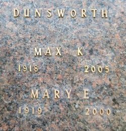
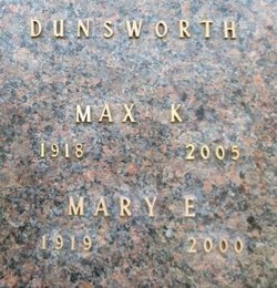
Mary Elmore Coplan Dunsworth
| Birth | : | 4 Apr 1919 Ola, Yell County, Arkansas, USA |
| Death | : | 4 May 2000 Willows, Glenn County, California, USA |
| Burial | : | State School Cemetery, Coldwater, Branch County, USA |
| Coordinate | : | 41.9613900, -84.9925000 |
frequently asked questions (FAQ):
-
Where is Mary Elmore Coplan Dunsworth's memorial?
Mary Elmore Coplan Dunsworth's memorial is located at: State School Cemetery, Coldwater, Branch County, USA.
-
When did Mary Elmore Coplan Dunsworth death?
Mary Elmore Coplan Dunsworth death on 4 May 2000 in Willows, Glenn County, California, USA
-
Where are the coordinates of the Mary Elmore Coplan Dunsworth's memorial?
Latitude: 41.9613900
Longitude: -84.9925000
Family Members:
Parent
Spouse
Siblings
Flowers:
Nearby Cemetories:
1. State School Cemetery
Coldwater, Branch County, USA
Coordinate: 41.9613900, -84.9925000
2. Morse Street Cemetery
Coldwater, Branch County, USA
Coordinate: 41.9486111, -84.9950000
3. First Presbyterian Church Columbarium
Coldwater, Branch County, USA
Coordinate: 41.9425100, -84.9996800
4. United Methodist Memorial Garden
Coldwater, Branch County, USA
Coordinate: 41.9415850, -85.0001050
5. Saint Marks Memorial Garden
Coldwater, Branch County, USA
Coordinate: 41.9406740, -84.9992740
6. Oak Grove Cemetery
Coldwater, Branch County, USA
Coordinate: 41.9427986, -85.0338974
7. Hurley Cemetery
Coldwater, Branch County, USA
Coordinate: 41.9562990, -85.0467110
8. Mason Cemetery
Coldwater, Branch County, USA
Coordinate: 41.9216995, -84.9597015
9. Branch Cemetery
Coldwater, Branch County, USA
Coordinate: 41.9368200, -85.0485990
10. Tripp Cemetery
Batavia, Branch County, USA
Coordinate: 41.9425000, -85.0694440
11. Evergreen Cemetery
Girard Township, Branch County, USA
Coordinate: 42.0217018, -84.9989014
12. West Girard Cemetery
Girard, Branch County, USA
Coordinate: 42.0203018, -85.0393982
13. Lake View Cemetery
Quincy, Branch County, USA
Coordinate: 41.9366989, -84.8933029
14. Lockwood Cemetery
Coldwater, Branch County, USA
Coordinate: 41.8837250, -85.0145170
15. Dayburg Cemetery
Butler, Branch County, USA
Coordinate: 42.0194016, -84.9072037
16. Batavia Cemetery
Batavia, Branch County, USA
Coordinate: 41.9202778, -85.0975000
17. Wilson Cemetery
Ovid Township, Branch County, USA
Coordinate: 41.8685989, -84.9713974
18. Amish Cemetery
Butler, Branch County, USA
Coordinate: 42.0211790, -84.8935030
19. Ovid Cemetery
Ovid Township, Branch County, USA
Coordinate: 41.8688580, -85.0484920
20. Shooks Prairie Cemetery
Butler, Branch County, USA
Coordinate: 42.0003014, -84.8561020
21. Fisher Hill Cemetery
Fisher, Branch County, USA
Coordinate: 41.8813880, -84.8830550
22. York Cemetery
Batavia, Branch County, USA
Coordinate: 41.9009350, -85.1318550
23. White Cemetery
Butler, Branch County, USA
Coordinate: 42.0339940, -84.8638920
24. Card Cemetery
Bethel Township, Branch County, USA
Coordinate: 41.8544006, -85.0693970


