

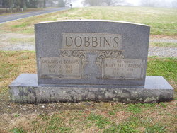
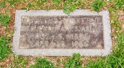
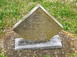
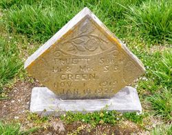
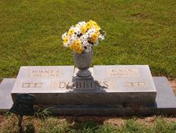
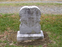
Mary Etta Greene Dobbins
| Birth | : | 5 Jan 1895 Rutherford County, North Carolina, USA |
| Death | : | 13 Oct 1971 Rutherford County, North Carolina, USA |
| Burial | : | Mission Creek Cemetery, Pawnee County, USA |
| Coordinate | : | 40.0149994, -96.4263992 |
frequently asked questions (FAQ):
-
Where is Mary Etta Greene Dobbins's memorial?
Mary Etta Greene Dobbins's memorial is located at: Mission Creek Cemetery, Pawnee County, USA.
-
When did Mary Etta Greene Dobbins death?
Mary Etta Greene Dobbins death on 13 Oct 1971 in Rutherford County, North Carolina, USA
-
Where are the coordinates of the Mary Etta Greene Dobbins's memorial?
Latitude: 40.0149994
Longitude: -96.4263992
Family Members:
Parent

Spouse
Siblings
Children


Nearby Cemetories:
1. Mission Creek Cemetery
Pawnee County, USA
Coordinate: 40.0149994, -96.4263992
2. Tanner Cemetery
Pawnee County, USA
Coordinate: 40.0238991, -96.4143982
3. Mission Creek Cemetery
Marshall County, USA
Coordinate: 39.9866982, -96.4649963
4. Evangelical Lutheran Cemetery
Liberty, Gage County, USA
Coordinate: 40.0083300, -96.4825100
5. Richland Center Cemetery
Marshall County, USA
Coordinate: 39.9584000, -96.4073700
6. Summerfield Cemetery
Summerfield, Marshall County, USA
Coordinate: 40.0005989, -96.3422012
7. Holy Family Cemetery
Summerfield, Marshall County, USA
Coordinate: 39.9994011, -96.3414001
8. Liberty Cemetery
Liberty, Gage County, USA
Coordinate: 40.0772018, -96.4982986
9. Guittard Cemetery
Beattie, Marshall County, USA
Coordinate: 39.9094009, -96.4152985
10. North Elm Cemetery
Marshall County, USA
Coordinate: 39.9431000, -96.5325012
11. Saint Josephs Cemetery
Barneston, Gage County, USA
Coordinate: 40.0653000, -96.5757980
12. Barneston Cemetery
Barneston, Gage County, USA
Coordinate: 40.0661011, -96.5755997
13. West Branch Cemetery
Pawnee County, USA
Coordinate: 40.0787940, -96.2797160
14. Pleasant Hill Cemetery
Gage County, USA
Coordinate: 40.1462250, -96.4676820
15. Burchard Cemetery
Burchard, Pawnee County, USA
Coordinate: 40.1383018, -96.3538971
16. Shockleys Fairland Cemetery
Marshall County, USA
Coordinate: 39.9284500, -96.2866500
17. Johnson Creek Cemetery
Pawnee City, Pawnee County, USA
Coordinate: 40.0270000, -96.2465000
18. Sacred Heart Cemetery
Burchard, Pawnee County, USA
Coordinate: 40.1460991, -96.3683014
19. Madden Cemetery
Axtell, Marshall County, USA
Coordinate: 39.9866800, -96.2490300
20. Kinney Cemetery
Gage County, USA
Coordinate: 40.1102100, -96.5588800
21. Saint Bridget Cemetery
Axtell, Marshall County, USA
Coordinate: 39.9572000, -96.2578000
22. Oketo Cemetery
Oketo, Marshall County, USA
Coordinate: 39.9571991, -96.5950012
23. Beattie Union Cemetery
Beattie, Marshall County, USA
Coordinate: 39.8717003, -96.4207993
24. Saint Patricks Cemetery
Beattie, Marshall County, USA
Coordinate: 39.8703003, -96.4231033