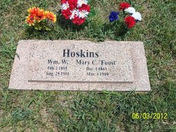
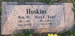
Mary Foust Hoskins
| Birth | : | 1 Dec 1843 Carter County, Tennessee, USA |
| Death | : | 3 Mar 1919 Gorin, Scotland County, Missouri, USA |
| Burial | : | Sunset Memorial Cemetery, Moose Lake, Carlton County, USA |
| Coordinate | : | 46.4789400, -92.7236300 |
| Description | : | widowed, daughter of Zachariah Foust d. cert 12675 |
frequently asked questions (FAQ):
-
Where is Mary Foust Hoskins's memorial?
Mary Foust Hoskins's memorial is located at: Sunset Memorial Cemetery, Moose Lake, Carlton County, USA.
-
When did Mary Foust Hoskins death?
Mary Foust Hoskins death on 3 Mar 1919 in Gorin, Scotland County, Missouri, USA
-
Where are the coordinates of the Mary Foust Hoskins's memorial?
Latitude: 46.4789400
Longitude: -92.7236300
Family Members:
Parent
Spouse
Siblings
Children
Flowers:
Nearby Cemetories:
1. Sunset Memorial Cemetery
Moose Lake, Carlton County, USA
Coordinate: 46.4789400, -92.7236300
2. Riverside Cemetery
Moose Lake, Carlton County, USA
Coordinate: 46.4597700, -92.7526200
3. Riverside Cemetery
Barnum, Carlton County, USA
Coordinate: 46.4998100, -92.6918900
4. Emmanuel Lutheran Cemetery
Barnum, Carlton County, USA
Coordinate: 46.5008910, -92.6920370
5. Moose Lake State Hospital Cemetery
Moose Lake, Carlton County, USA
Coordinate: 46.4372230, -92.7514830
6. Leonard Cemetery
Kettle River, Carlton County, USA
Coordinate: 46.5097008, -92.8450012
7. Blomskog Cemetery
Sturgeon Lake, Pine County, USA
Coordinate: 46.3967018, -92.7817001
8. Saint Peters Lutheran Cemetery
Moose Lake, Carlton County, USA
Coordinate: 46.4491030, -92.8685000
9. Saint Isidores Catholic Cemetery
Sturgeon Lake, Pine County, USA
Coordinate: 46.3852240, -92.8146451
10. Sturgeon Lake Cemetery
Sturgeon Lake, Pine County, USA
Coordinate: 46.3860320, -92.8300090
11. Mount Salem Cemetery
Mahtowa, Carlton County, USA
Coordinate: 46.5918010, -92.6597480
12. Oak Lake Lutheran Cemetery
Kerrick, Pine County, USA
Coordinate: 46.3968420, -92.5932360
13. Oak Lake Cemetery
Kerrick, Pine County, USA
Coordinate: 46.3964900, -92.5902100
14. Holy Trinity Cemetery
Kettle River, Carlton County, USA
Coordinate: 46.5052986, -92.9002991
15. Riverside Cemetery
Pine County, USA
Coordinate: 46.3610992, -92.6457977
16. Kettle River Cemetery
Kettle River, Carlton County, USA
Coordinate: 46.5056000, -92.9081000
17. West Side Church Cemetery
Kettle River, Carlton County, USA
Coordinate: 46.4488800, -92.9091900
18. National Polish Catholic Cemetery
Kettle River, Carlton County, USA
Coordinate: 46.4480710, -92.9093250
19. Sacred Heart Catholic Cemetery
Split Rock Township, Carlton County, USA
Coordinate: 46.4476113, -92.9107011
20. West Branch Cemetery
Kettle River, Carlton County, USA
Coordinate: 46.5430984, -92.9100037
21. Elim Lutheran Cemetery
Pine County, USA
Coordinate: 46.5196240, -92.5058280
22. Elim Lutheran Church Cemetery
Barnum, Carlton County, USA
Coordinate: 46.5194440, -92.5052780
23. Duquette Community Cemetery
Pine County, USA
Coordinate: 46.3726500, -92.5581900
24. Saint Michaels Cemetery
Kerrick, Pine County, USA
Coordinate: 46.3458519, -92.5943604


