| Birth | : | 1828 Greenbrier County, West Virginia, USA |
| Death | : | 18 Nov 1854 Greenbrier County, West Virginia, USA |
| Burial | : | Boston Cemetery and Crematorium, Boston, Boston Borough, England |
| Coordinate | : | 52.9888100, -0.0273450 |
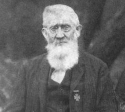
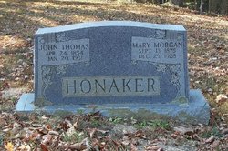
| Description | : | Mary Jane Toothman Honaker, aged 26 years, died on November 18, 1854 at Greenbrier County, West Virginia. She was born about 1828 at Greenbrier, West Virginia to Jacob and Sarah Sipps Toothman. Mary Jane Toothman married Frederick Styrus Honaker October 22, 1850 in Greenbrier County, West Virginia. To this union were born two children: Emmeline Honaker and John Thomas Honaker. She passed away November 18, 1854 at Greenbrier County, West Virginia. Some info from her death certificate ----------------- When Mary Jane died her husband, Frederick married Elizabeth Caroline Coats and had five more children: George Edward Honaker, Rebecca Jane Honaker, Joseph Dewitt... Read More |
frequently asked questions (FAQ):
-
Where is Mary Jane Toothman Honaker's memorial?
Mary Jane Toothman Honaker's memorial is located at: Boston Cemetery and Crematorium, Boston, Boston Borough, England.
-
When did Mary Jane Toothman Honaker death?
Mary Jane Toothman Honaker death on 18 Nov 1854 in Greenbrier County, West Virginia, USA
-
Where are the coordinates of the Mary Jane Toothman Honaker's memorial?
Latitude: 52.9888100
Longitude: -0.0273450
Family Members:
Spouse
Children
Flowers:
Nearby Cemetories:
1. Boston Cemetery and Crematorium
Boston, Boston Borough, England
Coordinate: 52.9888100, -0.0273450
2. Boston Centenary Methodist Churchyard
Boston Borough, England
Coordinate: 52.9803214, -0.0241620
3. Holy Trinity Churchyard
Boston, Boston Borough, England
Coordinate: 52.9837160, -0.0150690
4. Black Friars Priory
Boston, Boston Borough, England
Coordinate: 52.9786110, -0.0258330
5. St. Botolph Churchyard
Boston, Boston Borough, England
Coordinate: 52.9785700, -0.0252740
6. Unitarian Burial Ground
Boston, Boston Borough, England
Coordinate: 52.9765987, -0.0212365
7. St. Aiden's Churchyard
Boston Borough, England
Coordinate: 52.9727909, -0.0250366
8. Boston Baptist Cemetery
Boston, Boston Borough, England
Coordinate: 52.9726351, -0.0477945
9. St. Thomas Churchyard
Skirbeck, Boston Borough, England
Coordinate: 52.9649810, -0.0296080
10. Tranquility Gardens
Quesnel, Cariboo Regional District, Canada
Coordinate: 53.0184530, 0.0000000
11. St. Leodegar Churchyard
Wyberton, Boston Borough, England
Coordinate: 52.9480560, -0.0236110
12. Wyberton Cemetery
Wyberton, Boston Borough, England
Coordinate: 52.9480560, -0.0225000
13. St. James Churchyard
Freiston, Boston Borough, England
Coordinate: 52.9738620, 0.0484651
14. St. Peter's Churchyard
Frithville, East Lindsey District, England
Coordinate: 53.0380330, -0.0391600
15. St. Gilbert of Sempringham
Brothertoft, Boston Borough, England
Coordinate: 52.9987500, -0.1090160
16. St Mary's Churchyard
Frampton, Boston Borough, England
Coordinate: 52.9335410, -0.0289950
17. St. Andrew's Churchyard
Butterwick, Boston Borough, England
Coordinate: 52.9837000, 0.0655000
18. Kirton in Holland New Cemetery
Kirton, Boston Borough, England
Coordinate: 52.9361110, -0.0597220
19. Kirton in Holland Old Cemetery
Kirton, Boston Borough, England
Coordinate: 52.9352780, -0.0583330
20. Church of St. Peter and St. Paul
Kirton, Boston Borough, England
Coordinate: 52.9280560, -0.0597220
21. St. Margaret Churchyard
Langrick, East Lindsey District, England
Coordinate: 53.0206370, -0.1214770
22. All Saints Churchyard
Benington, Boston Borough, England
Coordinate: 52.9977010, 0.0803000
23. St. Mary's Churchyard
Old Leake, Boston Borough, England
Coordinate: 53.0311810, 0.0967100
24. St. Paul's Churchyard
Carrington, East Lindsey District, England
Coordinate: 53.0783300, -0.0437200


