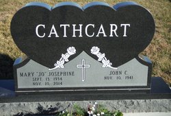
Mary Josephine “Jo” Belt Cathcart
| Birth | : | 13 Sep 1934 Council Grove, Morris County, Kansas, USA |
| Death | : | 10 Nov 2014 Topeka, Shawnee County, Kansas, USA |
| Burial | : | Comiskey Cemetery, Morris County, USA |
| Coordinate | : | 38.6521988, -96.3535995 |
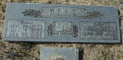
| Description | : | The Emporia Gazette Wednesday, November 12, 2014 Mary Josephine Cathcart, 80, of Council Grove, Kansas, passed away Monday, November 10, 2014, at Stormont Vail Hospital in Topeka. She was born September 13, 1934 in Council Grove, Kansas to Elmer and Opal (Williams) Belt. She was one of the youngest of thirteen children. Jo married John Cathcart on November 25, 1968 in Rossville, Kansas. After several moves, they have lived in this area for the last several years. She worked as a waitress at the Hays House and Saddlerock Café. She was a homemaker and supported her husband in his business. She was a... Read More |
frequently asked questions (FAQ):
-
Where is Mary Josephine “Jo” Belt Cathcart's memorial?
Mary Josephine “Jo” Belt Cathcart's memorial is located at: Comiskey Cemetery, Morris County, USA.
-
When did Mary Josephine “Jo” Belt Cathcart death?
Mary Josephine “Jo” Belt Cathcart death on 10 Nov 2014 in Topeka, Shawnee County, Kansas, USA
-
Where are the coordinates of the Mary Josephine “Jo” Belt Cathcart's memorial?
Latitude: 38.6521988
Longitude: -96.3535995
Family Members:
Parent
Siblings
Flowers:
Nearby Cemetories:
1. Comiskey Cemetery
Morris County, USA
Coordinate: 38.6521988, -96.3535995
2. Raglan Cemetery
Dunlap, Morris County, USA
Coordinate: 38.6370100, -96.3942700
3. Gilbert Family Cemetery
Bushong, Lyon County, USA
Coordinate: 38.6895800, -96.3458500
4. Little John Cemetery
Council Grove, Morris County, USA
Coordinate: 38.6568300, -96.4175100
5. Dunlap Colored Cemetery
Dunlap, Morris County, USA
Coordinate: 38.5875015, -96.3538971
6. Agnes City Cemetery
Bushong, Lyon County, USA
Coordinate: 38.6880989, -96.2799988
7. Sunnyside Cemetery
Bushong, Lyon County, USA
Coordinate: 38.6083900, -96.2853700
8. Dunlap Cemetery
Dunlap, Morris County, USA
Coordinate: 38.5792007, -96.3538971
9. Henry Clousing Burial Site
Bushong, Lyon County, USA
Coordinate: 38.6954800, -96.2608700
10. Hebrank Cemetery
Council Grove, Morris County, USA
Coordinate: 38.7172000, -96.4260100
11. Bushong Cemetery
Bushong, Lyon County, USA
Coordinate: 38.6366997, -96.2431030
12. Sunnyslope Memorial Gardens
Council Grove, Morris County, USA
Coordinate: 38.6796700, -96.4644400
13. Greenwood Cemetery
Council Grove, Morris County, USA
Coordinate: 38.6581900, -96.5010900
14. Exon Family Cemetery
Eskridge, Wabaunsee County, USA
Coordinate: 38.7595800, -96.2988400
15. Calvary Cemetery
Council Grove, Morris County, USA
Coordinate: 38.6567001, -96.5111008
16. Chalk Cemetery
Wabaunsee County, USA
Coordinate: 38.7675018, -96.2910995
17. Four Mile Cemetery
Council Grove, Morris County, USA
Coordinate: 38.6086200, -96.5097000
18. Pleasant Ridge Cemetery
Wabaunsee County, USA
Coordinate: 38.7969017, -96.3347015
19. Fruitland Cemetery
Americus, Lyon County, USA
Coordinate: 38.5078011, -96.3308029
20. Allen Cemetery
Allen, Lyon County, USA
Coordinate: 38.6521988, -96.1611023
21. Frost Cemetery
Americus, Lyon County, USA
Coordinate: 38.5573900, -96.2022300
22. Garfield Cemetery
Morris County, USA
Coordinate: 38.7817001, -96.4591980
23. Prairie View Cemetery
Wabaunsee County, USA
Coordinate: 38.8114014, -96.3696976
24. Americus Cemetery
Americus, Lyon County, USA
Coordinate: 38.5154686, -96.2420425


